


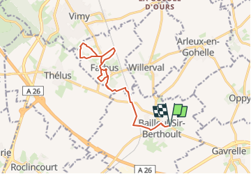


12.9 km | 14.3 km-effort


User


FREE GPS app for hiking
 SityTrail
IGN / Geographical institutes
SityTrail World
The world is yours!
Trail Walking of 13.8 km to be discovered at Hauts-de-France, Pas-de-Calais, Bailleul-Sir-Berthoult. This trail is proposed by Uninated.
Bailleul > Farbus > Bailleul
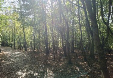
Randonnée équestre avec des jolis passages sous bois et des chemins en herbe. Idéal pour faire un trotting car les chemins sont entretenus et il y a un peu de dénivelé.
Les chemins sont accessibles été comme hiver.
Attention, plusieurs passages à côté d'une voie ferrée.
Attention aux randonneurs, notamment le dimanche (lorsque vous serez au trot ou au galop).
Promenade parfaitement adaptée aux randonneurs à pied et aux vélos (VTT).

Walking

Walking

Walking

Walking
Walking
Walking

Walking
Walking
Walking