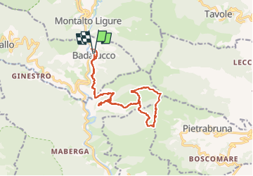

17.2 km | 30 km-effort


User


FREE GPS app for hiking
 SityTrail
IGN / Geographical institutes
SityTrail World
The world is yours!
Trail Walking of 18.2 km to be discovered at Liguria, Imperia, Badalucco. This trail is proposed by JEAN06910.
Départ de Badalucco, tracé assez absent, mais trouvable.
Faire attention sur les crêtes pour repérer ke sentier.
Montée avec des oliveraies dans des terrains escarpés.
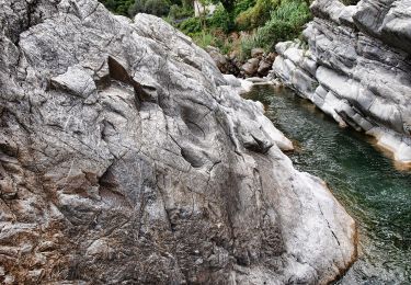
De très belles cabanes de bergers.

On foot
On foot