![](/images/other/stat-length.png)
![Trail Walking Soudorgues - La Vallée Borgne - Photo](https://media.geolcdn.com/t/1900/400/ext.pjpeg?maxdim=2&url=https%3A%2F%2Fmedia.geolcdn.com%2Ff%2Ffc66911e-f8e1-402c-a199-faceb474f5bb.jpg)
La Vallée Borgne
ARVIEU
User
![Length](/images/other/stat-length.png)
Length
14.6 km
![Max alt](https://static1.geolcdn.com/siteimages/upload/files/1508320355ic_sort_altitude_max_24dp.png)
Max alt
672 m
![Uphill gradient](https://static1.geolcdn.com/siteimages/upload/files/1508320355ic_sort_den_pos_24dp.png)
Uphill gradient
575 m
![Km-Effort](/images/other/stat-length.png)
Km-Effort
22 km
![Min alt](https://static1.geolcdn.com/siteimages/upload/files/1508320355ic_sort_altitude_min_24dp.png)
Min alt
245 m
![Downhill gradient](https://static1.geolcdn.com/siteimages/upload/files/1508320355ic_sort_den_neg_24dp.png)
Downhill gradient
572 m
![Boucle](https://static1.geolcdn.com/siteimages/upload/files/16400158638029165_repeat_loop_refresh_sync_direction_icon.png)
Boucle
Yes
Creation date :
2023-05-09 18:12:44.532
Updated on :
2023-05-09 18:20:44.219
![Walking](https://static1.geolcdn.com/sitytour/trail-icons/101.png)
5h30
Difficulty : Difficult
![Scan this QR Code to open this trail in the SityTrail application](https://capi.geolives.com/qq0zvz2zws4bq2lad0pu/sitytour/trails/3653742/qr.png?size=200)
FREE GPS app for hiking
About
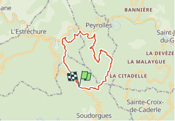
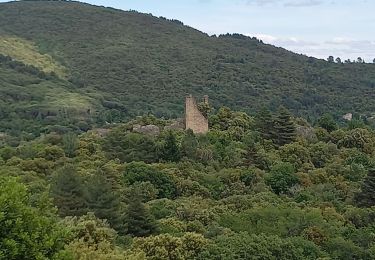
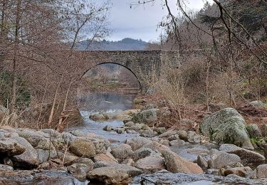
Trail Walking of 14.6 km to be discovered at Occitania, Gard, Soudorgues. This trail is proposed by ARVIEU.
Description
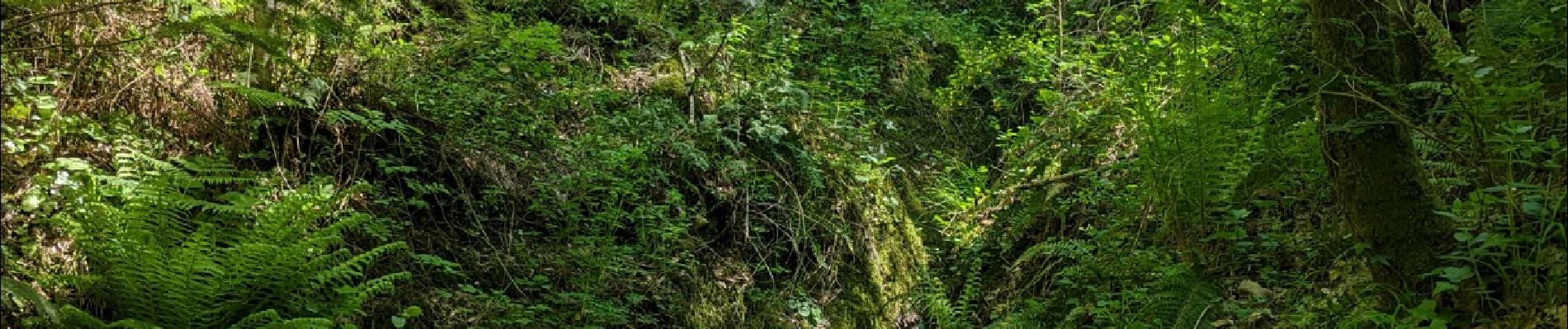
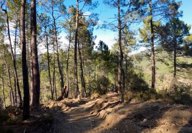
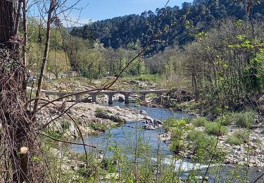
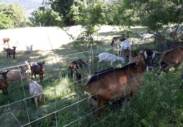
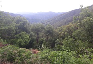
Départ col du Mercou, descente en sous-bois au gardon de Saint Jean, puis à partir du km 6,5, montée sur route jusqu'à l'embranchement vers la Jasse d'Aldmiras, km 9, cote 404. Montée raide, en sous bois, du km 10, cote 453, à la Jasse d'Almiras, cote 619, balisage jaune pas toujours visible, GPS conseillé...
Positioning
Country:
France
Region :
Occitania
Department/Province :
Gard
Municipality :
Soudorgues
Location:
Unknown
Start:(Dec)
Start:(UTM)
565595 ; 4881013 (31T) N.
Comments
Trails nearby
![Trail Walking Saint-Jean-du-Gard - rocher des chèvres - Photo](https://media.geolcdn.com/t/375/260/ext.jpg?maxdim=2&url=https%3A%2F%2Fmedia.geolcdn.com%2Ff%2Ff651fafb-b1d1-4725-b624-a9394b90fcdc.jpg)
![Walking Walking](https://static1.geolcdn.com/sitytour/trail-icons/101.png)
rocher des chèvres
Walking
Medium
(1)
Saint-Jean-du-Gard,
Occitania,
Gard,
France
![](/images/other/stat-length.png)
4 km | 8.4 km-effort
55min
![](https://static1.geolcdn.com/siteimages/upload/files/16400158638029165_repeat_loop_refresh_sync_direction_icon.png)
Yes
![Trail Walking Saint-Jean-du-Gard - Signal Saint Pierre - Photo](https://media.geolcdn.com/t/375/260/ext.jpg?maxdim=2&url=https%3A%2F%2Fmedia.geolcdn.com%2Ff%2Fc97a240b-eff8-49fc-8022-a55a2f6c33fc.jpg)
![Walking Walking](https://static1.geolcdn.com/sitytour/trail-icons/101.png)
Signal Saint Pierre
Walking
Medium
Saint-Jean-du-Gard,
Occitania,
Gard,
France
![](/images/other/stat-length.png)
17.7 km | 26 km-effort
4h 44min
![](https://static1.geolcdn.com/siteimages/upload/files/16400158638029165_repeat_loop_refresh_sync_direction_icon.png)
No
![Trail Walking Soudorgues - Vallée Salindrenque - Photo](https://media.geolcdn.com/t/375/260/ext.jpg?maxdim=2&url=https%3A%2F%2Fmedia.geolcdn.com%2Ff%2Fcdaa973a-fc3c-410e-b572-e43390419aac.jpg)
![Walking Walking](https://static1.geolcdn.com/sitytour/trail-icons/101.png)
Vallée Salindrenque
Walking
Difficult
Soudorgues,
Occitania,
Gard,
France
![](/images/other/stat-length.png)
19.4 km | 30 km-effort
6h 20min
![](https://static1.geolcdn.com/siteimages/upload/files/16400158638029165_repeat_loop_refresh_sync_direction_icon.png)
Yes
![Trail Walking Saumane - Exil / pont des chèvres - Photo](https://media.geolcdn.com/t/375/260/ext.jpg?maxdim=2&url=https%3A%2F%2Fmedia.geolcdn.com%2Ff%2F39a7cc5c-3f5d-4e21-9683-712e89b6243b.jpg)
![Walking Walking](https://static1.geolcdn.com/sitytour/trail-icons/101.png)
Exil / pont des chèvres
Walking
Difficult
Saumane,
Occitania,
Gard,
France
![](/images/other/stat-length.png)
17.3 km | 27 km-effort
5h 53min
![](https://static1.geolcdn.com/siteimages/upload/files/16400158638029165_repeat_loop_refresh_sync_direction_icon.png)
Yes
![Trail Walking Peyrolles - la Diligence - Photo](https://media.geolcdn.com/t/375/260/ext.jpg?maxdim=2&url=https%3A%2F%2Fmedia.geolcdn.com%2Ff%2F586b4281-ee2f-4585-9155-506814e7d72d.jpg)
![Walking Walking](https://static1.geolcdn.com/sitytour/trail-icons/101.png)
![Trail Walking Lasalle - LASALLE - SAINTE-CROIX-DE-CADERLE – CALVIAC - 8.3Km - 02h30 - Dénivelé 352 m - Photo](https://media.geolcdn.com/t/375/260/ext.jpg?maxdim=2&url=https%3A%2F%2Fstatic1.geolcdn.com%2Fsiteimages%2Fupload%2Ffiles%2F1553511878bg_sport_marche.png)
![Walking Walking](https://static1.geolcdn.com/sitytour/trail-icons/101.png)
LASALLE - SAINTE-CROIX-DE-CADERLE – CALVIAC - 8.3Km - 02h30 - Dénivelé 352 m
Walking
Difficult
(1)
Lasalle,
Occitania,
Gard,
France
![](/images/other/stat-length.png)
12.8 km | 19.1 km-effort
3h 59min
![](https://static1.geolcdn.com/siteimages/upload/files/16400158638029165_repeat_loop_refresh_sync_direction_icon.png)
Yes
![Trail Walking Lasalle - Lasalle - Photo](https://media.geolcdn.com/t/375/260/ext.jpg?maxdim=2&url=https%3A%2F%2Fmedia.geolcdn.com%2Ff%2Ff5798f1a-39ae-4247-a0e3-4c9a96cfa841.jpg)
![Walking Walking](https://static1.geolcdn.com/sitytour/trail-icons/101.png)
![Trail Walking Lasalle - LaSalle - Photo](https://media.geolcdn.com/t/375/260/ext.jpg?maxdim=2&url=https%3A%2F%2Fmedia.geolcdn.com%2Ff%2F7a654ce7-e102-4459-8e43-06423b1a0861.jpg)
![Walking Walking](https://static1.geolcdn.com/sitytour/trail-icons/101.png)
![Trail Walking Lasalle - vallée Salindrenque autour de Lasalle - Photo](https://media.geolcdn.com/t/375/260/ext.jpg?maxdim=2&url=https%3A%2F%2Fmedia.geolcdn.com%2Ff%2Fa73dda74-f27d-4781-8977-cf2b7ac09d72.jpg)
![Walking Walking](https://static1.geolcdn.com/sitytour/trail-icons/101.png)
vallée Salindrenque autour de Lasalle
Walking
Medium
Lasalle,
Occitania,
Gard,
France
![](/images/other/stat-length.png)
13.3 km | 19.7 km-effort
5h 9min
![](https://static1.geolcdn.com/siteimages/upload/files/16400158638029165_repeat_loop_refresh_sync_direction_icon.png)
Yes