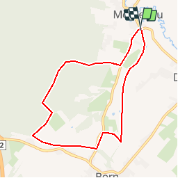
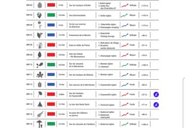
![](/images/other/stat-length.png)
Montenau - Circuit Natura 2000 - Lg22
Natura 2000
Randonnées de Natura 2000 GUIDE+
![Length](/images/other/stat-length.png)
![Max alt](https://static1.geolcdn.com/siteimages/upload/files/1508320355ic_sort_altitude_max_24dp.png)
![Uphill gradient](https://static1.geolcdn.com/siteimages/upload/files/1508320355ic_sort_den_pos_24dp.png)
![Km-Effort](/images/other/stat-length.png)
![Min alt](https://static1.geolcdn.com/siteimages/upload/files/1508320355ic_sort_altitude_min_24dp.png)
![Downhill gradient](https://static1.geolcdn.com/siteimages/upload/files/1508320355ic_sort_den_neg_24dp.png)
![Boucle](https://static1.geolcdn.com/siteimages/upload/files/16400158638029165_repeat_loop_refresh_sync_direction_icon.png)
![Walking](https://static1.geolcdn.com/sitytour/trail-icons/101.png)
1h55
Difficulty : Easy
![Scan this QR Code to open this trail in the SityTrail application](https://capi.geolives.com/qq0zvz2zws4bq2lad0pu/sitytour/trails/365329/qr.png?size=200)
FREE GPS app for hiking
About
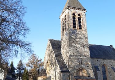
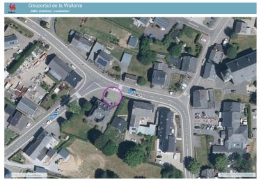
Trail Walking of 7.3 km to be discovered at Wallonia, Liège, Amel. This trail is proposed by Natura 2000.
Description
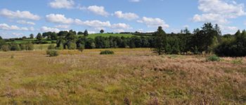
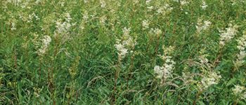
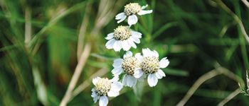
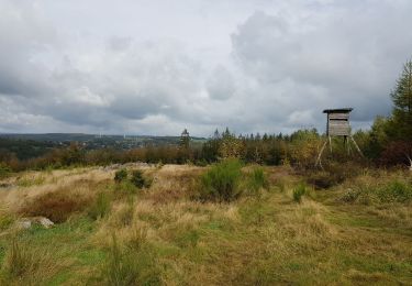
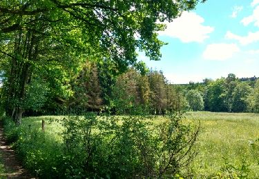
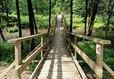
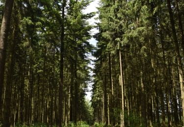
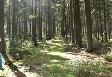
Ce circuit vous invite à parcourir un paysage partagé entre zones forestières et fonds de vallées très ouverts et humides.
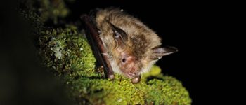
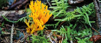
A cet endroit, se mêlent des prés de fauche à orchidées, des prairies à bistorte, des zones marécageuses, ... Cet ensemble forme une mosaïque de milieux de très grand intérêt biologique.
Au sein de ce site Natura 2000 nommé Vallée de l’Emmels, partez à la découverte d’habitats à la flore riche et variée, de zones d’accueil importantes pour l’avifaune et de la réserve naturelle de l’Emmels.
Points of interest
Positioning
Comments
Trails nearby
![Trail Walking Amel - 2021-05-17_18h56m57_montenau - Photo](https://media.geolcdn.com/t/375/260/39077950-0e33-4cc7-ace0-3c1287257ee0.jpg&format=jpg&maxdim=2)
![Walking Walking](https://static1.geolcdn.com/sitytour/trail-icons/101.png)
Walking
![](/images/other/stat-length.png)
![](https://static1.geolcdn.com/siteimages/upload/files/16400158638029165_repeat_loop_refresh_sync_direction_icon.png)
![Trail Walking Malmedy - ligneuville - ondeval aller retour - Photo](https://media.geolcdn.com/t/375/260/5d217ee2-30bd-4bc8-82e6-a4da860aa974.jpg&format=jpg&maxdim=2)
![Walking Walking](https://static1.geolcdn.com/sitytour/trail-icons/101.png)
Walking
![](/images/other/stat-length.png)
![](https://static1.geolcdn.com/siteimages/upload/files/16400158638029165_repeat_loop_refresh_sync_direction_icon.png)
![Trail Roller skating Malmedy - Vallée de l'Amblève - Photo](https://media.geolcdn.com/t/375/260/ext.jpg?maxdim=2&url=https%3A%2F%2Fservices.sitytrail.com%2FGeolivesWS%2FDownloadMedia.ashx%3FTrailID%3D767158%26Media%3Dfix__20170605123453.jpg)
![Roller skating Roller skating](https://static1.geolcdn.com/sitytour/trail-icons/901.png)
Roller skating
![](/images/other/stat-length.png)
![](https://static1.geolcdn.com/siteimages/upload/files/16400158638029165_repeat_loop_refresh_sync_direction_icon.png)
![Trail Walking Amel - 20241031 - TOTEMUS AMEL - 6.1 Km - Photo](https://media.geolcdn.com/t/375/260/20cb4eb7-78a4-4396-b0a0-3a5801e07d54.jpeg&format=jpg&maxdim=2)
![Walking Walking](https://static1.geolcdn.com/sitytour/trail-icons/101.png)
Walking
![](/images/other/stat-length.png)
![](https://static1.geolcdn.com/siteimages/upload/files/16400158638029165_repeat_loop_refresh_sync_direction_icon.png)
![Trail Walking Amel - La rivière d'or (9km) - Photo](https://media.geolcdn.com/t/375/260/eac006de-c0aa-46b2-933f-e559c8a45d2b.jpg&format=jpg&maxdim=2)
![Walking Walking](https://static1.geolcdn.com/sitytour/trail-icons/101.png)
Walking
![](/images/other/stat-length.png)
![](https://static1.geolcdn.com/siteimages/upload/files/16400158638029165_repeat_loop_refresh_sync_direction_icon.png)
![Walking Walking](https://static1.geolcdn.com/sitytour/trail-icons/101.png)
Walking
![](/images/other/stat-length.png)
![](https://static1.geolcdn.com/siteimages/upload/files/16400158638029165_repeat_loop_refresh_sync_direction_icon.png)
![Walking Walking](https://static1.geolcdn.com/sitytour/trail-icons/101.png)
Walking
![](/images/other/stat-length.png)
![](https://static1.geolcdn.com/siteimages/upload/files/16400158638029165_repeat_loop_refresh_sync_direction_icon.png)
![Trail Walking Waimes - Thirimont 16km - Photo](https://media.geolcdn.com/t/375/260/ext.jpg?maxdim=2&url=https%3A%2F%2Fstatic1.geolcdn.com%2Fsiteimages%2Fupload%2Ffiles%2F1553511878bg_sport_marche.png)
![Walking Walking](https://static1.geolcdn.com/sitytour/trail-icons/101.png)
Walking
![](/images/other/stat-length.png)
![](https://static1.geolcdn.com/siteimages/upload/files/16400158638029165_repeat_loop_refresh_sync_direction_icon.png)
![Trail Walking Waimes - 2024-05-30_07h49m09_t119964903_w16 sur les versants.gpx.xml - Photo](https://media.geolcdn.com/t/375/260/0aa31976-b707-4908-893e-d96b82af449f.jpg&format=jpg&maxdim=2)
![Walking Walking](https://static1.geolcdn.com/sitytour/trail-icons/101.png)
Walking
![](/images/other/stat-length.png)
![](https://static1.geolcdn.com/siteimages/upload/files/16400158638029165_repeat_loop_refresh_sync_direction_icon.png)
pousette enfant possible.