


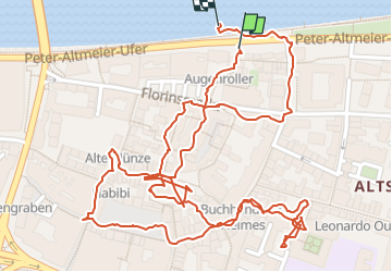

6.3 km | 8.2 km-effort


User


FREE GPS app for hiking
 SityTrail
IGN / Geographical institutes
SityTrail World
The world is yours!
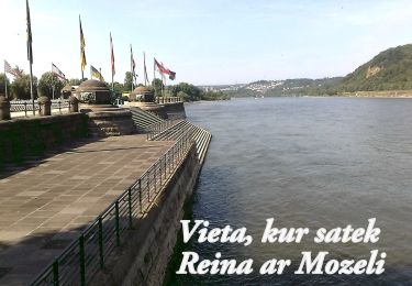
Trail Walking of 2.1 km to be discovered at Rhineland-Palatinate, Koblenz. This trail is proposed by Francisadrover.


On foot
On foot
On foot
On foot
On foot
On foot
On foot
On foot
![Trail On foot Vallendar - Rheinsteig - Etappe 9 [Vallendar - Koblenz-Ehrenbreitstein] - Photo](https://media.geolcdn.com/t/375/260/ext.jpg?maxdim=2&url=https%3A%2F%2Fstatic1.geolcdn.com%2Fsiteimages%2Fupload%2Ffiles%2F1545311037marcheuse_200dpi.jpg)
On foot