![](/images/other/stat-length.png)
![Trail Walking Unknown - Argiroupoli : l'église des 5 vierges et ses petites cascades (Rother n°39) - Photo](https://media.geolcdn.com/t/1900/400/cca1a243-a59f-47fb-9637-e9b626b68940.jpg&format=pjpeg&maxdim=2)
Argiroupoli : l'église des 5 vierges et ses petites cascades (Rother n°39)
Bart2015
User
![Length](/images/other/stat-length.png)
![Max alt](https://static1.geolcdn.com/siteimages/upload/files/1508320355ic_sort_altitude_max_24dp.png)
![Uphill gradient](https://static1.geolcdn.com/siteimages/upload/files/1508320355ic_sort_den_pos_24dp.png)
![Km-Effort](/images/other/stat-length.png)
![Min alt](https://static1.geolcdn.com/siteimages/upload/files/1508320355ic_sort_altitude_min_24dp.png)
![Downhill gradient](https://static1.geolcdn.com/siteimages/upload/files/1508320355ic_sort_den_neg_24dp.png)
![Boucle](https://static1.geolcdn.com/siteimages/upload/files/16400158638029165_repeat_loop_refresh_sync_direction_icon.png)
![Walking](https://static1.geolcdn.com/sitytour/trail-icons/101.png)
1h32
Difficulty : Medium
![Scan this QR Code to open this trail in the SityTrail application](https://capi.geolives.com/qq0zvz2zws4bq2lad0pu/sitytour/trails/3643397/qr.png?size=200)
FREE GPS app for hiking
About
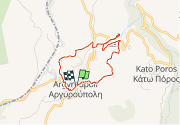
Trail Walking of 4.4 km to be discovered at Region of Crete, Rethymno Regional Unit. This trail is proposed by Bart2015.
Description
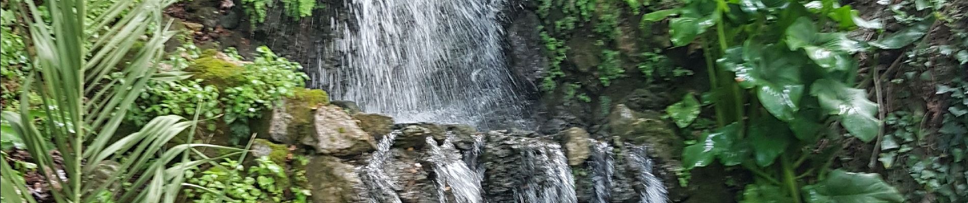
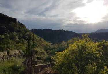
Petite balade autour du village à faire par temps sec car pavés glissants (au début). Découverte d'une chapelle à côté de nombreuses tombes creusées dans la roche, un peu plus loin un des platanes les plus anciens de Crète et près d'un ensemble de restaurants des petites cascades artificielles, avant de remonter par un joli sentiers vers l centre du village.
Bonne rando ...
Positioning
Comments
Trails nearby
![Trail Walking - Gorges de Moundros et de Kato Paros (rother n°36) - Photo](https://media.geolcdn.com/t/375/260/4c1c9ff2-c917-430b-ad8e-3f220251e491.jpg&format=jpg&maxdim=2)
![Walking Walking](https://static1.geolcdn.com/sitytour/trail-icons/101.png)
Walking
![](/images/other/stat-length.png)
![](https://static1.geolcdn.com/siteimages/upload/files/16400158638029165_repeat_loop_refresh_sync_direction_icon.png)
![Trail Walking - Kastellos-Patima-Kournas - Photo](https://media.geolcdn.com/t/375/260/b070b218-6c40-4696-8d2b-127cb4440565.jpg&format=jpg&maxdim=2)
![Walking Walking](https://static1.geolcdn.com/sitytour/trail-icons/101.png)
Walking
![](/images/other/stat-length.png)
![](https://static1.geolcdn.com/siteimages/upload/files/16400158638029165_repeat_loop_refresh_sync_direction_icon.png)
![Trail Walking - crete 01 - Photo](https://media.geolcdn.com/t/375/260/ext.jpg?maxdim=2&url=https%3A%2F%2Fstatic1.geolcdn.com%2Fsiteimages%2Fupload%2Ffiles%2F1553511878bg_sport_marche.png)
![Walking Walking](https://static1.geolcdn.com/sitytour/trail-icons/101.png)
Walking
![](/images/other/stat-length.png)
![](https://static1.geolcdn.com/siteimages/upload/files/16400158638029165_repeat_loop_refresh_sync_direction_icon.png)