![](/images/other/stat-length.png)
![Trail Electric bike Rolampont - Rolampont - Sts Geosmes - Rolampont - Photo](https://media.geolcdn.com/t/1900/400/ext.pjpeg?maxdim=2&url=https%3A%2F%2Fstatic1.geolcdn.com%2Fsiteimages%2Fupload%2Ffiles%2F1524743154velo.jpg)
Rolampont - Sts Geosmes - Rolampont
zombie52
User
![Length](/images/other/stat-length.png)
Length
68 km
![Max alt](https://static1.geolcdn.com/siteimages/upload/files/1508320355ic_sort_altitude_max_24dp.png)
Max alt
459 m
![Uphill gradient](https://static1.geolcdn.com/siteimages/upload/files/1508320355ic_sort_den_pos_24dp.png)
Uphill gradient
929 m
![Km-Effort](/images/other/stat-length.png)
Km-Effort
80 km
![Min alt](https://static1.geolcdn.com/siteimages/upload/files/1508320355ic_sort_altitude_min_24dp.png)
Min alt
307 m
![Downhill gradient](https://static1.geolcdn.com/siteimages/upload/files/1508320355ic_sort_den_neg_24dp.png)
Downhill gradient
933 m
![Boucle](https://static1.geolcdn.com/siteimages/upload/files/16400158638029165_repeat_loop_refresh_sync_direction_icon.png)
Boucle
Yes
Creation date :
2023-04-30 12:12:41.171
Updated on :
2023-05-01 18:03:11.069
![Electric bike](https://static1.geolcdn.com/sitytour/trail-icons/205.png)
4h15
Difficulty : Difficult
![Scan this QR Code to open this trail in the SityTrail application](https://capi.geolives.com/qq0zvz2zws4bq2lad0pu/sitytour/trails/3641818/qr.png?size=200)
FREE GPS app for hiking
About
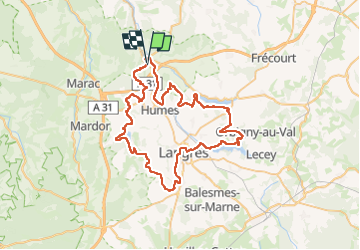
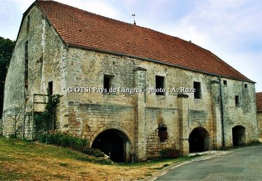
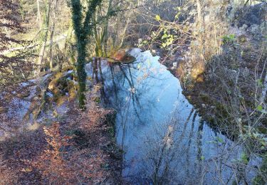
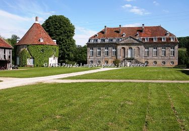
Trail Electric bike of 68 km to be discovered at Grand Est, Haute-Marne, Rolampont. This trail is proposed by zombie52.
Description
Rolampont - Chanoy - St Martin - St Ciergues - Perrancey - Sts Geosmes - Langres - La Liez - Bannes - Charmes - Hûmes - Rolampont
Positioning
Country:
France
Region :
Grand Est
Department/Province :
Haute-Marne
Municipality :
Rolampont
Location:
Unknown
Start:(Dec)
Start:(UTM)
670552 ; 5312746 (31T) N.
Comments
Trails nearby
![Trail Walking Humes-Jorquenay - Boucle 26 km autour de Humes - Photo](https://media.geolcdn.com/t/375/260/cf6c3e45-eb31-488c-9d40-076bc7c5c86d.jpg&format=jpg&maxdim=2)
![Walking Walking](https://static1.geolcdn.com/sitytour/trail-icons/101.png)
Boucle 26 km autour de Humes
Walking
Very difficult
Humes-Jorquenay,
Grand Est,
Haute-Marne,
France
![](/images/other/stat-length.png)
26 km | 33 km-effort
5h 56min
![](https://static1.geolcdn.com/siteimages/upload/files/16400158638029165_repeat_loop_refresh_sync_direction_icon.png)
Yes
![Trail Mountain bike Rolampont - Rolampont Thivet - Photo](https://media.geolcdn.com/t/375/260/ext.jpg?maxdim=2&url=https%3A%2F%2Fservices.sitytrail.com%2FGeolivesWS%2FDownloadMedia.ashx%3FTrailID%3D430827%26Media%3Dbd3938cb-7f66-4dcf-ac4e-c3757f1a14a2.PNG)
![Mountain bike Mountain bike](https://static1.geolcdn.com/sitytour/trail-icons/202.png)
Rolampont Thivet
Mountain bike
Medium
Rolampont,
Grand Est,
Haute-Marne,
France
![](/images/other/stat-length.png)
15.7 km | 18.4 km-effort
1h 13min
![](https://static1.geolcdn.com/siteimages/upload/files/16400158638029165_repeat_loop_refresh_sync_direction_icon.png)
Yes
![Trail Mountain bike Rolampont - Rolampont - Lac de la Liez - Photo](https://media.geolcdn.com/t/375/260/ext.jpg?maxdim=2&url=https%3A%2F%2Fservices.sitytrail.com%2FGeolivesWS%2FDownloadMedia.ashx%3FTrailID%3D142635%26Media%3Decbb10a6-f619-41a2-a626-4a74595062b5.jpg)
![Mountain bike Mountain bike](https://static1.geolcdn.com/sitytour/trail-icons/202.png)
Rolampont - Lac de la Liez
Mountain bike
Easy
Rolampont,
Grand Est,
Haute-Marne,
France
![](/images/other/stat-length.png)
42 km | 46 km-effort
3h 20min
![](https://static1.geolcdn.com/siteimages/upload/files/16400158638029165_repeat_loop_refresh_sync_direction_icon.png)
Yes
![Trail Cycle Rolampont - De la Suize à l'Aujon - Rolampont - Photo](https://media.geolcdn.com/t/375/260/ext.jpg?maxdim=2&url=https%3A%2F%2Fservices.sitytrail.com%2FGeolivesWS%2FDownloadMedia.ashx%3FTrailID%3D109267%26Media%3D3387_5.jpg)
![Cycle Cycle](https://static1.geolcdn.com/sitytour/trail-icons/200.png)
De la Suize à l'Aujon - Rolampont
Cycle
Difficult
(1)
Rolampont,
Grand Est,
Haute-Marne,
France
![](/images/other/stat-length.png)
53 km | 62 km-effort
4h 30min
![](https://static1.geolcdn.com/siteimages/upload/files/16400158638029165_repeat_loop_refresh_sync_direction_icon.png)
Yes
![Trail Walking Humes-Jorquenay - Humes saint ciergues - Photo](https://media.geolcdn.com/t/375/260/bd5883bf-5224-4ade-8fc0-1b68dee20862.jpg&format=jpg&maxdim=2)
![Walking Walking](https://static1.geolcdn.com/sitytour/trail-icons/101.png)
Humes saint ciergues
Walking
Medium
Humes-Jorquenay,
Grand Est,
Haute-Marne,
France
![](/images/other/stat-length.png)
15.8 km | 19.1 km-effort
4h 29min
![](https://static1.geolcdn.com/siteimages/upload/files/16400158638029165_repeat_loop_refresh_sync_direction_icon.png)
Yes
![Trail Electric bike Rolampont - Vallée des Caivottes, Trimeule et Tufiere - Photo](https://media.geolcdn.com/t/375/260/edf3e753-6302-4789-9fb5-b467cca70c93.jpg&format=jpg&maxdim=2)
![Electric bike Electric bike](https://static1.geolcdn.com/sitytour/trail-icons/205.png)
Vallée des Caivottes, Trimeule et Tufiere
Electric bike
Medium
Rolampont,
Grand Est,
Haute-Marne,
France
![](/images/other/stat-length.png)
34 km | 42 km-effort
3h 0min
![](https://static1.geolcdn.com/siteimages/upload/files/16400158638029165_repeat_loop_refresh_sync_direction_icon.png)
Yes
![Trail Mountain bike Rolampont - Source de la Tuffiere - Photo](https://media.geolcdn.com/t/375/260/de7a3704-ddd1-4ad9-a445-c7ed348fc8b8.jpg&format=jpg&maxdim=2)
![Mountain bike Mountain bike](https://static1.geolcdn.com/sitytour/trail-icons/202.png)
Source de la Tuffiere
Mountain bike
Very easy
Rolampont,
Grand Est,
Haute-Marne,
France
![](/images/other/stat-length.png)
21 km | 25 km-effort
3h 15min
![](https://static1.geolcdn.com/siteimages/upload/files/16400158638029165_repeat_loop_refresh_sync_direction_icon.png)
Yes
![Trail Mountain bike Rolampont - SityTrail - Autour de la Tuffière - Photo](https://media.geolcdn.com/t/375/260/0a3804a2-f563-4878-95d1-65c4ec4baa98.jpg&format=jpg&maxdim=2)
![Mountain bike Mountain bike](https://static1.geolcdn.com/sitytour/trail-icons/202.png)
SityTrail - Autour de la Tuffière
Mountain bike
Medium
Rolampont,
Grand Est,
Haute-Marne,
France
![](/images/other/stat-length.png)
20 km | 25 km-effort
1h 38min
![](https://static1.geolcdn.com/siteimages/upload/files/16400158638029165_repeat_loop_refresh_sync_direction_icon.png)
Yes
![Trail Mountain bike Humes-Jorquenay - Le Val de Mouche - Humes - Photo](https://media.geolcdn.com/t/375/260/ext.jpg?maxdim=2&url=https%3A%2F%2Fservices.sitytrail.com%2FGeolivesWS%2FDownloadMedia.ashx%3FTrailID%3D108731%26Media%3D1823_2.jpg)
![Mountain bike Mountain bike](https://static1.geolcdn.com/sitytour/trail-icons/202.png)
Le Val de Mouche - Humes
Mountain bike
Very difficult
Humes-Jorquenay,
Grand Est,
Haute-Marne,
France
![](/images/other/stat-length.png)
18.7 km | 23 km-effort
2h 30min
![](https://static1.geolcdn.com/siteimages/upload/files/16400158638029165_repeat_loop_refresh_sync_direction_icon.png)
Yes