Trail Walking Saint-Hippolyte-de-Montaigu - Etang de capelle Masmolene - Photo

Etang de capelle Masmolene

 JMJ42
JMJ42

User

© OpenStreetMap contributors
Length
Length
16.2 km
Max alt
Max alt
253 m
Uphill gradient
Uphill gradient
220 m
Km-Effort
Km-Effort  
19.2 km
Min alt
Min alt
136 m
Downhill gradient
Downhill gradient
222 m
Boucle
Boucle
Yes
Creation date :
2023-04-25 08:03:23.202
Updated on :
2023-04-25 13:57:45.613

(0 Reviews)

Walking
Walking
4h13
Difficulty : Medium

Scan this QR Code to open this trail in the SityTrail application

FREE GPS app for hiking

Logo SityTrail SityTrail

IGN / Geographical institutes

Download SityTrail from the App Store Download SityTrail from Google Play

Logo SityTrail SityTrail World

The world is yours!

Download SityTrail from the App Store Download SityTrail from Google Play Download SityTrail on Huawei AppGallery

About

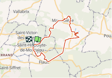
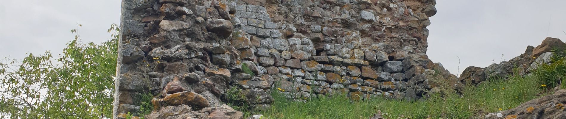
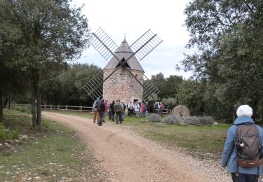
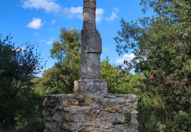
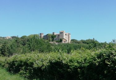
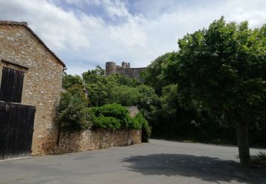
Trail Walking of 16.2 km to be discovered at Occitania, Gard, Saint-Hippolyte-de-Montaigu. This trail is proposed by JMJ42.

Elevation profile

Photos

Positioning

Country:
France
Region :
Occitania
Department/Province :
Gard
Municipality :
Saint-Hippolyte-de-Montaigu
Location:
Unknown
Start:(UTM)
619598 ; 4876636 (31T) N.

Trails nearby

Trail Running Saint-Maximin - St-Maximin et la vallée d'Eure - Photo
Running
tracegps

Running

Medium
(1)
Saint-Maximin, Occitania, Gard, France
18 km | 23 km-effort
2h 0min
Yes
Trail Walking La Capelle-et-Masmolène - Masmolène et l'étang de la Capelle - Photo
Walking
jesusmarieclaire

Walking

Very easy
(1)
La Capelle-et-Masmolène, Occitania, Gard, France
14.4 km | 16.8 km-effort
3h 37min
No
Trail Walking Saint-Siffret - au départ de St Siffrey - Photo
Walking
GUIDE
nadinebondoux

Walking

Medium
Saint-Siffret, Occitania, Gard, France
18.2 km | 22 km-effort
5h 27min
Yes
Trail Mountain bike Uzès - GARD VTT 2017 J3 - Photo
Mountain bike
Mariolebeno

Mountain bike

Medium
(2)
Uzès, Occitania, Gard, France
48 km | 60 km-effort
3h 53min
No
Trail Walking La Capelle-et-Masmolène - La Capelle-et-Masmolène - Photo
Walking
Gegetop

Walking

Easy
La Capelle-et-Masmolène, Occitania, Gard, France
7.7 km | 9.1 km-effort
2h 8min
Yes
Trail Walking La Capelle-et-Masmolène - la Capelle Masmolène - Photo
Walking
GUIDE
nadinebondoux

Walking

Medium
La Capelle-et-Masmolène, Occitania, Gard, France
16.8 km | 21 km-effort
5h 45min
Yes
Trail Mountain bike La Capelle-et-Masmolène - 30-vtt-lacapelle-St-Siffret-25km-230m-juin21 - Photo
Mountain bike
SyMA

Mountain bike

Medium
La Capelle-et-Masmolène, Occitania, Gard, France
25 km | 28 km-effort
2h 41min
Yes
Trail Walking La Capelle-et-Masmolène - 30-lacapelle-forets-15km-240m-juin21 - Photo
Walking
SyMA

Walking

Medium
La Capelle-et-Masmolène, Occitania, Gard, France
14.9 km | 18.1 km-effort
3h 37min
Yes
Trail Walking Saint-Maximin - Saint Maximin, boucle  par Saint Siffret - Photo
Walking
jll7513

Walking

Easy
Saint-Maximin, Occitania, Gard, France
12.7 km | 15.7 km-effort
3h 30min
Yes


Close
My subscriptions