13.5 km | 15.2 km-effort
Boissy SUCY parc départemental
© OpenStreetMap contributors
Walking
2h24
Difficulty : Unknown
Length
10.7 km
Max alt
109 m
Uphill gradient
104 m
Km-Effort
12.1 km
Min alt
48 m
Downhill gradient
103 m
Boucle
Yes
Creation date :
2023-04-24 12:29:27.0
Updated on :
2023-04-24 15:23:48.758
2h24
Difficulty : Unknown
FREE GPS app for hiking
About
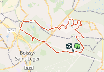
Trail Walking of 10.7 km to be discovered at Ile-de-France, Val-de-Marne, Boissy-Saint-Léger. This trail is proposed by 001185.1a411e07e05844e0b21535b8a6fe40df.0829.
Description
Parking centre aéré château de Piple
Bous de petit Val parc départemental de SUCY
Positioning
Country:
France
Region :
Ile-de-France
Department/Province :
Val-de-Marne
Municipality :
Boissy-Saint-Léger
Location:
Unknown
Start:(Dec)
Start:(UTM)
466163 ; 5399671 (31U) N.
Comments
Trails nearby
GRP CV-IDF 05
Walking
Difficult
(1)
Marolles-en-Brie,
Ile-de-France,
Val-de-Marne,
France
3h 27min
No
J 26 Mandres, Boussy , Brunoy le chemin des fresques
Walking
Medium
(2)
Mandres-les-Roses,
Ile-de-France,
Val-de-Marne,
France
12.2 km | 13.8 km-effort
3h 7min
Yes
J 01 11.97 km les 5 châteaux
On foot
Medium
(1)
Servon,
Ile-de-France,
Seine-et-Marne,
France
11.7 km | 13.2 km-effort
3h 3min
Yes
R 04 - 8 km - Servon, Santeny, Servon
On foot
Very difficult
(4)
Servon,
Ile-de-France,
Seine-et-Marne,
France
7.9 km | 9.1 km-effort
2h 3min
Yes
depuis Noiseau
Walking
Easy
(2)
Noiseau,
Ile-de-France,
Val-de-Marne,
France
17 km | 19.1 km-effort
4h 35min
Yes
BM Foret Regionale de Grobois 10km
Walking
Medium
(1)
Yerres,
Ile-de-France,
Essonne,
France
10.4 km | 11 km-effort
2h 30min
Yes
BM Foret Regionale Grosbois 10km
Walking
Medium
(1)
Yerres,
Ile-de-France,
Essonne,
France
9.8 km | 10.5 km-effort
2h 23min
Yes
J 43 Yerres Parc Caillebotte, île des Prévôts
Walking
Medium
(2)
Yerres,
Ile-de-France,
Essonne,
France
11.4 km | 13.1 km-effort
2h 59min
Yes
JC 24 Servon , Villecresnes, forêt de la Grange
Walking
Difficult
(3)
Servon,
Ile-de-France,
Seine-et-Marne,
France
20 km | 22 km-effort
5h 6min
Yes