Vieux Rhin SityTrail > Trails > Outdoor > France > Grand Est > Haut-Rhin > Niffer SityTrail > Trails > Outdoor > France > Grand Est > Haut-Rhin > Niffer Vieux Rhin 000765.142160d7ea0b4e969e84406e0607fae5.1254 User 3D © OpenStreetMap contributors Length 4.6 km Max alt 237 m Uphill gradient 49 m Km-Effort 5.2 km Min alt 219 m Downhill gradient 48 m Boucle Yes Creation date : 2023-04-20 16:09:24.0 Updated on : 2023-04-20 17:40:37.837 (0 Reviews) FREE GPS app for hiking SityTrail IGN / Geographical institutes SityTrail World The world is yours! About 
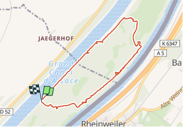
Trail of 4.6 km to be discovered at Grand Est, Haut-Rhin, Niffer. This trail is proposed by 000765.142160d7ea0b4e969e84406e0607fae5.1254. Legends | More details (PDF) Elevation profile Legends > 15% 15% - 10% 10% - 5% flat 5% - 10% 10% - 15% 15% - 30% > 30% Positioning Country: France Region : Grand Est Department/Province : Haut-Rhin Municipality : Niffer Location: Unknown Start:(Dec) 47.712737 / 7.522471 Start:(UTM) 389174 ; 5285430 (32T) N. Comments Please log in to post a review or rate the element Trails nearby meggstone Canal Run Equestrian Medium Niffer, Grand Est, Haut-Rhin, France 16.4 km | 17.9 km-effort 2h 16min Yes