![](/images/other/stat-length.png)
![Trail Walking Saint-Joseph-de-Rivière - Chartreuse Rocher Fenêtre Tourbière Herretang - Photo](https://media.geolcdn.com/t/1900/400/ext.pjpeg?maxdim=2&url=https%3A%2F%2Fstatic1.geolcdn.com%2Fsiteimages%2Fupload%2Ffiles%2F1553511878bg_sport_marche.png)
Chartreuse Rocher Fenêtre Tourbière Herretang
c.gourme
User
![Length](/images/other/stat-length.png)
Length
15.8 km
![Max alt](https://static1.geolcdn.com/siteimages/upload/files/1508320355ic_sort_altitude_max_24dp.png)
Max alt
884 m
![Uphill gradient](https://static1.geolcdn.com/siteimages/upload/files/1508320355ic_sort_den_pos_24dp.png)
Uphill gradient
603 m
![Km-Effort](/images/other/stat-length.png)
Km-Effort
24 km
![Min alt](https://static1.geolcdn.com/siteimages/upload/files/1508320355ic_sort_altitude_min_24dp.png)
Min alt
397 m
![Downhill gradient](https://static1.geolcdn.com/siteimages/upload/files/1508320355ic_sort_den_neg_24dp.png)
Downhill gradient
605 m
![Boucle](https://static1.geolcdn.com/siteimages/upload/files/16400158638029165_repeat_loop_refresh_sync_direction_icon.png)
Boucle
Yes
Creation date :
2023-04-19 07:24:10.0
Updated on :
2023-04-19 13:46:06.347
![Walking](https://static1.geolcdn.com/sitytour/trail-icons/101.png)
5h29
Difficulty : Difficult
![Scan this QR Code to open this trail in the SityTrail application](https://capi.geolives.com/qq0zvz2zws4bq2lad0pu/sitytour/trails/3627485/qr.png?size=200)
FREE GPS app for hiking
About
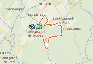
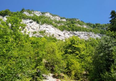
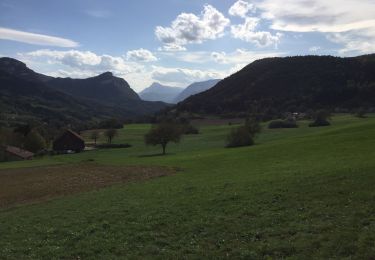
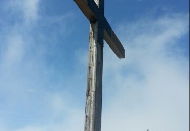
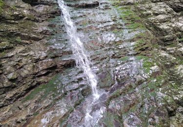
Trail Walking of 15.8 km to be discovered at Auvergne-Rhône-Alpes, Isère, Saint-Joseph-de-Rivière. This trail is proposed by c.gourme.
Description
Ne pas refaire, passage de barbelés. Promenade un peu longt,ne présentant pas beaucoup de curiosités .
Positioning
Country:
France
Region :
Auvergne-Rhône-Alpes
Department/Province :
Isère
Municipality :
Saint-Joseph-de-Rivière
Location:
Unknown
Start:(Dec)
Start:(UTM)
711235 ; 5028247 (31T) N.
Comments
Trails nearby
![Trail Horseback riding Saint-Aupre - CHA - J3 - 12/09 - St Aupre > La Ruchère - R - Photo](https://media.geolcdn.com/t/375/260/ext.jpg?maxdim=2&url=https%3A%2F%2Fstatic1.geolcdn.com%2Fsiteimages%2Fupload%2Ffiles%2F1524743154cheval.jpg)
![Horseback riding Horseback riding](https://static1.geolcdn.com/sitytour/trail-icons/301.png)
CHA - J3 - 12/09 - St Aupre > La Ruchère - R
Horseback riding
Medium
(1)
Saint-Aupre,
Auvergne-Rhône-Alpes,
Isère,
France
![](/images/other/stat-length.png)
21 km | 37 km-effort
2h 59min
![](https://static1.geolcdn.com/siteimages/upload/files/16400158638029165_repeat_loop_refresh_sync_direction_icon.png)
No
![Trail Horseback riding Saint-Aupre - CHA - J3 - 12/09 - St Aupre > La Ruchère - Photo](https://media.geolcdn.com/t/375/260/ext.jpg?maxdim=2&url=https%3A%2F%2Fstatic1.geolcdn.com%2Fsiteimages%2Fupload%2Ffiles%2F1524743154cheval.jpg)
![Horseback riding Horseback riding](https://static1.geolcdn.com/sitytour/trail-icons/301.png)
CHA - J3 - 12/09 - St Aupre > La Ruchère
Horseback riding
Medium
(1)
Saint-Aupre,
Auvergne-Rhône-Alpes,
Isère,
France
![](/images/other/stat-length.png)
22 km | 40 km-effort
2h 59min
![](https://static1.geolcdn.com/siteimages/upload/files/16400158638029165_repeat_loop_refresh_sync_direction_icon.png)
No
![Trail Walking Saint-Laurent-du-Pont - Le balcon de Saint Laurent - Photo](https://media.geolcdn.com/t/375/260/b9bd2f7b-5bbd-4508-aa19-8047e66c1538.jpg&format=jpg&maxdim=2)
![Walking Walking](https://static1.geolcdn.com/sitytour/trail-icons/101.png)
Le balcon de Saint Laurent
Walking
Easy
Saint-Laurent-du-Pont,
Auvergne-Rhône-Alpes,
Isère,
France
![](/images/other/stat-length.png)
8.5 km | 11.5 km-effort
2h 19min
![](https://static1.geolcdn.com/siteimages/upload/files/16400158638029165_repeat_loop_refresh_sync_direction_icon.png)
Yes
![Trail Walking Saint-Aupre - Circuit au départ de Saint Aupre - Photo](https://media.geolcdn.com/t/375/260/accbf58a-78f2-4cef-8ae0-2acfb4e853de.jpg&format=jpg&maxdim=2)
![Walking Walking](https://static1.geolcdn.com/sitytour/trail-icons/101.png)
Circuit au départ de Saint Aupre
Walking
Easy
Saint-Aupre,
Auvergne-Rhône-Alpes,
Isère,
France
![](/images/other/stat-length.png)
9.7 km | 15.4 km-effort
3h 28min
![](https://static1.geolcdn.com/siteimages/upload/files/16400158638029165_repeat_loop_refresh_sync_direction_icon.png)
Yes
![Trail Walking Saint-Joseph-de-Rivière - Saint Joseph stade boucle - Photo](https://media.geolcdn.com/t/375/260/3b9ebf6d-8e83-447a-99bf-3e5f86261759.jpg&format=jpg&maxdim=2)
![Walking Walking](https://static1.geolcdn.com/sitytour/trail-icons/101.png)
Saint Joseph stade boucle
Walking
Difficult
Saint-Joseph-de-Rivière,
Auvergne-Rhône-Alpes,
Isère,
France
![](/images/other/stat-length.png)
12.2 km | 16.8 km-effort
3h 33min
![](https://static1.geolcdn.com/siteimages/upload/files/16400158638029165_repeat_loop_refresh_sync_direction_icon.png)
Yes
![Trail Walking Saint-Joseph-de-Rivière - Boucle SAINT JOSEPH XE RIVIÈRE - Photo](https://media.geolcdn.com/t/375/260/0d4a7437-b567-42d0-9a40-464d503135eb.jpg&format=jpg&maxdim=2)
![Walking Walking](https://static1.geolcdn.com/sitytour/trail-icons/101.png)
Boucle SAINT JOSEPH XE RIVIÈRE
Walking
Difficult
Saint-Joseph-de-Rivière,
Auvergne-Rhône-Alpes,
Isère,
France
![](/images/other/stat-length.png)
12.6 km | 18.9 km-effort
3h 45min
![](https://static1.geolcdn.com/siteimages/upload/files/16400158638029165_repeat_loop_refresh_sync_direction_icon.png)
Yes
![Trail Walking La Sure en Chartreuse - Rando au départ de Saint Julien - Photo](https://media.geolcdn.com/t/375/260/811901f9-ca1c-41ba-81ee-4f9bb9027cab.jpg&format=jpg&maxdim=2)
![Walking Walking](https://static1.geolcdn.com/sitytour/trail-icons/101.png)
Rando au départ de Saint Julien
Walking
Medium
La Sure en Chartreuse,
Auvergne-Rhône-Alpes,
Isère,
France
![](/images/other/stat-length.png)
9.8 km | 12.4 km-effort
2h 37min
![](https://static1.geolcdn.com/siteimages/upload/files/16400158638029165_repeat_loop_refresh_sync_direction_icon.png)
Yes
![Trail Other activity Saint-Laurent-du-Pont - La grande Sure depuis la Chartreuse de Curière - Photo](https://media.geolcdn.com/t/375/260/ext.jpg?maxdim=2&url=https%3A%2F%2Fservices.sitytrail.com%2FGeolivesWS%2FDownloadMedia.ashx%3FTrailID%3D210333%26Media%3Dfix__20130804145735.jpg)
![Other activity Other activity](https://static1.geolcdn.com/sitytour/trail-icons/900.png)
La grande Sure depuis la Chartreuse de Curière
Other activity
Medium
Saint-Laurent-du-Pont,
Auvergne-Rhône-Alpes,
Isère,
France
![](/images/other/stat-length.png)
18 km | 32 km-effort
8h 17min
![](https://static1.geolcdn.com/siteimages/upload/files/16400158638029165_repeat_loop_refresh_sync_direction_icon.png)
Yes
![Trail Walking Saint-Laurent-du-Pont - Crêtes des Charmilles - Photo](https://media.geolcdn.com/t/375/260/56f8250f-3f79-4e12-a38c-411c36326b83.jpg&format=jpg&maxdim=2)
![Walking Walking](https://static1.geolcdn.com/sitytour/trail-icons/101.png)
Crêtes des Charmilles
Walking
Medium
Saint-Laurent-du-Pont,
Auvergne-Rhône-Alpes,
Isère,
France
![](/images/other/stat-length.png)
10.3 km | 21 km-effort
5h 8min
![](https://static1.geolcdn.com/siteimages/upload/files/16400158638029165_repeat_loop_refresh_sync_direction_icon.png)
Yes