Trail Walking L'Aigle - L'aigle Voie verte - Photo

L'aigle Voie verte

© OpenStreetMap contributors
Length
Length
6.7 km
Max alt
Max alt
206 m
Uphill gradient
Uphill gradient
49 m
Km-Effort
Km-Effort  
7.3 km
Min alt
Min alt
190 m
Downhill gradient
Downhill gradient
49 m
Boucle
Boucle
Yes
Creation date :
2023-04-18 11:49:03.824
Updated on :
2023-04-18 13:43:53.145

(0 Reviews)

Walking
Walking
1h41
Difficulty : Medium

Scan this QR Code to open this trail in the SityTrail application

FREE GPS app for hiking

Logo SityTrail SityTrail

IGN / Geographical institutes

Download SityTrail from the App Store Download SityTrail from Google Play

Logo SityTrail SityTrail World

The world is yours!

Download SityTrail from the App Store Download SityTrail from Google Play Download SityTrail on Huawei AppGallery

About

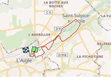
Trail Walking of 6.7 km to be discovered at Normandy, Orne, L'Aigle. This trail is proposed by DranoelNiala.

Description

Départ près des Platanes
Rue Marcel Guiet

Elevation profile

Positioning

Country:
France
Region :
Normandy
Department/Province :
Orne
Municipality :
L'Aigle
Location:
Unknown
Start:(UTM)
325962 ; 5404213 (31U) N.

Trails nearby

Trail Mountain bike Saint-Martin-d'Écublei - VTT_Nd et Ouest Biéville-Beuville - Photo
Mountain bike
baccojac

Mountain bike

Very difficult
Saint-Martin-d'Écublei, Normandy, Orne, France
103 km | 114 km-effort
7h 53min
Yes
Trail Other activity Saint-Sulpice-sur-Risle - Basse Normandie - Ligne 00G - L'Aigle - La Hutte-Coulombiers (Section de L'Aigle à St Rémy-des-Monts) - Photo
Other activity
mich54

Other activity

Very easy
Saint-Sulpice-sur-Risle, Normandy, Orne, France
72 km | 81 km-effort
5min
No
Trail Other activity Saint-Sulpice-sur-Risle - Haute - Normandie - Ligne 398 - Saint-Martin-d'Écublei - Conches - Photo
Other activity
mich54

Other activity

Very easy
Saint-Sulpice-sur-Risle, Normandy, Orne, France
36 km | 39 km-effort
5min
No
Trail sport Saint-Martin-d'Écublei - Perche4 - Photo
sport
batzephyr

sport

Very easy
Saint-Martin-d'Écublei, Normandy, Orne, France
112 km | 125 km-effort
Unknown
No
Trail sport Saint-Martin-d'Écublei - Perche3 - Photo
sport
batzephyr

sport

Very easy
Saint-Martin-d'Écublei, Normandy, Orne, France
123 km | 137 km-effort
Unknown
No
Trail sport Saint-Martin-d'Écublei - Perche2 - Photo
sport
batzephyr

sport

Very easy
Saint-Martin-d'Écublei, Normandy, Orne, France
109 km | 125 km-effort
Unknown
No
Trail Walking L'Aigle - L'Aigle Nord-Ouest  - Photo
Walking
DranoelNiala

Walking

Medium
L'Aigle, Normandy, Orne, France
8 km | 9.1 km-effort
2h 3min
Yes
Trail Walking L'Aigle - L'Aigle Sud ouest  - Photo
Walking
DranoelNiala

Walking

Medium
L'Aigle, Normandy, Orne, France
7.4 km | 8.5 km-effort
1h 56min
Yes
Trail Walking L'Aigle - L'Aigle Chappelle de la place  - Photo
Walking
DranoelNiala

Walking

Medium
L'Aigle, Normandy, Orne, France
8.5 km | 9.7 km-effort
2h 12min
Yes


Close
My subscriptions