


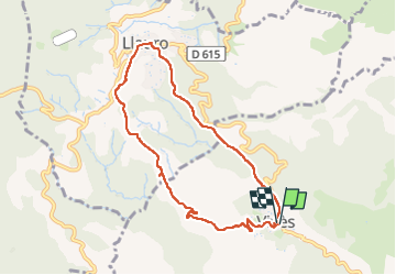

8.4 km | 10.5 km-effort


User GUIDE


FREE GPS app for hiking
 SityTrail
IGN / Geographical institutes
SityTrail World
The world is yours!
Trail Walking of 8.2 km to be discovered at Occitania, Pyrénées-Orientales, Vivès. This trail is proposed by antignacs.
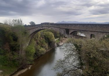
Balade sur une piste forestière à travers la forêt de chênes liège. Café épicerie à Lauro, sinon, village, sans intérêt à éviter en passant plus au sud.


Walking
Walking

Walking

Walking

Walking

Walking

Hybrid bike

Walking
Walking