![](/images/other/stat-length.png)
![Trail Walking Gonfaron - Plateau du Treps - Photo](https://media.geolcdn.com/t/1900/400/5b8085ae-4066-4df0-84c4-b4dd57e7e50c.jpg&format=pjpeg&maxdim=2)
Plateau du Treps
FSantoni
User
![Length](/images/other/stat-length.png)
Length
19.4 km
![Max alt](https://static1.geolcdn.com/siteimages/upload/files/1508320355ic_sort_altitude_max_24dp.png)
Max alt
645 m
![Uphill gradient](https://static1.geolcdn.com/siteimages/upload/files/1508320355ic_sort_den_pos_24dp.png)
Uphill gradient
467 m
![Km-Effort](/images/other/stat-length.png)
Km-Effort
26 km
![Min alt](https://static1.geolcdn.com/siteimages/upload/files/1508320355ic_sort_altitude_min_24dp.png)
Min alt
514 m
![Downhill gradient](https://static1.geolcdn.com/siteimages/upload/files/1508320355ic_sort_den_neg_24dp.png)
Downhill gradient
464 m
![Boucle](https://static1.geolcdn.com/siteimages/upload/files/16400158638029165_repeat_loop_refresh_sync_direction_icon.png)
Boucle
Yes
Creation date :
2023-04-16 07:17:39.353
Updated on :
2023-04-16 17:33:40.405
![Walking](https://static1.geolcdn.com/sitytour/trail-icons/101.png)
5h49
Difficulty : Very difficult
![Scan this QR Code to open this trail in the SityTrail application](https://capi.geolives.com/qq0zvz2zws4bq2lad0pu/sitytour/trails/3623637/qr.png?size=200)
FREE GPS app for hiking
About
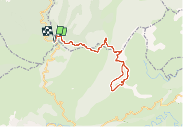
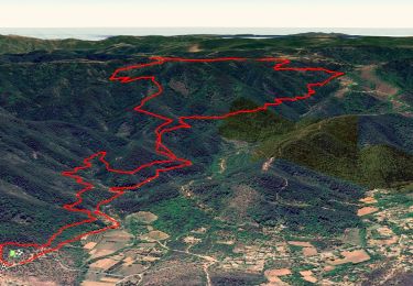
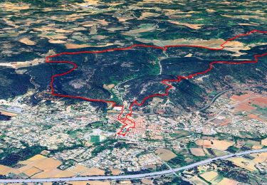
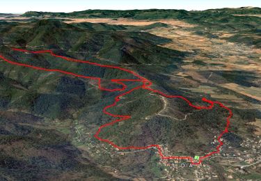
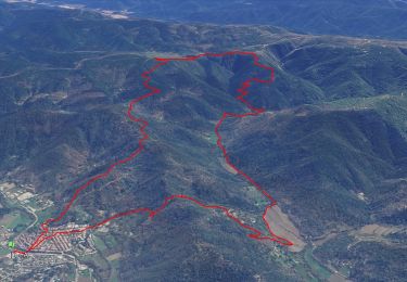
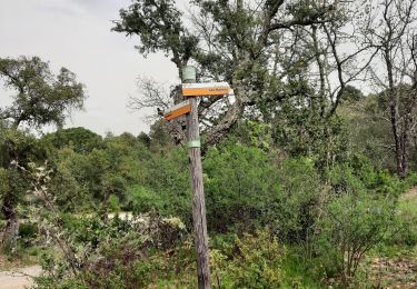
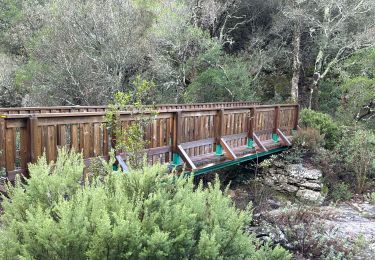
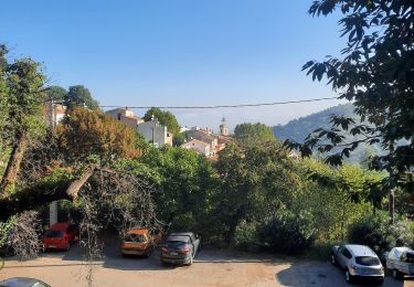
Trail Walking of 19.4 km to be discovered at Provence-Alpes-Côte d'Azur, Var, Gonfaron. This trail is proposed by FSantoni.
Description
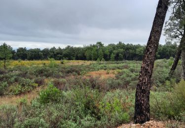
Rando trés agréable, sans réelles difficultés, avec de magnifiques paysages au cœur des Maures.
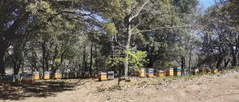
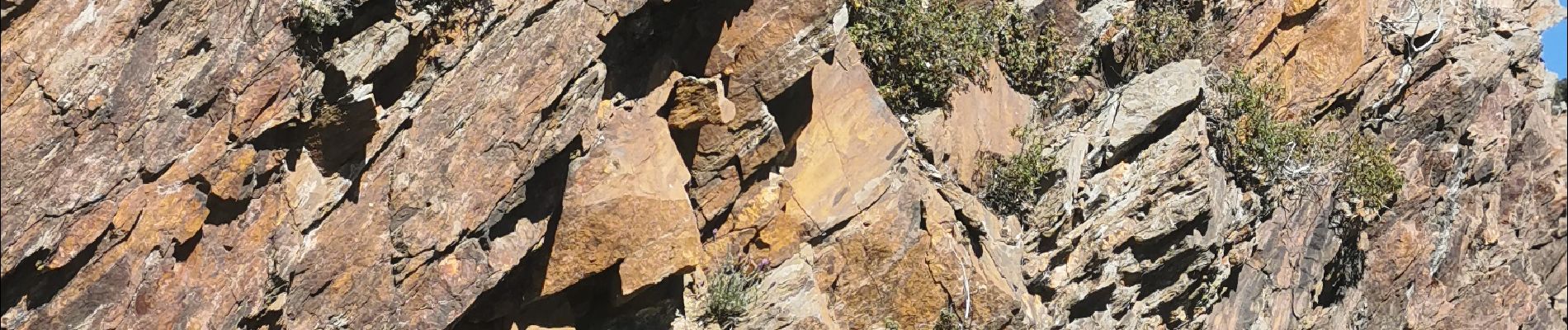
Positioning
Country:
France
Region :
Provence-Alpes-Côte d'Azur
Department/Province :
Var
Municipality :
Gonfaron
Location:
Unknown
Start:(Dec)
Start:(UTM)
283064 ; 4795722 (32T) N.
Comments
Trails nearby
![Trail Walking Les Mayons - FFRandonnée-Sur_les_traces_du_decauville - Photo](https://media.geolcdn.com/t/375/260/bcb1604c-22f0-433d-9ea7-43bb42cd787e.jpg&format=jpg&maxdim=2)
![Walking Walking](https://static1.geolcdn.com/sitytour/trail-icons/101.png)
FFRandonnée-Sur_les_traces_du_decauville
Walking
Medium
(1)
Les Mayons,
Provence-Alpes-Côte d'Azur,
Var,
France
![](/images/other/stat-length.png)
18 km | 26 km-effort
6h 0min
![](https://static1.geolcdn.com/siteimages/upload/files/16400158638029165_repeat_loop_refresh_sync_direction_icon.png)
Yes
![Trail Walking Gonfaron - CVI7-GonfaronNG-291121 - Photo](https://media.geolcdn.com/t/375/260/2df2772b-e3d9-4738-9a0c-a1cefdfdedfb.jpg&format=jpg&maxdim=2)
![Walking Walking](https://static1.geolcdn.com/sitytour/trail-icons/101.png)
CVI7-GonfaronNG-291121
Walking
Easy
(1)
Gonfaron,
Provence-Alpes-Côte d'Azur,
Var,
France
![](/images/other/stat-length.png)
15.2 km | 21 km-effort
6h 0min
![](https://static1.geolcdn.com/siteimages/upload/files/16400158638029165_repeat_loop_refresh_sync_direction_icon.png)
Yes
![Trail Walking Les Mayons - Sur les hauteurs des Mayons - Photo](https://media.geolcdn.com/t/375/260/a3854856-9a5e-4079-97cc-abf551e29f44.jpg&format=jpg&maxdim=2)
![Walking Walking](https://static1.geolcdn.com/sitytour/trail-icons/101.png)
Sur les hauteurs des Mayons
Walking
Medium
(1)
Les Mayons,
Provence-Alpes-Côte d'Azur,
Var,
France
![](/images/other/stat-length.png)
13.5 km | 21 km-effort
6h 0min
![](https://static1.geolcdn.com/siteimages/upload/files/16400158638029165_repeat_loop_refresh_sync_direction_icon.png)
Yes
![Trail Walking Collobrières - SityTrail - Collobriéres - Menhirs de Lambert - Photo](https://media.geolcdn.com/t/375/260/72b69c29-7d29-4189-adbb-316e95f51f98.jpg&format=jpg&maxdim=2)
![Walking Walking](https://static1.geolcdn.com/sitytour/trail-icons/101.png)
SityTrail - Collobriéres - Menhirs de Lambert
Walking
Medium
(1)
Collobrières,
Provence-Alpes-Côte d'Azur,
Var,
France
![](/images/other/stat-length.png)
12.8 km | 20 km-effort
6h 0min
![](https://static1.geolcdn.com/siteimages/upload/files/16400158638029165_repeat_loop_refresh_sync_direction_icon.png)
Yes
![Trail Walking Gonfaron - notre dame des anges - Photo](https://media.geolcdn.com/t/375/260/ext.jpg?maxdim=2&url=https%3A%2F%2Fstatic1.geolcdn.com%2Fsiteimages%2Fupload%2Ffiles%2F1553511878bg_sport_marche.png)
![Walking Walking](https://static1.geolcdn.com/sitytour/trail-icons/101.png)
notre dame des anges
Walking
Difficult
(1)
Gonfaron,
Provence-Alpes-Côte d'Azur,
Var,
France
![](/images/other/stat-length.png)
10.2 km | 16.9 km-effort
3h 51min
![](https://static1.geolcdn.com/siteimages/upload/files/16400158638029165_repeat_loop_refresh_sync_direction_icon.png)
Yes
![Trail Walking Le Cannet-des-Maures - Autour de](https://media.geolcdn.com/t/375/260/3960aebc-118c-48a0-9a3c-97208858bc15.jpg&format=jpg&maxdim=2)
![Walking Walking](https://static1.geolcdn.com/sitytour/trail-icons/101.png)
Autour de "La dernière plaine sauvage" - version raccourcie - La plaine des M...
Walking
Medium
Le Cannet-des-Maures,
Provence-Alpes-Côte d'Azur,
Var,
France
![](/images/other/stat-length.png)
8 km | 9.1 km-effort
2h 23min
![](https://static1.geolcdn.com/siteimages/upload/files/16400158638029165_repeat_loop_refresh_sync_direction_icon.png)
Yes
![Trail Walking Les Mayons - Les Mayons - le Castel des Maures - Photo](https://media.geolcdn.com/t/375/260/a47ad560-13ae-4c6e-9e30-50d56076ccfc.jpg&format=jpg&maxdim=2)
![Walking Walking](https://static1.geolcdn.com/sitytour/trail-icons/101.png)
Les Mayons - le Castel des Maures
Walking
Medium
Les Mayons,
Provence-Alpes-Côte d'Azur,
Var,
France
![](/images/other/stat-length.png)
5.9 km | 8.9 km-effort
2h 0min
![](https://static1.geolcdn.com/siteimages/upload/files/16400158638029165_repeat_loop_refresh_sync_direction_icon.png)
Yes
![Trail Walking Les Mayons - Les Mayons - Photo](https://media.geolcdn.com/t/375/260/1badac48-cbca-4183-a70b-8bb397a237bb.jpg&format=jpg&maxdim=2)
![Walking Walking](https://static1.geolcdn.com/sitytour/trail-icons/101.png)
Les Mayons
Walking
Medium
Les Mayons,
Provence-Alpes-Côte d'Azur,
Var,
France
![](/images/other/stat-length.png)
20 km | 29 km-effort
6h 39min
![](https://static1.geolcdn.com/siteimages/upload/files/16400158638029165_repeat_loop_refresh_sync_direction_icon.png)
Yes
![Trail Walking Les Mayons - Les Mayons - piste de Pin-Pignon - Photo](https://media.geolcdn.com/t/375/260/621a8d31-0535-4b3d-8e88-9aed815ea420.jpg&format=jpg&maxdim=2)
![Walking Walking](https://static1.geolcdn.com/sitytour/trail-icons/101.png)
Les Mayons - piste de Pin-Pignon
Walking
Medium
Les Mayons,
Provence-Alpes-Côte d'Azur,
Var,
France
![](/images/other/stat-length.png)
5.4 km | 7.9 km-effort
1h 47min
![](https://static1.geolcdn.com/siteimages/upload/files/16400158638029165_repeat_loop_refresh_sync_direction_icon.png)
Yes