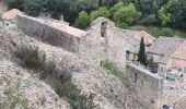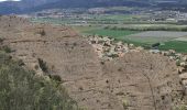

2023-04-14 Les Apollinaires- Haute montagne - Les Pénitents

Kargil
User GUIDE

Length
17.5 km

Max alt
829 m

Uphill gradient
612 m

Km-Effort
26 km

Min alt
406 m

Downhill gradient
609 m
Boucle
Yes
Creation date :
2023-04-14 07:29:45.204
Updated on :
2023-04-15 05:46:32.808
5h49
Difficulty : Medium

FREE GPS app for hiking
About
Trail Walking of 17.5 km to be discovered at Provence-Alpes-Côte d'Azur, Alpes-de-Haute-Provence, Les Mées. This trail is proposed by Kargil.
Description
Pas de grosses difficultés. L'arrête des Pénitents ne présente pas de difficulté et du fait d'un sentier assez large, la sensation de vide n'est pas excessive.
En résumé, les pénitents sont bien plus jolis de loin que de près :).
Positioning
Country:
France
Region :
Provence-Alpes-Côte d'Azur
Department/Province :
Alpes-de-Haute-Provence
Municipality :
Les Mées
Location:
Unknown
Start:(Dec)
Start:(UTM)
738445 ; 4879425 (31T) N.
Comments
Trails nearby
Les Mées - Malijai - Les Mées


Walking
Medium
(1)
Les Mées,
Provence-Alpes-Côte d'Azur,
Alpes-de-Haute-Provence,
France

12.1 km | 18.1 km-effort
4h 30min
Yes
Les Pénitents - circuit long - Les Mées


Walking
Medium
(1)
Les Mées,
Provence-Alpes-Côte d'Azur,
Alpes-de-Haute-Provence,
France

14.3 km | 21 km-effort
4h 0min
Yes
Les Pénitents - circuit court - Les Mées


Walking
Medium
(2)
Les Mées,
Provence-Alpes-Côte d'Azur,
Alpes-de-Haute-Provence,
France

5.8 km | 9.5 km-effort
2h 0min
Yes
Plateau de Ganagobie


Walking
Medium
(2)
Ganagobie,
Provence-Alpes-Côte d'Azur,
Alpes-de-Haute-Provence,
France

7.6 km | 10.9 km-effort
3h 0min
Yes
les Mées les pénitents


Walking
Easy
Les Mées,
Provence-Alpes-Côte d'Azur,
Alpes-de-Haute-Provence,
France

3.5 km | 5.9 km-effort
1h 31min
Yes

trail 29 07 2013


Running
Medium
(1)
Peyruis,
Provence-Alpes-Côte d'Azur,
Alpes-de-Haute-Provence,
France

13.5 km | 20 km-effort
1h 27min
Yes
Montfort/Puimichel par les collines


Mountain bike
Medium
Montfort,
Provence-Alpes-Côte d'Azur,
Alpes-de-Haute-Provence,
France

42 km | 53 km-effort
2h 49min
Yes
peyrius ganagobie 700m 18kms


Walking
Medium
Peyruis,
Provence-Alpes-Côte d'Azur,
Alpes-de-Haute-Provence,
France

16.8 km | 26 km-effort
8h 6min
No
les mees . oratoire Saint Antoine.


Walking
Easy
Les Mées,
Provence-Alpes-Côte d'Azur,
Alpes-de-Haute-Provence,
France

8 km | 10 km-effort
2h 32min
Yes


 SityTrail


