14.2 km | 16.2 km-effort
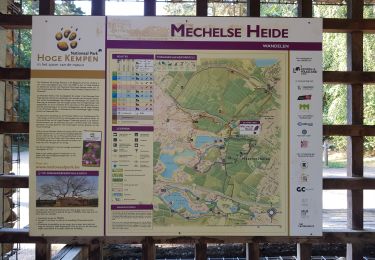
Mechelse Heide
© OpenStreetMap contributors
Walking
2h00
Difficulty : Easy
Length
9.1 km
Max alt
93 m
Uphill gradient
82 m
Km-Effort
10.2 km
Min alt
42 m
Downhill gradient
83 m
Boucle
Yes
Creation date :
2015-05-28 00:00:00.0
Updated on :
2015-05-28 00:00:00.0
2h00
Difficulty : Easy
FREE GPS app for hiking
About
Trail Walking of 9.1 km to be discovered at Flanders, Limburg, Maasmechelen. This trail is proposed by kris.peirelinck@skynet.be.
Positioning
Country:
Belgium
Region :
Flanders
Department/Province :
Limburg
Municipality :
Maasmechelen
Location:
Mechelen-aan-de-Maas
Start:(Dec)
Start:(UTM)
686657 ; 5650690 (31U) N.
Comments
Trails nearby
Erfgoedwandeling Eisden Tuinwijk
On foot
Easy
Maasmechelen,
Flanders,
Limburg,
Belgium
3.1 km | 3.3 km-effort
44min
Yes
Connecterra Rode driehoek
On foot
Easy
Dilsen-Stokkem,
Flanders,
Limburg,
Belgium
6.2 km | 7 km-effort
1h 35min
No
Station As Groene rechthoek
On foot
Easy
Maasmechelen,
Flanders,
Limburg,
Belgium
3.3 km | 3.8 km-effort
51min
Yes
Leut & Meeswijk Gele zeshoek
On foot
Easy
Maasmechelen,
Flanders,
Limburg,
Belgium
7 km | 7.4 km-effort
1h 40min
Yes
Station As Blauwe ruit
On foot
Easy
Maasmechelen,
Flanders,
Limburg,
Belgium
6.5 km | 7.1 km-effort
1h 36min
Yes
Station As Rode driehoek
On foot
Easy
Maasmechelen,
Flanders,
Limburg,
Belgium
12 km | 13.4 km-effort
3h 3min
Yes
Litzberg groene rechthoek
On foot
Easy
Dilsen-Stokkem,
Flanders,
Limburg,
Belgium
3 km | 3.7 km-effort
49min
Yes