![](/images/other/stat-length.png)
![Trail Walking Castellet-lès-Sausses - Tête de travers et Mourre Frey, du Col du Fam - Photo](https://media.geolcdn.com/t/1900/400/a4176451-cb19-4ec9-86ca-b1e3e647aa87.jpg&format=pjpeg&maxdim=2)
Tête de travers et Mourre Frey, du Col du Fam
GrouGary
User
![Length](/images/other/stat-length.png)
![Max alt](https://static1.geolcdn.com/siteimages/upload/files/1508320355ic_sort_altitude_max_24dp.png)
![Uphill gradient](https://static1.geolcdn.com/siteimages/upload/files/1508320355ic_sort_den_pos_24dp.png)
![Km-Effort](/images/other/stat-length.png)
![Min alt](https://static1.geolcdn.com/siteimages/upload/files/1508320355ic_sort_altitude_min_24dp.png)
![Downhill gradient](https://static1.geolcdn.com/siteimages/upload/files/1508320355ic_sort_den_neg_24dp.png)
![Boucle](https://static1.geolcdn.com/siteimages/upload/files/16400158638029165_repeat_loop_refresh_sync_direction_icon.png)
![Walking](https://static1.geolcdn.com/sitytour/trail-icons/101.png)
5h28
Difficulty : Medium
![Scan this QR Code to open this trail in the SityTrail application](https://capi.geolives.com/qq0zvz2zws4bq2lad0pu/sitytour/trails/3617377/qr.png?size=200)
FREE GPS app for hiking
About
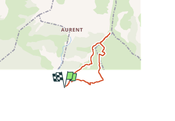
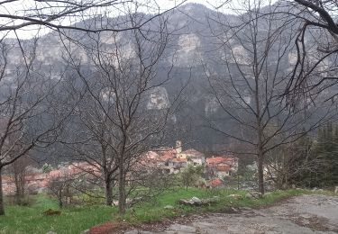
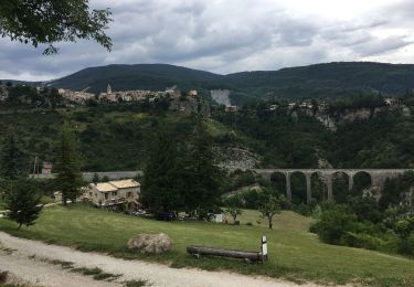
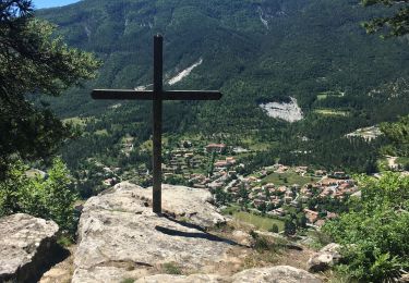
Trail Walking of 11.9 km to be discovered at Provence-Alpes-Côte d'Azur, Alpes-de-Haute-Provence, Castellet-lès-Sausses. This trail is proposed by GrouGary.
Description
Boucle au départ du col de Fam (route goudronnée étroite à partir de Castellet les Sausses puis piste en bon état).
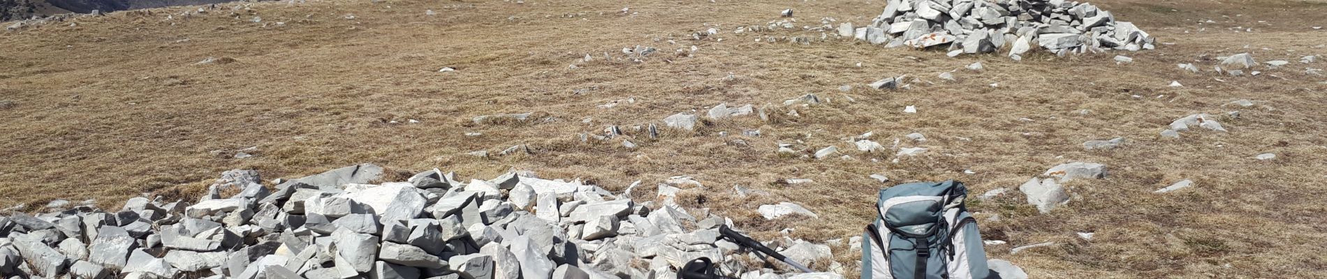
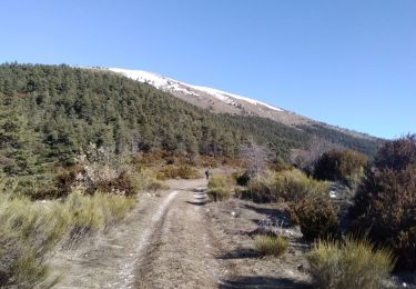
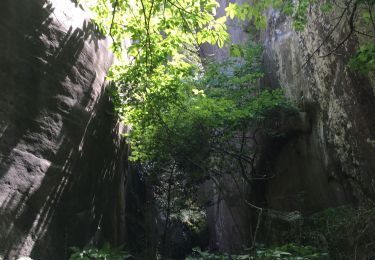
Montée agréable en sentier, puis piste et enfin dans les alpages. Passer au-dessus de la Cabane de Mourre Frey par un sentier pas toujours visible mais sans difficulté. Remonter sur le versant Est du Mourre frey pour traverser le ruisseau à sec du ravin de la Gourre. Dépasser la Cabane de Sausses pour remonter lentement dans les alpages vers "la Tête de travers". On peut la rejoindre plus directe pour atteindre la crête (b. 2122, avec vue sur le village de Aurent côté Ouest ;
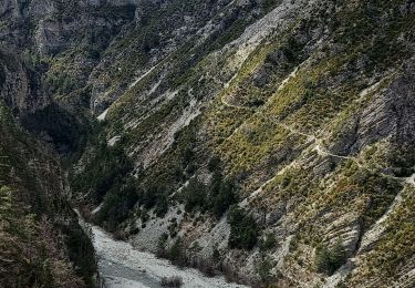
Vue superbe de la b. 2161 vers St Léger, Pibossan, ... et sommet enneigé du Mercantour.
Rejoindre en suivant la crête vers le Mourre Frey : Belle vue sur le vallon sauvage du village de Aurent. L'ensemble vallonné Est a un air de Mongolie sauvage.
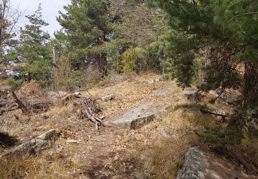
Du Mourre Frey, suivre les courbes de niveau plus douces et non boisées pour redescendre vers le Col du Fam. Des cairns signalent régulièrement la sente pour le retour. La descente ne présente pas de difficultés mais elle est soutenue sur 900m.
Positioning
Comments
Trails nearby
![Trail Touring skiing Castellet-lès-Sausses - mourre Frey te tête de travers - Photo](https://media.geolcdn.com/t/375/260/1b767a21-1868-437d-b876-59d00a73f0ab.jpg&format=jpg&maxdim=2)
![Touring skiing Touring skiing](https://static1.geolcdn.com/sitytour/trail-icons/503.png)
Touring skiing
![](/images/other/stat-length.png)
![](https://static1.geolcdn.com/siteimages/upload/files/16400158638029165_repeat_loop_refresh_sync_direction_icon.png)
![Trail Walking Braux - Rando Pieŕre qui tremble Chabrieres Peloussis Argenton - Photo](https://media.geolcdn.com/t/375/260/cfc0cc00-9a69-459b-9e00-f152d8d54736.jpg&format=jpg&maxdim=2)
![Walking Walking](https://static1.geolcdn.com/sitytour/trail-icons/101.png)
Walking
![](/images/other/stat-length.png)
![](https://static1.geolcdn.com/siteimages/upload/files/16400158638029165_repeat_loop_refresh_sync_direction_icon.png)
![Trail Walking Braux - Chabrieres,Pelloussis,Argenton, Aurent, Col du Fa,Le Coulomp - Photo](https://media.geolcdn.com/t/375/260/f6f9a83c-04ee-40b9-a5e8-e4ac69620223.jpg&format=jpg&maxdim=2)
![Walking Walking](https://static1.geolcdn.com/sitytour/trail-icons/101.png)
Walking
![](/images/other/stat-length.png)
![](https://static1.geolcdn.com/siteimages/upload/files/16400158638029165_repeat_loop_refresh_sync_direction_icon.png)
![Trail Walking Braux - Canal de Braux Créte du Clôt Martin - Photo](https://media.geolcdn.com/t/375/260/750c766f-b28a-4536-81b9-25d4ffd2efbc.jpg&format=jpg&maxdim=2)
![Walking Walking](https://static1.geolcdn.com/sitytour/trail-icons/101.png)
Walking
![](/images/other/stat-length.png)
![](https://static1.geolcdn.com/siteimages/upload/files/16400158638029165_repeat_loop_refresh_sync_direction_icon.png)
![Trail Electric bike Annot - Annot - Peresq - Photo](https://media.geolcdn.com/t/375/260/f9d6f0d3-2fb5-435d-b41a-baaa9e1dae8a.jpg&format=jpg&maxdim=2)
![Electric bike Electric bike](https://static1.geolcdn.com/sitytour/trail-icons/205.png)
Electric bike
![](/images/other/stat-length.png)
![](https://static1.geolcdn.com/siteimages/upload/files/16400158638029165_repeat_loop_refresh_sync_direction_icon.png)
![Trail Walking Annot - Les grés d'Annot: Jardins et chambre du Roi - Photo](https://media.geolcdn.com/t/375/260/2b865830-3fe2-49c9-9a69-3696cb0f2f88.jpg&format=jpg&maxdim=2)
![Walking Walking](https://static1.geolcdn.com/sitytour/trail-icons/101.png)
Walking
![](/images/other/stat-length.png)
![](https://static1.geolcdn.com/siteimages/upload/files/16400158638029165_repeat_loop_refresh_sync_direction_icon.png)
![Trail Walking Castellet-lès-Sausses - retour par Balmont - Photo](https://media.geolcdn.com/t/375/260/f87c59e6-3944-40d3-a949-79bed44c35f4.jpg&format=jpg&maxdim=2)
![Walking Walking](https://static1.geolcdn.com/sitytour/trail-icons/101.png)
Walking
![](/images/other/stat-length.png)
![](https://static1.geolcdn.com/siteimages/upload/files/16400158638029165_repeat_loop_refresh_sync_direction_icon.png)
![Trail Walking Annot - baou-de-parou - Photo](https://media.geolcdn.com/t/375/260/3aa1988d-245e-4273-8eb3-d20ff83d89e8.jpg&format=jpg&maxdim=2)
![Walking Walking](https://static1.geolcdn.com/sitytour/trail-icons/101.png)
Walking
![](/images/other/stat-length.png)
![](https://static1.geolcdn.com/siteimages/upload/files/16400158638029165_repeat_loop_refresh_sync_direction_icon.png)
![Trail Walking Castellet-lès-Sausses - Col du Fa - Aurent - Argenton - Photo](https://media.geolcdn.com/t/375/260/ext.jpg?maxdim=2&url=https%3A%2F%2Fstatic1.geolcdn.com%2Fsiteimages%2Fupload%2Ffiles%2F1553511878bg_sport_marche.png)
![Walking Walking](https://static1.geolcdn.com/sitytour/trail-icons/101.png)
Walking
![](/images/other/stat-length.png)
![](https://static1.geolcdn.com/siteimages/upload/files/16400158638029165_repeat_loop_refresh_sync_direction_icon.png)