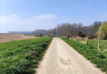
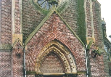
Trail Motorbike Remicourt - Roadtrip moto jusque Nice - Photo

Roadtrip moto jusque Nice

 Tim0130
Tim0130

User

© OpenStreetMap contributors
Length
Length
1349 km
Max alt
Max alt
1232 m
Uphill gradient
Uphill gradient
13641 m
Km-Effort
Km-Effort  
1529 km
Min alt
Min alt
65 m
Downhill gradient
Downhill gradient
13120 m
Boucle
Boucle
No
Creation date :
2023-04-03 23:04:50.041
Updated on :
2023-04-04 03:28:58.658

(0 Reviews)

Motorbike
Motorbike
45h00
Difficulty : Very difficult

Scan this QR Code to open this trail in the SityTrail application

FREE GPS app for hiking

Logo SityTrail SityTrail

IGN / Geographical institutes

Download SityTrail from the App Store Download SityTrail from Google Play

Logo SityTrail SityTrail World

The world is yours!

Download SityTrail from the App Store Download SityTrail from Google Play Download SityTrail on Huawei AppGallery

About

Trail Motorbike of 1349 km to be discovered at Wallonia, Liège, Remicourt. This trail is proposed by Tim0130.

Description

                         Jour 1 (stop Nancy => 343 Km)

- Revotel Centre Gare et Congrès
- Adresse : 43 Rue Raymond Poincaré, 54000 Nancy
- Téléphone :  33 3 83 28 02 13
- Web: https://www.revotel-hotel.com/fr/


            Jour 2 (stop Pontarlier => 314Km. Total Km:657Km)

- Ibis budget Pontarlier
-Adresse: 29 rue Denis Papin, 25300 Pontarlier
-Gps: 46.909624, 6.335264
-Téléphone:   33 892 70 04 46
-Mail: h7418@accor.com
-Web: https://all.accor.com/hotel/7418/index.fr.shtml?
dateIn=&nights=&compositions=1&stayplus=false&snu=false#section-location


            Jour 3 (stop Mens => 369Km. Total Km: 1019Km)

- Les Dimathal
- Adresse: 91 rue du Breuil, 38710 Mens
- Téléphone:  33 6 82 97 03 44 ou  33 6 85 58 98 66
-Mail: lalezan@orange.fr
- Web: https://www.isere-tourisme.com/hebergement- locatif/les-dimathal


                         Jour 4 (arrivée Nice)

Elevation profile

Photos

Points of interest

Point of interest Pontarlier - Ibis budget Pontarlier - Photo
Tim0130
Point of interest Mens - Les Dimathal - Photo
Tim0130

Positioning

Country:
Belgium
Region :
Wallonia
Department/Province :
Liège
Municipality :
Remicourt
Location:
Unknown
Start:(UTM)
665850 ; 5618519 (31U) N.

Trails nearby

Trail Walking Waremme - Cirkwi-Waremme_-_Autour_de_la_Vallée_du_Geer_-_7,1km - Photo
Walking
PhilippeetEvelyne

Walking

Medium
(2)
Waremme, Wallonia, Liège, Belgium
7.1 km | 7.6 km-effort
1h 43min
Yes
Trail Walking Tongeren - Promenade de la beauté cachée à Lauw  - Photo
Walking
GUIDE+

Walking

Medium
(5)
Tongeren, Flanders, Limburg, Belgium
5.8 km | 6.5 km-effort
1h 27min
Yes
Trail On foot Tongeren - Lauw Rode pijl - Photo
On foot
GUIDE+

On foot

Easy
Tongeren, Flanders, Limburg, Belgium
5.8 km | 6.4 km-effort
1h 27min
Yes
Trail Walking Waremme - Waremme ( autour de la vallée du Geer) - Photo
Walking
evelynevd

Walking

Medium
Waremme, Wallonia, Liège, Belgium
7.6 km | 8.2 km-effort
2h 4min
Yes
Trail Walking Waremme - Oleye - bous de Horne  - Photo
Walking
GUIDE
stef789

Walking

Very easy
Waremme, Wallonia, Liège, Belgium
8.9 km | 9.8 km-effort
2h 12min
Yes
Trail Walking Crisnée - Le long de la rivière Geer à Lauw - Photo
Walking
GUIDE
Benjamin27

Walking

Medium
Crisnée, Wallonia, Liège, Belgium
6.1 km | 6.8 km-effort
1h 32min
Yes
Trail Walking Tongeren - Verborgen moois Lauw - Photo
Walking
cedricclaessens

Walking

Very easy
Tongeren, Flanders, Limburg, Belgium
6.2 km | 6.9 km-effort
1h 32min
Yes
Trail Walking Remicourt - Momalle - Photo
Walking
dyfy

Walking

Very easy
(1)
Remicourt, Wallonia, Liège, Belgium
11.7 km | 12.8 km-effort
3h 27min
Yes
Trail Other activity Crisnée - crisnee 2013 1123 - Photo
Other activity
fabrassart

Other activity

Very easy
Crisnée, Wallonia, Liège, Belgium
10.6 km | 11.6 km-effort
2h 5min
Yes


Close
My subscriptions