Trail Bicycle tourism Andermatt - EuroVelo 15 - developed - Photo

EuroVelo 15 - developed

 Max2+
Max2+

User

© OpenStreetMap contributors
Length
Length
1417 km
Boucle
Boucle
No
Creation date :
2023-03-30 15:34:00.059
Updated on :
2023-03-30 16:29:24.929

(0 Reviews)

Bicycle tourism
Bicycle tourism
0m
Difficulty : Very easy

Scan this QR Code to open this trail in the SityTrail application

FREE GPS app for hiking

Logo SityTrail SityTrail

IGN / Geographical institutes

Download SityTrail from the App Store Download SityTrail from Google Play

Logo SityTrail SityTrail World

The world is yours!

Download SityTrail from the App Store Download SityTrail from Google Play Download SityTrail on Huawei AppGallery

About

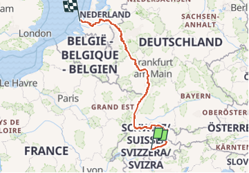
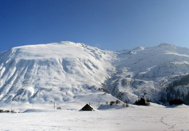
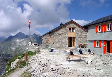
Trail Bicycle tourism of 1417 km to be discovered at Uri, Korporation Ursern, Andermatt. This trail is proposed by Max2+.

Elevation profile

Positioning

Country:
Switzerland
Region :
Uri
Department/Province :
Korporation Ursern
Municipality :
Andermatt
Location:
Unknown
Start:(UTM)
468992 ; 5164920 (32T) N.

Trails nearby

Trail On foot Andermatt - Kräuterlehrpfad Mur - Photo
On foot
GUIDE+

On foot

Easy
Andermatt, Uri, Korporation Ursern, Switzerland
7.6 km | 10.5 km-effort
2h 23min
No
Trail On foot Andermatt - Blumen- und Lawinenlehrpfad Chilchenberg - Photo
On foot
GUIDE+

On foot

Easy
Andermatt, Uri, Korporation Ursern, Switzerland
3.9 km | 8.4 km-effort
1h 54min
No
Trail On foot Andermatt - Schöni - Pazolalücke - Photo
On foot
GUIDE+

On foot

Easy
Andermatt, Uri, Korporation Ursern, Switzerland
3.7 km | 10.3 km-effort
2h 20min
No
Trail On foot Andermatt - Stöckli - Steglaui Riental - Photo
On foot
GUIDE+

On foot

Easy
Andermatt, Uri, Korporation Ursern, Switzerland
6.7 km | 11.2 km-effort
2h 33min
No
Trail On foot Andermatt - Golfrundweg - Photo
On foot
GUIDE+

On foot

Easy
Andermatt, Uri, Korporation Ursern, Switzerland
5.6 km | 7.2 km-effort
1h 38min
Yes
Trail On foot Andermatt - Vermigel - Capanna Cadlimo - Photo
On foot
GUIDE+

On foot

Easy
Andermatt, Uri, Korporation Ursern, Switzerland
7.4 km | 17.6 km-effort
4h 0min
No
Trail On foot Andermatt - Ursener Höhenweg - Photo
On foot
GUIDE+

On foot

Medium
Andermatt, Uri, Korporation Ursern, Switzerland
13.9 km | 26 km-effort
5h 49min
No
Trail On foot Andermatt - Andermatt - Vermigel - Photo
On foot
GUIDE+

On foot

Easy
Andermatt, Uri, Korporation Ursern, Switzerland
5.5 km | 10.1 km-effort
2h 17min
No
Trail On foot Andermatt - Andermatt-Göschenen - Photo
On foot
GUIDE+

On foot

Easy
Andermatt, Uri, Korporation Ursern, Switzerland
4.5 km | 6.1 km-effort
1h 23min
No


Close
My subscriptions