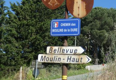
Trail Walking Moussoulens - Vignes et garrigues autour de Moussoulens - Photo

Vignes et garrigues autour de Moussoulens

© OpenStreetMap contributors
Length
Length
18.9 km
Max alt
Max alt
298 m
Uphill gradient
Uphill gradient
279 m
Km-Effort
Km-Effort  
23 km
Min alt
Min alt
156 m
Downhill gradient
Downhill gradient
279 m
Boucle
Boucle
Yes
Creation date :
2023-03-24 22:00:53.83
Updated on :
2023-03-24 22:01:18.851

(0 Reviews)

Walking
Walking
5h08
Difficulty : Very difficult

Scan this QR Code to open this trail in the SityTrail application

FREE GPS app for hiking

Logo SityTrail SityTrail

IGN / Geographical institutes

Download SityTrail from the App Store Download SityTrail from Google Play

Logo SityTrail SityTrail World

The world is yours!

Download SityTrail from the App Store Download SityTrail from Google Play Download SityTrail on Huawei AppGallery

About

Trail Walking of 18.9 km to be discovered at Occitania, Aude, Moussoulens. This trail is proposed by philou6351.

Elevation profile

Points of interest

Point of interest Moussoulens - Place du Calcadis à Moussoulens - Photo
philou6351
Point of interest Moussoulens - Carrefour de la boucle  - Photo
philou6351
Point of interest Moussoulens - Transformateur EDF - Photo
philou6351
MOUSSOULENS 
Point of interest Moussoulens - 1er lac - Photo
philou6351
MOUSSOULENS 
Point of interest Moussoulens - Vers le 2nd lac - Photo
philou6351
MOUSSOULENS 
Point of interest Moussoulens - Croisement D48 - Photo
philou6351
MOUSSOULENS 
Point of interest Moussoulens - Sortie du bois - Photo
philou6351
MOUSSOULENS 
Point of interest Moussoulens - Croisement - Photo
philou6351
MOUSSOULENS 
Point of interest Ventenac-Cabardès - Le Colombier - Photo
philou6351
VENTENAC-CABARDÈS 
Point of interest Ventenac-Cabardès - Bifurcation vers la Caunelle - Photo
philou6351
VENTENAC-CABARDÈS 
Point of interest Montolieu - Traversée de la D48 - Photo
philou6351
Point of interest Montolieu - Croisement Chapelle Saint-Roch - Photo
philou6351
Point of interest Montolieu - Chapelle Saint-Roch - Photo
philou6351
Point of interest Moussoulens - Croisement avant D48 - Photo
philou6351
Point of interest Moussoulens - Route Impériale - Photo
philou6351
MOUSSOULENS 
Point of interest Moussoulens - Place du Calcadis à Moussoulens - Photo
philou6351

Positioning

Country:
France
Region :
Occitania
Department/Province :
Aude
Municipality :
Moussoulens
Location:
Unknown
Start:(UTM)
437578 ; 4792129 (31T) N.

Trails nearby

Trail Walking Montolieu - Montolieu Moulins de la Dure - Photo
Walking
dufland

Walking

Easy
(1)
Montolieu, Occitania, Aude, France
6.6 km | 8.7 km-effort
2h 0min
Yes
Trail Walking Moussoulens - Boucle de la Combe a la Biterelle  - Photo
Walking
livfoss

Walking

Easy
(1)
Moussoulens, Occitania, Aude, France
7.1 km | 8.6 km-effort
1h 50min
No
Trail Walking Moussoulens - Moussoulens La Plaine VM - Photo
Walking
dufland

Walking

Medium
(2)
Moussoulens, Occitania, Aude, France
8.5 km | 10.5 km-effort
2h 22min
Yes
Trail Walking Moussoulens - Moussoulens Saint Roch - Photo
Walking
GUIDE
Ada11

Walking

Easy
Moussoulens, Occitania, Aude, France
25 km | 30 km-effort
5h 52min
No
Trail Walking Ventenac-Cabardès - Ventenac Cab Montpeyrous VM - Photo
Walking
dufland

Walking

Medium
(2)
Ventenac-Cabardès, Occitania, Aude, France
8.3 km | 9.8 km-effort
2h 13min
Yes
Trail Walking Ventenac-Cabardès - Ventenac, La Ventaillole, Le Sauvage - Photo
Walking
mikaou.t

Walking

Medium
(1)
Ventenac-Cabardès, Occitania, Aude, France
10.7 km | 13 km-effort
1h 38min
Yes
Trail Other activity Pezens - montagne noire n1 - Photo
Other activity
jroussel

Other activity

Very easy
Pezens, Occitania, Aude, France
70 km | 90 km-effort
Unknown
Yes
Trail Walking Ventenac-Cabardès - autour du péché St Jean - Photo
Walking
Mascart

Walking

Easy
Ventenac-Cabardès, Occitania, Aude, France
6.8 km | 8.5 km-effort
2h 24min
Yes
Trail Walking Montolieu - Cap de Pic - Photo
Walking
Mascart

Walking

Medium
Montolieu, Occitania, Aude, France
11.1 km | 14 km-effort
3h 16min
Yes


Close
My subscriptions