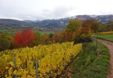
7.7 km | 11.3 km-effort
Gueberschwihr - Osenbuhr (23/03/2023)
Richard68500
User
Length
8.6 km
Max alt
597 m
Uphill gradient
273 m
Km-Effort
12.3 km
Min alt
349 m
Downhill gradient
274 m
Boucle
Yes
Creation date :
2023-03-23 08:52:15.534
Updated on :
2023-03-23 15:40:18.7
2h48
Difficulty : Easy
FREE GPS app for hiking
About
Trail Walking of 8.6 km to be discovered at Grand Est, Haut-Rhin, Gueberschwihr. This trail is proposed by Richard68500.
Description
Petite balade sympa
Positioning
Country:
France
Region :
Grand Est
Department/Province :
Haut-Rhin
Municipality :
Gueberschwihr
Location:
Unknown
Start:(Dec)
Start:(UTM)
371025 ; 5318381 (32U) N.
Comments
Trails nearby
Osenbach - Sentier des Sols
Walking
Easy
(1)
Osenbach,
Grand Est,
Haut-Rhin,
France
4.7 km | 6.6 km-effort
3h 0min
Yes
suuntoapp-Hiking-2023-12-29T09-05-16Z
Walking
Medium
Eguisheim,
Grand Est,
Haut-Rhin,
France
22 km | 32 km-effort
7h 16min
Yes
SityTrail - Rouffach vers Schauenberg variante
Walking
Easy
(1)
Rouffach,
Grand Est,
Haut-Rhin,
France
10.6 km | 15.3 km-effort
3h 29min
Yes
ND du Hubel_Schauenberg
Walking
Medium
(2)
Westhalten,
Grand Est,
Haut-Rhin,
France
8.3 km | 11.7 km-effort
2h 39min
Yes
Schauenberg 1
Walking
Easy
(1)
Pfaffenheim,
Grand Est,
Haut-Rhin,
France
10.3 km | 16.5 km-effort
3h 30min
Yes
eguishem- vignoble et château
Walking
Medium
Eguisheim,
Grand Est,
Haut-Rhin,
France
9.3 km | 13 km-effort
2h 34min
Yes
SityTrail - 2709807 - eguisheim-husseren-les-chateux-
Walking
Medium
(1)
Eguisheim,
Grand Est,
Haut-Rhin,
France
8.4 km | 11.5 km-effort
2h 37min
Yes
Marche TL 10/2024 - Parking Chataignier- ND du Schauenburg-Rocher du Coucou-C...
Walking
Difficult
(1)
Pfaffenheim,
Grand Est,
Haut-Rhin,
France
8.5 km | 12.5 km-effort
2h 50min
Yes