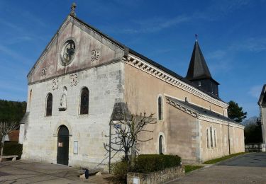
Trail Walking Sanilhac - Notre Dame de Sanilhac ( longue)  - Photo

Notre Dame de Sanilhac ( longue)

 Marc 24
Marc 24

User

© OpenStreetMap contributors
Length
Length
11.8 km
Max alt
Max alt
227 m
Uphill gradient
Uphill gradient
249 m
Km-Effort
Km-Effort  
15.1 km
Min alt
Min alt
152 m
Downhill gradient
Downhill gradient
248 m
Boucle
Boucle
Yes
Creation date :
2023-03-20 13:34:04.0
Updated on :
2023-03-24 16:10:00.013

(0 Reviews)

Walking
Walking
3h14
Difficulty : Medium

Scan this QR Code to open this trail in the SityTrail application

FREE GPS app for hiking

Logo SityTrail SityTrail

IGN / Geographical institutes

Download SityTrail from the App Store Download SityTrail from Google Play

Logo SityTrail SityTrail World

The world is yours!

Download SityTrail from the App Store Download SityTrail from Google Play Download SityTrail on Huawei AppGallery

About

Trail Walking of 11.8 km to be discovered at New Aquitaine, Dordogne, Sanilhac. This trail is proposed by Marc 24.

Description

Une belle balade de 11,8 km à effectuer plutôt par temps sec car les chemins sont souvent très argileux.
Il y a un vieux puits à trouver sur votre itinéraire à un carrefour.
Il y a aussi quelques côtes qui vous attendent pour vous faire un peu souffler, et d 'autres pour vous faire pousser sur les bâtons si vous avez penser à les emmener ! En définitive, c'est une belle balade exigeant un peu d'entraînement préalable.
Vous pouvez néanmoins raccourcir cette balade en supprimant le crochet vers "les Bitarelles" ( coopérative de stockage et vente de fruits) et en positionnant votre voiture plus au sud pour vous éviter un aller retour sur ce bout de trajet.
Vous emprunterez de temps à autre un sentier balisé par le Conseil Départemental ( poteaux en bois coiffés d'un capuchon jaune )
Bonne promenade à faire sur une demi-journée.

Elevation profile

Positioning

Country:
France
Region :
New Aquitaine
Department/Province :
Dordogne
Municipality :
Sanilhac
Location:
Unknown
Start:(UTM)
320250 ; 4999003 (31T) N.

Trails nearby

Trail Walking Boulazac Isle Manoire - Atur - Photo
Walking
CC.RIDER

Walking

Easy
(1)
Boulazac Isle Manoire, New Aquitaine, Dordogne, France
12.5 km | 15.8 km-effort
3h 23min
Yes
Trail Walking Sanilhac - ND de Sanilhac-Boucle du Pic - Photo
Walking
sidore

Walking

Easy
(2)
Sanilhac, New Aquitaine, Dordogne, France
7.3 km | 9 km-effort
1h 43min
Yes
Trail Walking Creyssensac-et-Pissot - boucle creyssensac - Photo
Walking
fab0202

Walking

Easy
Creyssensac-et-Pissot, New Aquitaine, Dordogne, France
10.2 km | 12.7 km-effort
2h 14min
Yes
Trail Other activity Creyssensac-et-Pissot - étang des rosiers - Photo
Other activity
annemo

Other activity

Very easy
Creyssensac-et-Pissot, New Aquitaine, Dordogne, France
11.1 km | 14.6 km-effort
3h 17min
Yes
Trail Walking Sanilhac - Boucle du puits trouillier - Notre-Dame-de-Sanilhac - Photo
Walking
tracegps

Walking

Medium
Sanilhac, New Aquitaine, Dordogne, France
8.2 km | 10.6 km-effort
2h 0min
Yes
Trail Walking Coulounieix-Chamiers - boucle coulounieix - Photo
Walking
fab0202

Walking

Easy
(1)
Coulounieix-Chamiers, New Aquitaine, Dordogne, France
12.7 km | 16.4 km-effort
2h 50min
Yes
Trail On foot Chalagnac - Boucle du Bas-Combin - Photo
On foot
GUIDE+

On foot

Easy
Chalagnac, New Aquitaine, Dordogne, France
6.8 km | 9.1 km-effort
2h 4min
Yes
Trail On foot Creyssensac-et-Pissot - Boucle des écureuils - Photo
On foot
GUIDE+

On foot

Easy
Creyssensac-et-Pissot, New Aquitaine, Dordogne, France
7 km | 8.9 km-effort
2h 1min
Yes
Trail Walking Sanilhac - boucle autour de l ambroise - Photo
Walking
fab0202

Walking

Easy
Sanilhac, New Aquitaine, Dordogne, France
9.8 km | 13.3 km-effort
2h 26min
Yes


Close
My subscriptions