


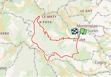

22 km | 35 km-effort


User


FREE GPS app for hiking
 SityTrail
IGN / Geographical institutes
SityTrail World
The world is yours!
Trail Walking of 17.2 km to be discovered at Auvergne-Rhône-Alpes, Rhône, Rivolet. This trail is proposed by Thomasdanielle.
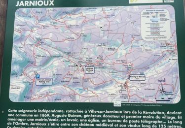
D/A : Parking Cimetière
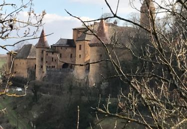
La première partie de la randonnée se passe sur une route (un peu longue à mon goût), il faut rester prudent et bien rester sur la droite.
Randonnée difficile il y a beaucoup de cailloux.

On foot

Walking
Walking
Walking

Walking
Walking
Walking
Walking

Walking