Trail Walking Digne-les-Bains - Rando Col de Peipin Courbons - Photo
© OpenStreetMap contributors
Length
Length
18.5 km
Max alt
Max alt
1105 m
Uphill gradient
Uphill gradient
642 m
Km-Effort
Km-Effort  
27 km
Min alt
Min alt
579 m
Downhill gradient
Downhill gradient
642 m
Boucle
Boucle
Yes
Creation date :
2023-03-16 08:21:20.99
Updated on :
2023-03-17 12:22:04.807

(0 Reviews)

Walking
Walking
5h55
Difficulty : Medium

Scan this QR Code to open this trail in the SityTrail application

FREE GPS app for hiking

Logo SityTrail SityTrail

IGN / Geographical institutes

Download SityTrail from the App Store Download SityTrail from Google Play

Logo SityTrail SityTrail World
The world is yours!

Download SityTrail from the App Store Download SityTrail from Google Play Download SityTrail on Huawei AppGallery

About

Trail Walking of 18.5 km to be discovered at Provence-Alpes-Côte d'Azur, Alpes-de-Haute-Provence, Digne-les-Bains. This trail is proposed by Marchopier.

Description

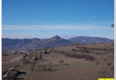
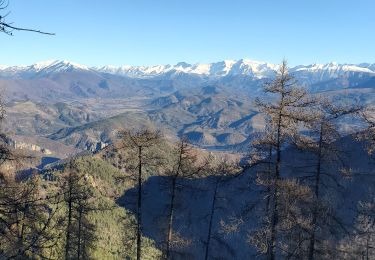
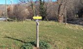
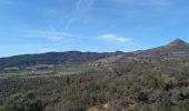
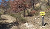
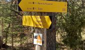
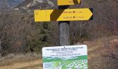
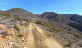
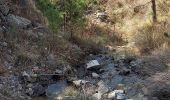
Départ Les Sièyes  près de l'école primaire et montée le long du Ravin de Rouveiret, en direction de Champtercier,Chemin du Col du Masse,  puis du  Col de Peipin, passage du ravin de La Gourre
Le Col de Peipin franchi à 903m d'altitude, la montée continue pourtant sur une piste en direction commune de Thoard et Courbons, ensuite choisi comme direction près de Vachon.
Passage près des pentes de la Colle, point culminant de l'itinéraire 1105m, où un troupeau de moutons venus paitre au soleil, est encadré par six chiens Patou qui donnent de la voix et s'approchent rapidement des promeneurs, nullement effrayés qui leur parlent en réponse à leurs aboiements.
Après des échanges sympathiques les chiens retournent à leurs moutons, et les marcheurs à leurs pas.
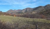
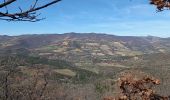
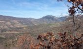
Le sentier descend enfin ,bien qu'agrémenté de quelques rampes, passe La Draille, le Ravin de La Buègue, La Chauvine, Suillet, La Martine, et Courbons, joli village perché.
Retour en descente par La Chapelle et les Hautes Sièyes, pour rejoindre le point de départ.


Elevation profile

Photos

22 photos in total. Please click on a photo to see them all in the gallery.

Positioning

Country:
France
Region :
Provence-Alpes-Côte d'Azur
Department/Province :
Alpes-de-Haute-Provence
Municipality :
Digne-les-Bains
Location:
Unknown
Start:(UTM)
275974 ; 4884896 (32T) N.

Trails nearby

Trail Walking Digne-les-Bains - Le Cousson - Photo
Walking
GUIDE
Marco05

Walking

Difficult
(1)
Digne-les-Bains, Provence-Alpes-Côte d'Azur, Alpes-de-Haute-Provence, France
15.4 km | 29 km-effort
6h 39min
Yes
Trail Walking Digne-les-Bains - Autour de Courbons - Digne les Bains - Photo
Walking
tracegps

Walking

Medium
(1)
Digne-les-Bains, Provence-Alpes-Côte d'Azur, Alpes-de-Haute-Provence, France
12.6 km | 18.4 km-effort
5h 0min
Yes
Trail Walking Digne-les-Bains - DIGNE. LA PLATRIERE. RUINES DE GIVAUDAN. CHAPELLE MADELEINE. O L S - Photo
Walking
GUIDE
RobinMicheline

Walking

Difficult
Digne-les-Bains, Provence-Alpes-Côte d'Azur, Alpes-de-Haute-Provence, France
11.1 km | 18.4 km-effort
4h 32min
Yes
Trail Walking Aiglun - AIGLUN.  Le vieil Aiglun , sommet du Puy o l s - Photo
Walking
GUIDE
RobinMicheline

Walking

Medium
Aiglun, Provence-Alpes-Côte d'Azur, Alpes-de-Haute-Provence, France
7 km | 11.9 km-effort
2h 14min
Yes
Trail Walking Digne-les-Bains - COURBONS  , Le tour du Rouveyret o - Photo
Walking
GUIDE
RobinMicheline

Walking

Difficult
Digne-les-Bains, Provence-Alpes-Côte d'Azur, Alpes-de-Haute-Provence, France
15.7 km | 23 km-effort
3h 30min
Yes
Trail Walking Digne-les-Bains - 65bis-Digne- Cousson N et S- Caramantran- Digne  - Photo
Walking
dumotier

Walking

Medium
(1)
Digne-les-Bains, Provence-Alpes-Côte d'Azur, Alpes-de-Haute-Provence, France
17.4 km | 32 km-effort
3h 49min
Yes
Trail Mountain bike Digne-les-Bains - Terres Noires 2011 (50km) - Photo
Mountain bike
tracegps

Mountain bike

Difficult
(2)
Digne-les-Bains, Provence-Alpes-Côte d'Azur, Alpes-de-Haute-Provence, France
46 km | 63 km-effort
5h 0min
Yes
Trail Walking Digne-les-Bains - Digne-les-Bains cousson  jean Roland 1161m 19.280kms - Photo
Walking
GUIDE
Danielba

Walking

Medium
Digne-les-Bains, Provence-Alpes-Côte d'Azur, Alpes-de-Haute-Provence, France
18.1 km | 33 km-effort
8h 32min
Yes
Trail Walking Digne-les-Bains - Digne gassendi cousson 1060m 18kms  - Photo
Walking
GUIDE
Danielba

Walking

Medium
Digne-les-Bains, Provence-Alpes-Côte d'Azur, Alpes-de-Haute-Provence, France
16.9 km | 30 km-effort
7h 57min
Yes


Close
My subscriptions