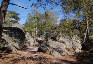
Trail Walking Fontainebleau - Le Cul de Chaudron, le Rocher de Milly et la Cuisinière - Photo

Le Cul de Chaudron, le Rocher de Milly et la Cuisinière

© OpenStreetMap contributors
Length
Length
12.6 km
Max alt
Max alt
136 m
Uphill gradient
Uphill gradient
225 m
Km-Effort
Km-Effort  
15.6 km
Min alt
Min alt
81 m
Downhill gradient
Downhill gradient
226 m
Boucle
Boucle
Yes
Creation date :
2023-03-15 10:01:21.436
Updated on :
2023-03-15 10:02:42.192

(0 Reviews)

Walking
Walking
3h33
Difficulty : Difficult

Scan this QR Code to open this trail in the SityTrail application

FREE GPS app for hiking

Logo SityTrail SityTrail

IGN / Geographical institutes

Download SityTrail from the App Store Download SityTrail from Google Play

Logo SityTrail SityTrail World

The world is yours!

Download SityTrail from the App Store Download SityTrail from Google Play Download SityTrail on Huawei AppGallery

About

Trail Walking of 12.6 km to be discovered at Ile-de-France, Seine-et-Marne, Fontainebleau. This trail is proposed by JacquesMARQUET.

Description

Une rando à découvrir.

Elevation profile

Points of interest

Point of interest Fontainebleau - Bifurcation - Photo
JacquesMARQUET
FONTAINEBLEAU 
Point of interest Fontainebleau - Carrefour - Route de Milly - Photo
JacquesMARQUET
Point of interest Fontainebleau - Carrefour de la Louve - Photo
JacquesMARQUET
FONTAINEBLEAU 
Point of interest Fontainebleau - Carrefour du Rocher de Milly - Photo
JacquesMARQUET
Point of interest Fontainebleau - Col sur la Route du Carnage - Photo
JacquesMARQUET
Point of interest Fontainebleau - Croisement de sentiers - Jonction avec le GR11 - Photo
JacquesMARQUET
Point of interest Fontainebleau - Route de la Gibelotte - Jonction GR1 et TMF - Photo
JacquesMARQUET
Point of interest Fontainebleau - Route de la Rabouillère - Photo
JacquesMARQUET
Point of interest Fontainebleau - Route de Milly - Photo
JacquesMARQUET
FONTAINEBLEAU 
Point of interest Fontainebleau - Route des Ventes Barbier - Photo
JacquesMARQUET

Positioning

Country:
France
Region :
Ile-de-France
Department/Province :
Seine-et-Marne
Municipality :
Fontainebleau
Location:
Unknown
Start:(UTM)
470286 ; 5362078 (31U) N.

Trails nearby

Trail Walking Barbizon - Sentier des peintres - Photo
Walking
onftest

Walking

Medium
(11)
Barbizon, Ile-de-France, Seine-et-Marne, France
7.5 km | 8.2 km-effort
1h 25min
Yes
Trail Walking Fontainebleau - 3pi-150428 - DésertApremont-Jupiter - Photo
Walking
randodan

Walking

Easy
(1)
Fontainebleau, Ile-de-France, Seine-et-Marne, France
16 km | 19.4 km-effort
6h 30min
Yes
Trail Walking Noisy-sur-École - M&R-121118 - 250Marches - Photo
Walking
randodan

Walking

Easy
(1)
Noisy-sur-École, Ile-de-France, Seine-et-Marne, France
14.3 km | 18.1 km-effort
3h 50min
Yes
Trail Walking Noisy-sur-École - Bois Rond#4 - Photo
Walking
aubr

Walking

Very easy
(1)
Noisy-sur-École, Ile-de-France, Seine-et-Marne, France
8.8 km | 10.5 km-effort
2h 18min
Yes
Trail Walking Noisy-sur-École - Les 25 Bosses - Gps en Forêt de Fontainebleau - Photo
Walking
tracegps

Walking

Very difficult
(2)
Noisy-sur-École, Ile-de-France, Seine-et-Marne, France
17.6 km | 23 km-effort
4h 45min
Yes
Trail Walking Noisy-sur-École - Boucle 24 km Fontainebleau Arbonne - Photo
Walking
GUIDE
chessyca

Walking

Easy
Noisy-sur-École, Ile-de-France, Seine-et-Marne, France
25 km | 31 km-effort
5h 52min
Yes
Trail Walking Noisy-sur-École - Noisy sur Ecole / Coquibus - Photo
Walking
GUIDE
chessyca

Walking

Medium
Noisy-sur-École, Ile-de-France, Seine-et-Marne, France
21 km | 26 km-effort
5h 20min
Yes
Trail Walking Barbizon - Le tour du Grand Paris via le GR1 etape 14 Barbizon- Malesherbes - Photo
Walking
GUIDE
chessyca

Walking

Very difficult
Barbizon, Ile-de-France, Seine-et-Marne, France
35 km | 41 km-effort
6h 11min
No
Trail On foot Fontainebleau - Promenade de la Gorge aux Archers - Photo
On foot
GUIDE+

On foot

Easy
Fontainebleau, Ile-de-France, Seine-et-Marne, France
5.4 km | 6.2 km-effort
1h 24min
Yes


Close
My subscriptions