![](/images/other/stat-length.png)
![Trail Electric bike Rousson - Tour du Mont-Bouquet - Photo](https://media.geolcdn.com/t/1900/400/6cb0bff4-b846-4486-8ff2-e6201a86b912.jpeg&format=pjpeg&maxdim=2)
Tour du Mont-Bouquet
asclier0
User
![Length](/images/other/stat-length.png)
Length
28 km
![Max alt](https://static1.geolcdn.com/siteimages/upload/files/1508320355ic_sort_altitude_max_24dp.png)
Max alt
356 m
![Uphill gradient](https://static1.geolcdn.com/siteimages/upload/files/1508320355ic_sort_den_pos_24dp.png)
Uphill gradient
437 m
![Km-Effort](/images/other/stat-length.png)
Km-Effort
34 km
![Min alt](https://static1.geolcdn.com/siteimages/upload/files/1508320355ic_sort_altitude_min_24dp.png)
Min alt
140 m
![Downhill gradient](https://static1.geolcdn.com/siteimages/upload/files/1508320355ic_sort_den_neg_24dp.png)
Downhill gradient
437 m
![Boucle](https://static1.geolcdn.com/siteimages/upload/files/16400158638029165_repeat_loop_refresh_sync_direction_icon.png)
Boucle
Yes
Creation date :
2023-03-11 13:05:35.0
Updated on :
2023-03-12 15:45:45.426
![Electric bike](https://static1.geolcdn.com/sitytour/trail-icons/205.png)
1h25
Difficulty : Medium
![Scan this QR Code to open this trail in the SityTrail application](https://capi.geolives.com/qq0zvz2zws4bq2lad0pu/sitytour/trails/3580968/qr.png?size=200)
FREE GPS app for hiking
About
Trail Electric bike of 28 km to be discovered at Occitania, Gard, Rousson. This trail is proposed by asclier0.
Description
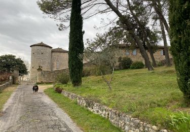
Départ de la station d'épuration du Mas Chabert. Possible de se garer au Mas Chabert.
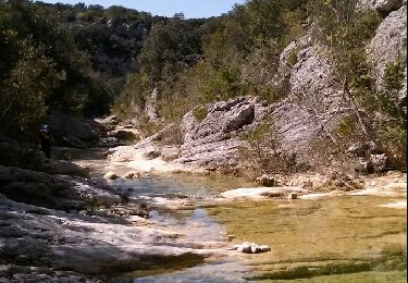
Boucle roulante et non technique effectué en VTTAE.
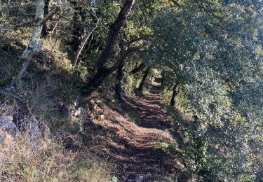
Plaine agricole, DFCI et route secondaire.
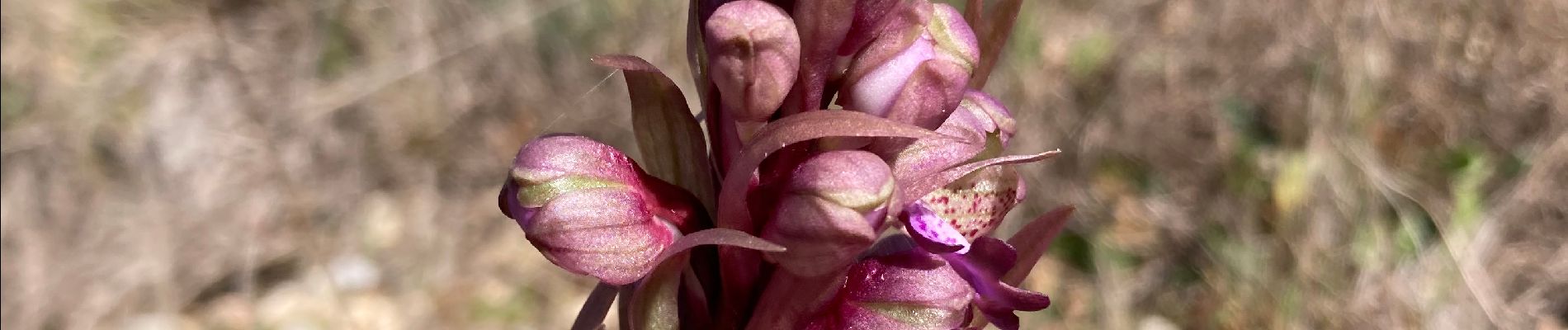
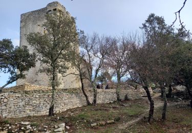
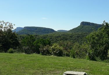
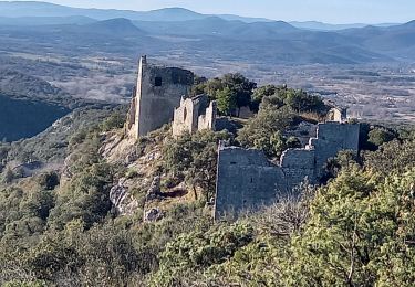
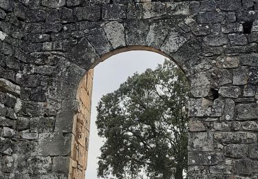
Garrigue et jolis villages traversés.
Positioning
Country:
France
Region :
Occitania
Department/Province :
Gard
Municipality :
Rousson
Location:
Unknown
Start:(Dec)
Start:(UTM)
595899 ; 4892184 (31T) N.
Comments
Trails nearby
![Trail Walking Navacelles - Les Aiguiéres au départ de Call - Photo](https://media.geolcdn.com/t/375/260/ceda67ec-d101-468c-8a83-e91809d135cb.jpg&format=jpg&maxdim=2)
![Walking Walking](https://static1.geolcdn.com/sitytour/trail-icons/101.png)
Les Aiguiéres au départ de Call
Walking
Difficult
(1)
Navacelles,
Occitania,
Gard,
France
![](/images/other/stat-length.png)
10.4 km | 14.9 km-effort
4h 39min
![](https://static1.geolcdn.com/siteimages/upload/files/16400158638029165_repeat_loop_refresh_sync_direction_icon.png)
Yes
![Trail Walking Navacelles - Aiguieres par Cal - Photo](https://media.geolcdn.com/t/375/260/ext.jpg?maxdim=2&url=https%3A%2F%2Fservices.sitytrail.com%2FGeolivesWS%2FDownloadMedia.ashx%3FTrailID%3D406963%26Media%3Dfix__20150412123451.jpg)
![Walking Walking](https://static1.geolcdn.com/sitytour/trail-icons/101.png)
Aiguieres par Cal
Walking
Medium
(2)
Navacelles,
Occitania,
Gard,
France
![](/images/other/stat-length.png)
8.9 km | 12.6 km-effort
2h 20min
![](https://static1.geolcdn.com/siteimages/upload/files/16400158638029165_repeat_loop_refresh_sync_direction_icon.png)
Yes
![Trail Walking Brouzet-lès-Alès - Mont Bouquet - Photo](https://media.geolcdn.com/t/375/260/7ba04687-b363-48b1-b29f-006a975fa7e7.jpg&format=jpg&maxdim=2)
![Walking Walking](https://static1.geolcdn.com/sitytour/trail-icons/101.png)
Mont Bouquet
Walking
Medium
Brouzet-lès-Alès,
Occitania,
Gard,
France
![](/images/other/stat-length.png)
14.5 km | 21 km-effort
3h 41min
![](https://static1.geolcdn.com/siteimages/upload/files/16400158638029165_repeat_loop_refresh_sync_direction_icon.png)
Yes
![Trail Walking Navacelles - Château d'Allegre / Aiguières - Photo](https://media.geolcdn.com/t/375/260/3f553ed7-1a33-4856-a98a-164e5181c4df.jpg&format=jpg&maxdim=2)
![Walking Walking](https://static1.geolcdn.com/sitytour/trail-icons/101.png)
Château d'Allegre / Aiguières
Walking
Difficult
Navacelles,
Occitania,
Gard,
France
![](/images/other/stat-length.png)
20 km | 29 km-effort
7h 18min
![](https://static1.geolcdn.com/siteimages/upload/files/16400158638029165_repeat_loop_refresh_sync_direction_icon.png)
Yes
![Trail Walking Rousson - Le plateau de Rousson - Photo](https://media.geolcdn.com/t/375/260/41c9e0a2-2597-4a1d-bdd7-df5fb4557267.jpg&format=jpg&maxdim=2)
![Walking Walking](https://static1.geolcdn.com/sitytour/trail-icons/101.png)
Le plateau de Rousson
Walking
Very difficult
Rousson,
Occitania,
Gard,
France
![](/images/other/stat-length.png)
15.5 km | 21 km-effort
5h 56min
![](https://static1.geolcdn.com/siteimages/upload/files/16400158638029165_repeat_loop_refresh_sync_direction_icon.png)
Yes
![Walking Walking](https://static1.geolcdn.com/sitytour/trail-icons/101.png)
Argensol, chapelle St Saturnin, Château d'Alègre
Walking
Difficult
Allègre-les-Fumades,
Occitania,
Gard,
France
![](/images/other/stat-length.png)
8.7 km | 12.1 km-effort
2h 44min
![](https://static1.geolcdn.com/siteimages/upload/files/16400158638029165_repeat_loop_refresh_sync_direction_icon.png)
Yes
![Trail Walking Allègre-les-Fumades - Chateau d'Allegre par les crêtes et défilé d'Argensol - Photo](https://media.geolcdn.com/t/375/260/cf4de307-4e0a-401c-8a29-7a796fd485c8.jpg&format=jpg&maxdim=2)
![Walking Walking](https://static1.geolcdn.com/sitytour/trail-icons/101.png)
Chateau d'Allegre par les crêtes et défilé d'Argensol
Walking
Medium
Allègre-les-Fumades,
Occitania,
Gard,
France
![](/images/other/stat-length.png)
9.5 km | 13 km-effort
3h 42min
![](https://static1.geolcdn.com/siteimages/upload/files/16400158638029165_repeat_loop_refresh_sync_direction_icon.png)
Yes
![Trail Walking Navacelles - Aiguieres - Photo](https://media.geolcdn.com/t/375/260/19d58264-2201-47f9-81d9-199a44b0214c.jpg&format=jpg&maxdim=2)
![Walking Walking](https://static1.geolcdn.com/sitytour/trail-icons/101.png)
Aiguieres
Walking
Difficult
Navacelles,
Occitania,
Gard,
France
![](/images/other/stat-length.png)
8.4 km | 12.1 km-effort
2h 45min
![](https://static1.geolcdn.com/siteimages/upload/files/16400158638029165_repeat_loop_refresh_sync_direction_icon.png)
Yes
![Trail Walking Allègre-les-Fumades - Château d'Allègre depuis la Bégude - Photo](https://media.geolcdn.com/t/375/260/c7ad5edd-37ff-4c16-8ee0-7374b4c05db7.jpg&format=jpg&maxdim=2)
![Walking Walking](https://static1.geolcdn.com/sitytour/trail-icons/101.png)
Château d'Allègre depuis la Bégude
Walking
Medium
Allègre-les-Fumades,
Occitania,
Gard,
France
![](/images/other/stat-length.png)
5.2 km | 7.2 km-effort
2h 17min
![](https://static1.geolcdn.com/siteimages/upload/files/16400158638029165_repeat_loop_refresh_sync_direction_icon.png)
Yes