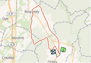
18.2 km | 22 km-effort
ochey
micksop
User
Length
15.7 km
Max alt
320 m
Uphill gradient
163 m
Km-Effort
17.9 km
Min alt
215 m
Downhill gradient
166 m
Boucle
No
Creation date :
2023-03-02 13:03:22.0
Updated on :
2023-08-01 08:57:57.254
3h40
Difficulty : Medium
FREE GPS app for hiking
About
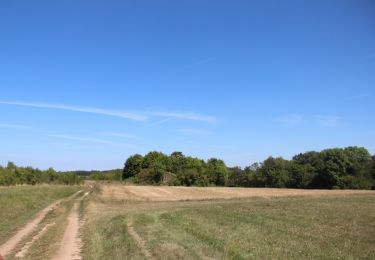
Trail Walking of 15.7 km to be discovered at Grand Est, Meurthe-et-Moselle, Ochey. This trail is proposed by micksop.
Description
boucle LM
Positioning
Country:
France
Region :
Grand Est
Department/Province :
Meurthe-et-Moselle
Municipality :
Ochey
Location:
Unknown
Start:(Dec)
Start:(UTM)
717579 ; 5385839 (31U) N.
Comments
Trails nearby
Circuit de la Vallée des Prés
On foot
Medium
Thuilley-aux-Groseilles,
Grand Est,
Meurthe-et-Moselle,
France
4h 57min
No
Circuit du Bois de Feys
On foot
Easy
Thuilley-aux-Groseilles,
Grand Est,
Meurthe-et-Moselle,
France
10 km | 12.6 km-effort
2h 52min
No
chahalot
Walking
Medium
(1)
Moutrot,
Grand Est,
Meurthe-et-Moselle,
France
8.6 km | 10.1 km-effort
2h 6min
Yes
2017 07 25 les 3 deuilles Ochey bis
Running
Very easy
Ochey,
Grand Est,
Meurthe-et-Moselle,
France
19.2 km | 23 km-effort
2h 42min
Yes
Entre Allain et Ochey
Walking
Medium
Allain,
Grand Est,
Meurthe-et-Moselle,
France
13.9 km | 16.3 km-effort
3h 7min
Yes
moutrot galette
Walking
Very difficult
Moutrot,
Grand Est,
Meurthe-et-Moselle,
France
27 km | 32 km-effort
4h 26min
No
la deuille résurgences départ ochey
Walking
Easy
(1)
Crézilles,
Grand Est,
Meurthe-et-Moselle,
France
6 km | 7 km-effort
1h 43min
Yes
Moutrot
sport
Very easy
Moutrot,
Grand Est,
Meurthe-et-Moselle,
France
4.1 km | 4.8 km-effort
Unknown
Yes
chahalot
Walking
Medium
Moutrot,
Grand Est,
Meurthe-et-Moselle,
France
9.2 km | 10.8 km-effort
3h 8min
Yes