


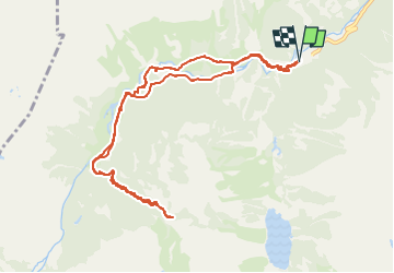

11.4 km | 17.5 km-effort


User


FREE GPS app for hiking
 SityTrail
IGN / Geographical institutes
SityTrail World
The world is yours!
Trail Snowshoes of 12.6 km to be discovered at Occitania, Hautespyrenees, Cauterets. This trail is proposed by topolino.
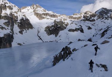
Une visite à ce petit vallon peu fréquenté. Temps superbe et panorama au rendez-vous. Pic de Gaube , Crête des Counillères, Pic de la Hucholle, mais aussi sur l'autre versant , les Aiguilles de castes Abarcat , la Carduinquère.
La neige s"est transformée vers12h.

Walking

Walking

Walking

Walking
Walking

Walking

Walking

Walking
Walking