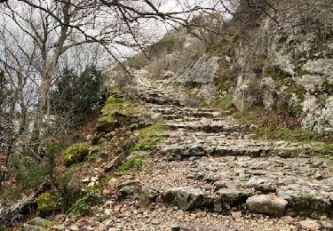
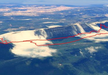
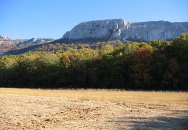
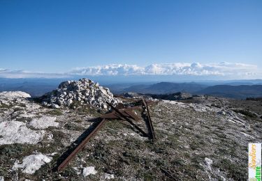
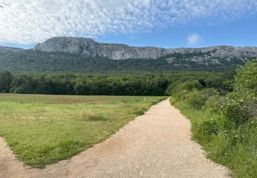
Trail Walking Nans-les-Pins - Le baou des glacières - Photo
 amiral13
amiral13

User GUIDE

© OpenStreetMap contributors
Length
Length
7.6 km
Max alt
Max alt
1033 m
Uphill gradient
Uphill gradient
347 m
Km-Effort
Km-Effort  
12.2 km
Min alt
Min alt
712 m
Downhill gradient
Downhill gradient
346 m
Boucle
Boucle
Yes
Creation date :
2015-01-03 00:00:00.0
Updated on :
2022-11-25 12:34:08.236

(1 Reviews)

Walking
Walking
4h27
Difficulty : Medium

Scan this QR Code to open this trail in the SityTrail application

FREE GPS app for hiking

Logo SityTrail SityTrail

IGN / Geographical institutes

Download SityTrail from the App Store Download SityTrail from Google Play

Logo SityTrail SityTrail World

The world is yours!

Download SityTrail from the App Store Download SityTrail from Google Play Download SityTrail on Huawei AppGallery

About

Trail Walking of 7.6 km to be discovered at Provence-Alpes-Côte d'Azur, Var, Nans-les-Pins. This trail is proposed by amiral13.

Description

le départ se situe au croisement de la D95 et du vallon du  Pommier. Partir dans le prolongement du vallon sur une sente qui suit la limite de domaine forestier pour atteindre un premier chemin DFCI; continuer dans la même direction jusqu'à un second chemin DFCI que l'on franchira aussi sur quelques dizaines de mètres pour rejoindre le sentier merveilleux; le suivre vers l'est jusqu'à rejoindre la piste DFCI que l'on empruntera jusqu'à ce qui reste du hêtre millénaire. A partir de là le prendre le sentier plein sud qui vous amènera en quelques lacets jusqu'au pas de l'Aï. le franchir pour accéder à la crête (pour profiter de la vue) que l'on suivra sur quelques centaines de mètres (on peut très bien ne pas le franchir et suivre le sentier au pieds des falaises qui vous amènera lui aussi au Paradis). Plusieurs possibilités de redescendre dans le vallon s'offriront en fonction de votre agilité ou de votre équipement avec ma fille nous avons choisi de délaisser le premier pour rejoindre le paradis par le vallon forestier (attention sentier peu marqué).
du paradis montez les quelques mètres qui vous amèneront à un joli point de vue.reprendre ensuite le sentier plein est pour traverser le vallon forestier et rejoindre le baou des glacières, un peu d'escalade facile sera nécessaire pour accéder au sommet. retour au paradis pour poursuivre le sentier en pieds de falaises qui contourne le baou de Saint Cassien et rejoint le hêtre millenaire. de là prendre la piste DFCI au carrefour suite virer à droite pour descendre vers la piste du dessous que l’on empruntera vers l'ouest, à la barrière filer plein nord pour rejoindre la voiture.

PS: la durée comprends tous les arrêts.

Elevation profile

Photos

Points of interest

Point of interest Plan-d'Aups-Sainte-Baume - le sentier de départ - Photo
amiral13
PLAN-D'AUPS-SAINTE-BAUME 
Point of interest Plan-d'Aups-Sainte-Baume - Départ ou fin du sentier merveilleux - Photo
amiral13
PLAN-D'AUPS-SAINTE-BAUME 
Point of interest Plan-d'Aups-Sainte-Baume - le hêtre millénaire - Photo
amiral13
PLAN-D'AUPS-SAINTE-BAUME 
Point of interest Plan-d'Aups-Sainte-Baume - Départ de la corniche Estruch - Photo
amiral13
PLAN-D'AUPS-SAINTE-BAUME 
Point of interest Plan-d'Aups-Sainte-Baume - Pas de l'ai - Photo
amiral13
PLAN-D'AUPS-SAINTE-BAUME 
Point of interest Plan-d'Aups-Sainte-Baume - la forêt de sainte Baume - Photo
amiral13
PLAN-D'AUPS-SAINTE-BAUME 
Point of interest Mazaugues - le baou des Glacières - Photo
amiral13

Positioning

Country:
France
Region :
Provence-Alpes-Côte d'Azur
Department/Province :
Var
Municipality :
Nans-les-Pins
Location:
Unknown
Start:(UTM)
726815 ; 4803037 (31T) N.

Comments

Please log in to post a review or rate the element


top!


Trails nearby

Trail Walking Plan-d'Aups-Sainte-Baume - Sainte Baume 8,5 km - Photo
Walking
GUIDE
rvapeldo

Walking

Medium
(1)
Plan-d'Aups-Sainte-Baume, Provence-Alpes-Côte d'Azur, Var, France
8.4 km | 15.5 km-effort
4h 38min
Yes
Trail Walking Plan-d'Aups-Sainte-Baume - SityTrail - Sentier merveilleux - La Ste baume - Le Plan d'aups  - Photo
Walking
GUIDE
affinetataille

Walking

Medium
(1)
Plan-d'Aups-Sainte-Baume, Provence-Alpes-Côte d'Azur, Var, France
15 km | 23 km-effort
6h 0min
Yes
Trail Walking Plan-d'Aups-Sainte-Baume - Crêts de la Ste Baume - Photo
Walking
tracegps

Walking

Medium
(2)
Plan-d'Aups-Sainte-Baume, Provence-Alpes-Côte d'Azur, Var, France
15.4 km | 23 km-effort
5h 0min
Yes
Trail Walking Nans-les-Pins - La Croix des Glacières, Sainte-Baume - Photo
Walking
tracegps

Walking

Medium
(1)
Nans-les-Pins, Provence-Alpes-Côte d'Azur, Var, France
7.2 km | 12 km-effort
3h 19min
Yes
Trail Walking Plan-d'Aups-Sainte-Baume - Du Col du Saint-Pilon au Pas de l'Aï, Sainte Baume - Photo
Walking
tracegps

Walking

Medium
(1)
Plan-d'Aups-Sainte-Baume, Provence-Alpes-Côte d'Azur, Var, France
13.1 km | 20 km-effort
5h 15min
Yes
Trail Walking Riboux - Riboux - Forêt de Malaucène - Photo
Walking
tracegps

Walking

Medium
(4)
Riboux, Provence-Alpes-Côte d'Azur, Var, France
12.2 km | 15.2 km-effort
2h 40min
Yes
Trail On foot Plan-d'Aups-Sainte-Baume - Massif Sainte Baume et pas de l’Aï 15 km - Photo
On foot
GUIDE
rvapeldo

On foot

Medium
Plan-d'Aups-Sainte-Baume, Provence-Alpes-Côte d'Azur, Var, France
15 km | 22 km-effort
5h 0min
Yes
Trail Walking Plan-d'Aups-Sainte-Baume - Sainte Baume par le sentier Marcel d'Estruch - Photo
Walking
GUIDE
nadd73

Walking

Difficult
Plan-d'Aups-Sainte-Baume, Provence-Alpes-Côte d'Azur, Var, France
13.3 km | 23 km-effort
4h 40min
No
Trail Walking Plan-d'Aups-Sainte-Baume - Marcel estruche - Photo
Walking
GUIDE
Danielba

Walking

Difficult
Plan-d'Aups-Sainte-Baume, Provence-Alpes-Côte d'Azur, Var, France
10.4 km | 18.9 km-effort
8h 6min
No


Close
My subscriptions