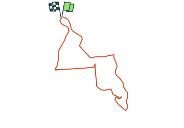
![](/images/other/stat-length.png)
![Trail Walking Cerfontaine - Balade à Senzeilles - Photo](https://media.geolcdn.com/t/1900/400/889aef67-7733-498d-b260-5760cb6b4d9f.jpeg&format=pjpeg&maxdim=2)
Balade à Senzeilles
Desrumaux
User GUIDE
![Length](/images/other/stat-length.png)
![Max alt](https://static1.geolcdn.com/siteimages/upload/files/1508320355ic_sort_altitude_max_24dp.png)
![Uphill gradient](https://static1.geolcdn.com/siteimages/upload/files/1508320355ic_sort_den_pos_24dp.png)
![Km-Effort](/images/other/stat-length.png)
![Min alt](https://static1.geolcdn.com/siteimages/upload/files/1508320355ic_sort_altitude_min_24dp.png)
![Downhill gradient](https://static1.geolcdn.com/siteimages/upload/files/1508320355ic_sort_den_neg_24dp.png)
![Boucle](https://static1.geolcdn.com/siteimages/upload/files/16400158638029165_repeat_loop_refresh_sync_direction_icon.png)
![Walking](https://static1.geolcdn.com/sitytour/trail-icons/101.png)
2h05
Difficulty : Medium
![Scan this QR Code to open this trail in the SityTrail application](https://capi.geolives.com/qq0zvz2zws4bq2lad0pu/sitytour/trails/3553516/qr.png?size=200)
FREE GPS app for hiking
About
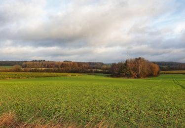
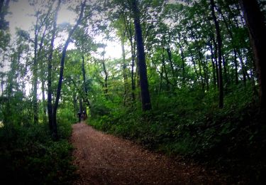
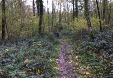
Trail Walking of 7.7 km to be discovered at Wallonia, Namur, Cerfontaine. This trail is proposed by Desrumaux.
Description
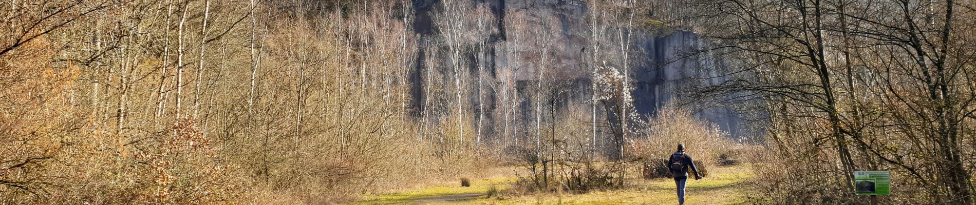
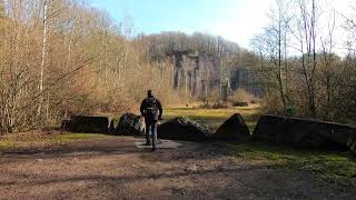
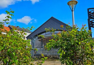
Promenade de la carrière du Beauchâteau
LA CARRIÈRE DE BEAUCHÂTEAU À SENZEILLE
Située à environ 2 km au sud-est de Senzeilles, cette carrière de marbre rouge fut probablement exploitée à partir du XVIIIème siècle. Elle appartient à ce riche gisement localisé sur le dernier massif calcaire avant la dépression de la Fagne.
Au XIXème siècle, cette activité d’extraction prit de l’importance notamment grâce à l’utilisation de nouvelles méthodes d’extraction. Ainsi, en 1874, le fil hélicoïdal est utilisé à la carrière de Beauchâteau. Il s’agit alors d’une première en Belgique.
https://www.entre-sambre-et-meuse.be/la-carriere-de-beauchateau-a
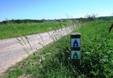
Positioning
Comments
Trails nearby
![Trail Walking Cerfontaine - La balade du Ballonnet - Photo](https://media.geolcdn.com/t/375/260/ext.jpg?maxdim=2&url=https%3A%2F%2Fservices.sitytrail.com%2FGeolivesWS%2FDownloadMedia.ashx%3FTrailID%3D661211%26Media%3Df8ef018a-8a4e-43e9-8982-4175f97a626c.jpg)
![Walking Walking](https://static1.geolcdn.com/sitytour/trail-icons/101.png)
Walking
![](/images/other/stat-length.png)
![](https://static1.geolcdn.com/siteimages/upload/files/16400158638029165_repeat_loop_refresh_sync_direction_icon.png)
![Trail Walking Cerfontaine - Balade au village de la source de l'eau d'Heure Cerfontaine - Photo](https://media.geolcdn.com/t/375/260/ext.jpg?maxdim=2&url=https%3A%2F%2Fservices.sitytrail.com%2FGeolivesWS%2FDownloadMedia.ashx%3FTrailID%3D479710%26Media%3D2fce6745-f1ff-4853-9950-93fb7818c454.JPG)
![Walking Walking](https://static1.geolcdn.com/sitytour/trail-icons/101.png)
Walking
![](/images/other/stat-length.png)
![](https://static1.geolcdn.com/siteimages/upload/files/16400158638029165_repeat_loop_refresh_sync_direction_icon.png)
![Trail Walking Cerfontaine - Balade à Cerfontaine - Photo](https://media.geolcdn.com/t/375/260/2eef0e24-fd5d-49ba-9ea4-39eb5a2f7225.jpg&format=jpg&maxdim=2)
![Walking Walking](https://static1.geolcdn.com/sitytour/trail-icons/101.png)
Walking
![](/images/other/stat-length.png)
![](https://static1.geolcdn.com/siteimages/upload/files/16400158638029165_repeat_loop_refresh_sync_direction_icon.png)
![Trail Walking Philippeville - Balade à Jamagne - Photo](https://media.geolcdn.com/t/375/260/ce171ec7-b1dd-4723-988d-0840c5fff04b.jpeg&format=jpg&maxdim=2)
![Walking Walking](https://static1.geolcdn.com/sitytour/trail-icons/101.png)
Walking
![](/images/other/stat-length.png)
![](https://static1.geolcdn.com/siteimages/upload/files/16400158638029165_repeat_loop_refresh_sync_direction_icon.png)
![Trail Walking Philippeville - Balade à Jamiolle - Photo](https://media.geolcdn.com/t/375/260/06c8177c-21a1-421c-9fc3-909bbee83463.jpeg&format=jpg&maxdim=2)
![Walking Walking](https://static1.geolcdn.com/sitytour/trail-icons/101.png)
Walking
![](/images/other/stat-length.png)
![](https://static1.geolcdn.com/siteimages/upload/files/16400158638029165_repeat_loop_refresh_sync_direction_icon.png)
![Trail Mountain bike Cerfontaine - Les Hauts de Cerfontaine - Photo](https://media.geolcdn.com/t/375/260/ext.jpg?maxdim=2&url=https%3A%2F%2Fpivotmedia.tourismewallonie.be%2FOTH-A0-004F-3144%2FOTH-A0-004F-3144.jpg)
![Mountain bike Mountain bike](https://static1.geolcdn.com/sitytour/trail-icons/202.png)
Mountain bike
![](/images/other/stat-length.png)
![](https://static1.geolcdn.com/siteimages/upload/files/16400158638029165_repeat_loop_refresh_sync_direction_icon.png)
![Mountain bike Mountain bike](https://static1.geolcdn.com/sitytour/trail-icons/202.png)
Mountain bike
![](/images/other/stat-length.png)
![](https://static1.geolcdn.com/siteimages/upload/files/16400158638029165_repeat_loop_refresh_sync_direction_icon.png)
![Mountain bike Mountain bike](https://static1.geolcdn.com/sitytour/trail-icons/202.png)
Mountain bike
![](/images/other/stat-length.png)
![](https://static1.geolcdn.com/siteimages/upload/files/16400158638029165_repeat_loop_refresh_sync_direction_icon.png)
![Trail Walking Cerfontaine - Promenade à Cerfontaine - Photo](https://media.geolcdn.com/t/375/260/ext.jpg?maxdim=2&url=https%3A%2F%2Fservices.sitytrail.com%2FGeolivesWS%2FDownloadMedia.ashx%3FTrailID%3D859850%26Media%3D688742af-ba12-46e5-bdcb-777d0764689c.JPG)
![Walking Walking](https://static1.geolcdn.com/sitytour/trail-icons/101.png)
Walking
![](/images/other/stat-length.png)
![](https://static1.geolcdn.com/siteimages/upload/files/16400158638029165_repeat_loop_refresh_sync_direction_icon.png)