![](/images/other/stat-length.png)
![Trail Walking Villeneuve-en-Retz - Bourgneuf - Pornic - Photo](https://media.geolcdn.com/t/1900/400/990b9ccf-eba1-4846-b79b-2e31a5fdc003.jpg&format=pjpeg&maxdim=2)
Bourgneuf - Pornic
Lobin
User
![Length](/images/other/stat-length.png)
Length
21 km
![Max alt](https://static1.geolcdn.com/siteimages/upload/files/1508320355ic_sort_altitude_max_24dp.png)
Max alt
27 m
![Uphill gradient](https://static1.geolcdn.com/siteimages/upload/files/1508320355ic_sort_den_pos_24dp.png)
Uphill gradient
142 m
![Km-Effort](/images/other/stat-length.png)
Km-Effort
23 km
![Min alt](https://static1.geolcdn.com/siteimages/upload/files/1508320355ic_sort_altitude_min_24dp.png)
Min alt
-2 m
![Downhill gradient](https://static1.geolcdn.com/siteimages/upload/files/1508320355ic_sort_den_neg_24dp.png)
Downhill gradient
145 m
![Boucle](https://static1.geolcdn.com/siteimages/upload/files/16400158638029165_repeat_loop_refresh_sync_direction_icon.png)
Boucle
No
Creation date :
2023-02-12 08:26:10.0
Updated on :
2023-02-12 20:38:22.204
![Walking](https://static1.geolcdn.com/sitytour/trail-icons/101.png)
4h15
Difficulty : Medium
![Scan this QR Code to open this trail in the SityTrail application](https://capi.geolives.com/qq0zvz2zws4bq2lad0pu/sitytour/trails/3549965/qr.png?size=200)
FREE GPS app for hiking
About
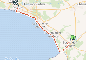
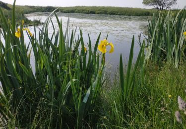
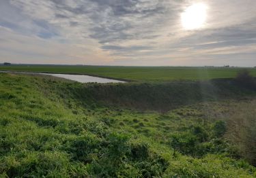
Trail Walking of 21 km to be discovered at Pays de la Loire, Loire-Atlantique, Villeneuve-en-Retz. This trail is proposed by Lobin.
Description
Randonnée sur deux jours après la plaine sur mer- Pornic.
Départ de Pornic
On prend le ter jusqu’à Bourgneuf en retz
Et retour à pied jusqu’à Pornic
Positioning
Country:
France
Region :
Pays de la Loire
Department/Province :
Loire-Atlantique
Municipality :
Villeneuve-en-Retz
Location:
Bourgneuf-en-Retz
Start:(Dec)
Start:(UTM)
579505 ; 5210927 (30T) N.
Comments
Trails nearby
![Trail On foot Villeneuve-en-Retz - PDIPR:1224 - Photo](https://media.geolcdn.com/t/375/260/1a57d417-9132-4bf4-870f-21ad0636d79e.jpeg&format=jpg&maxdim=2)
![On foot On foot](https://static1.geolcdn.com/sitytour/trail-icons/100.png)
PDIPR:1224
On foot
Easy
Villeneuve-en-Retz,
Pays de la Loire,
Loire-Atlantique,
France
![](/images/other/stat-length.png)
16.4 km | 17.8 km-effort
4h 2min
![](https://static1.geolcdn.com/siteimages/upload/files/16400158638029165_repeat_loop_refresh_sync_direction_icon.png)
No
![Trail On foot Les Moutiers-en-Retz - Le Collet - Photo](https://media.geolcdn.com/t/375/260/1a57d417-9132-4bf4-870f-21ad0636d79e.jpeg&format=jpg&maxdim=2)
![On foot On foot](https://static1.geolcdn.com/sitytour/trail-icons/100.png)
Le Collet
On foot
Easy
Les Moutiers-en-Retz,
Pays de la Loire,
Loire-Atlantique,
France
![](/images/other/stat-length.png)
9.9 km | 10.5 km-effort
2h 22min
![](https://static1.geolcdn.com/siteimages/upload/files/16400158638029165_repeat_loop_refresh_sync_direction_icon.png)
Yes
![Trail Walking Villeneuve-en-Retz - Bourgneuf - Photo](https://media.geolcdn.com/t/375/260/ext.jpg?maxdim=2&url=https%3A%2F%2Fservices.sitytrail.com%2FGeolivesWS%2FDownloadMedia.ashx%3FTrailID%3D242333%26Media%3D004523e4-4d0d-4608-bfa3-e711e62ed1cc.jpg)
![Walking Walking](https://static1.geolcdn.com/sitytour/trail-icons/101.png)
Bourgneuf
Walking
Medium
Villeneuve-en-Retz,
Pays de la Loire,
Loire-Atlantique,
France
![](/images/other/stat-length.png)
14.4 km | 15.5 km-effort
3h 20min
![](https://static1.geolcdn.com/siteimages/upload/files/16400158638029165_repeat_loop_refresh_sync_direction_icon.png)
Yes
![Trail Road bike Les Moutiers-en-Retz - 2023-06-25 port du collet -port des champs - port du bec A.R - Photo](https://media.geolcdn.com/t/375/260/239f987b-fb5d-4c97-a07a-46e1d6ee0353.jpg&format=jpg&maxdim=2)
![Road bike Road bike](https://static1.geolcdn.com/sitytour/trail-icons/201.png)
2023-06-25 port du collet -port des champs - port du bec A.R
Road bike
Medium
Les Moutiers-en-Retz,
Pays de la Loire,
Loire-Atlantique,
France
![](/images/other/stat-length.png)
37 km | 39 km-effort
2h 52min
![](https://static1.geolcdn.com/siteimages/upload/files/16400158638029165_repeat_loop_refresh_sync_direction_icon.png)
Yes
![Trail Walking Villeneuve-en-Retz - 2023-05-14 circuit des migrateurs - Bourgneuf en Retz - Villeneuve en Retz - Photo](https://media.geolcdn.com/t/375/260/1be5e16d-e40a-4440-a96a-f4180087ba32.jpg&format=jpg&maxdim=2)
![Walking Walking](https://static1.geolcdn.com/sitytour/trail-icons/101.png)
2023-05-14 circuit des migrateurs - Bourgneuf en Retz - Villeneuve en Retz
Walking
Easy
Villeneuve-en-Retz,
Pays de la Loire,
Loire-Atlantique,
France
![](/images/other/stat-length.png)
10.5 km | 11 km-effort
2h 23min
![](https://static1.geolcdn.com/siteimages/upload/files/16400158638029165_repeat_loop_refresh_sync_direction_icon.png)
Yes
![Trail Walking Les Moutiers-en-Retz - De Prigny à la Guérivière - Photo](https://media.geolcdn.com/t/375/260/732414e1-0d73-4bb4-8cbc-0e2adbd9a7b9.jpg&format=jpg&maxdim=2)
![Walking Walking](https://static1.geolcdn.com/sitytour/trail-icons/101.png)
De Prigny à la Guérivière
Walking
Easy
Les Moutiers-en-Retz,
Pays de la Loire,
Loire-Atlantique,
France
![](/images/other/stat-length.png)
7.8 km | 8.8 km-effort
2h 0min
![](https://static1.geolcdn.com/siteimages/upload/files/16400158638029165_repeat_loop_refresh_sync_direction_icon.png)
Yes
![Trail Cycle Les Moutiers-en-Retz - Prigny vélo - Photo](https://media.geolcdn.com/t/375/260/5d7bd996-9430-4362-855e-5cd32cea415b.jpg&format=jpg&maxdim=2)
![Cycle Cycle](https://static1.geolcdn.com/sitytour/trail-icons/200.png)
Prigny vélo
Cycle
Easy
Les Moutiers-en-Retz,
Pays de la Loire,
Loire-Atlantique,
France
![](/images/other/stat-length.png)
18 km | 19.4 km-effort
1h 30min
![](https://static1.geolcdn.com/siteimages/upload/files/16400158638029165_repeat_loop_refresh_sync_direction_icon.png)
Yes
![Trail Walking Les Moutiers-en-Retz - Marais de Bouin et Polder de la Coupelasse - Photo](https://media.geolcdn.com/t/375/260/f081bbb9-084c-4842-a239-92edeaf6330f.jpg&format=jpg&maxdim=2)
![Walking Walking](https://static1.geolcdn.com/sitytour/trail-icons/101.png)
Marais de Bouin et Polder de la Coupelasse
Walking
Difficult
(1)
Les Moutiers-en-Retz,
Pays de la Loire,
Loire-Atlantique,
France
![](/images/other/stat-length.png)
13 km | 13.4 km-effort
3h 19min
![](https://static1.geolcdn.com/siteimages/upload/files/16400158638029165_repeat_loop_refresh_sync_direction_icon.png)
Yes
![Trail Other activity Les Moutiers-en-Retz - Les Moutiers - Photo](https://media.geolcdn.com/t/375/260/ext.jpg?maxdim=2&url=https%3A%2F%2Fstatic1.geolcdn.com%2Fsiteimages%2Fupload%2Ffiles%2F1545311037marcheuse_200dpi.jpg)
![Other activity Other activity](https://static1.geolcdn.com/sitytour/trail-icons/900.png)
Les Moutiers
Other activity
Very easy
(1)
Les Moutiers-en-Retz,
Pays de la Loire,
Loire-Atlantique,
France
![](/images/other/stat-length.png)
2.4 km | 2.6 km-effort
Unknown
![](https://static1.geolcdn.com/siteimages/upload/files/16400158638029165_repeat_loop_refresh_sync_direction_icon.png)
No