

De Champles au Ry

Jean Goossens
User

Length
6.3 km

Max alt
108 m

Uphill gradient
64 m

Km-Effort
7.1 km

Min alt
70 m

Downhill gradient
63 m
Boucle
Yes
Creation date :
2023-02-10 13:37:13.999
Updated on :
2023-02-10 13:40:50.143
1h37
Difficulty : Medium

FREE GPS app for hiking
About
Trail Walking of 6.3 km to be discovered at Wallonia, Walloon Brabant, Wavre. This trail is proposed by Jean Goossens.
Description
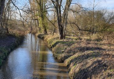
Balade de 6.2km à partir de l'ecole du Verseau, qui passe par Champles, longe le zoning Nord et remonte à l'école en passant par la ferme du Ry.
Positioning
Country:
Belgium
Region :
Wallonia
Department/Province :
Walloon Brabant
Municipality :
Wavre
Location:
Unknown
Start:(Dec)
Start:(UTM)
611650 ; 5620125 (31U) N.
Comments
Trails nearby
Balade de Rixensart au lac de Genval


Walking
Easy
(2)
Rixensart,
Wallonia,
Walloon Brabant,
Belgium

10.8 km | 13.3 km-effort
2h 52min
Yes
Lauzelle - Circuit Natura 2000, des sites qui valent le détour ! - Bw01


Walking
Easy
(2)
Ottignies-Louvain-la-Neuve,
Wallonia,
Walloon Brabant,
Belgium

3.8 km | 4.8 km-effort
1h 26min
Yes
RB-BW-07 - Des montagnes russes près de Wavre


Walking
Medium
(4)
Wavre,
Wallonia,
Walloon Brabant,
Belgium

27 km | 34 km-effort
7h 5min
Yes
#221104 - Florival > Pécrot, GRP127


Walking
Medium
(2)
Grez-Doiceau,
Wallonia,
Walloon Brabant,
Belgium

7 km | 8.4 km-effort
1h 55min
Yes
RB - BW - 6 Gastuche Precrot


Walking
Easy
(2)
Grez-Doiceau,
Wallonia,
Walloon Brabant,
Belgium

14.5 km | 17.2 km-effort
2h 58min
Yes
#201030 - Wavre, Bois ste Anne, Golf, Parc des Saules et Orangerie


Walking
Medium
(2)
Wavre,
Wallonia,
Walloon Brabant,
Belgium

7.7 km | 9.4 km-effort
1h 57min
Yes
#191230a - Ottenburg, Rondebos & St Agatha-Rodebos


Walking
Medium
(1)
Huldenberg,
Flanders,
Flemish Brabant,
Belgium

8.1 km | 10.3 km-effort
2h 13min
Yes
Terlanen - Up and Down


Walking
Medium
(2)
Huldenberg,
Flanders,
Flemish Brabant,
Belgium

8.4 km | 10.7 km-effort
2h 25min
Yes
Wavre Downtown


Walking
Difficult
(1)
Wavre,
Wallonia,
Walloon Brabant,
Belgium

11.5 km | 13.2 km-effort
3h 0min
Yes


 SityTrail


