![](/images/other/stat-length.png)
![Trail Walking Vaunaveys-la-Rochette - Vaunaveys Crest Vaunaveys - Photo](https://media.geolcdn.com/t/1900/400/ext.pjpeg?maxdim=2&url=https%3A%2F%2Fstatic1.geolcdn.com%2Fsiteimages%2Fupload%2Ffiles%2F1553511878bg_sport_marche.png)
Vaunaveys Crest Vaunaveys
LydiaMich
User
![Length](/images/other/stat-length.png)
Length
13.4 km
![Max alt](https://static1.geolcdn.com/siteimages/upload/files/1508320355ic_sort_altitude_max_24dp.png)
Max alt
412 m
![Uphill gradient](https://static1.geolcdn.com/siteimages/upload/files/1508320355ic_sort_den_pos_24dp.png)
Uphill gradient
437 m
![Km-Effort](/images/other/stat-length.png)
Km-Effort
19.2 km
![Min alt](https://static1.geolcdn.com/siteimages/upload/files/1508320355ic_sort_altitude_min_24dp.png)
Min alt
193 m
![Downhill gradient](https://static1.geolcdn.com/siteimages/upload/files/1508320355ic_sort_den_neg_24dp.png)
Downhill gradient
438 m
![Boucle](https://static1.geolcdn.com/siteimages/upload/files/16400158638029165_repeat_loop_refresh_sync_direction_icon.png)
Boucle
Yes
Creation date :
2023-02-09 09:33:18.964
Updated on :
2023-02-10 09:21:04.795
![Walking](https://static1.geolcdn.com/sitytour/trail-icons/101.png)
3h37
Difficulty : Easy
![Scan this QR Code to open this trail in the SityTrail application](https://capi.geolives.com/qq0zvz2zws4bq2lad0pu/sitytour/trails/3545970/qr.png?size=200)
FREE GPS app for hiking
About
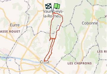
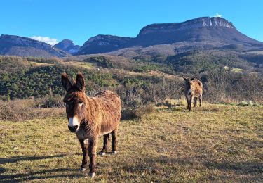
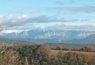
Trail Walking of 13.4 km to be discovered at Auvergne-Rhône-Alpes, Drôme, Vaunaveys-la-Rochette. This trail is proposed by LydiaMich .
Description
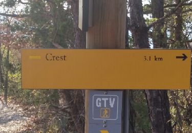
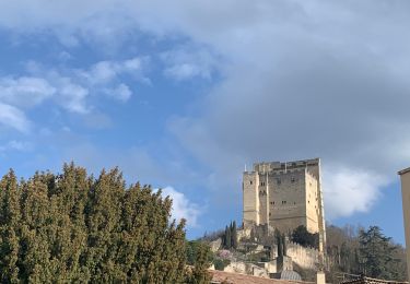
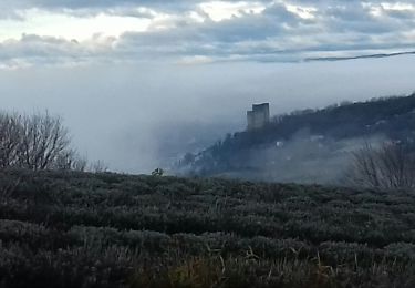
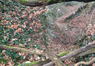
Randonnée entre Vaunaveys et Crest en boucle bien sympathique. On peut en profiter pour une petite visite du vieux Crest au passage avant de monter à sa tour.
Positioning
Country:
France
Region :
Auvergne-Rhône-Alpes
Department/Province :
Drôme
Municipality :
Vaunaveys-la-Rochette
Location:
Unknown
Start:(Dec)
Start:(UTM)
660882 ; 4959309 (31T) N.
Comments
Trails nearby
![Trail Walking Crest - Crest / Col de Bessot - Photo](https://media.geolcdn.com/t/375/260/ext.jpg?maxdim=2&url=https%3A%2F%2Fservices.sitytrail.com%2FGeolivesWS%2FDownloadMedia.ashx%3FTrailID%3D497687%26Media%3Dfix__20151127133911.jpg)
![Walking Walking](https://static1.geolcdn.com/sitytour/trail-icons/101.png)
Crest / Col de Bessot
Walking
Medium
(2)
Crest,
Auvergne-Rhône-Alpes,
Drôme,
France
![](/images/other/stat-length.png)
19.5 km | 28 km-effort
5h 52min
![](https://static1.geolcdn.com/siteimages/upload/files/16400158638029165_repeat_loop_refresh_sync_direction_icon.png)
Yes
![Trail Walking Crest - Crest à VAUNAVEY - Photo](https://media.geolcdn.com/t/375/260/ext.jpg?maxdim=2&url=https%3A%2F%2Fmedia.geolcdn.com%2Ff%2F286137c0-d121-4814-8720-e6aa22e27ac9.jpg)
![Walking Walking](https://static1.geolcdn.com/sitytour/trail-icons/101.png)
Crest à VAUNAVEY
Walking
Very easy
Crest,
Auvergne-Rhône-Alpes,
Drôme,
France
![](/images/other/stat-length.png)
9.2 km | 11.5 km-effort
1h 58min
![](https://static1.geolcdn.com/siteimages/upload/files/16400158638029165_repeat_loop_refresh_sync_direction_icon.png)
No
![Trail Walking Crest - Crest les crêtes - Photo](https://media.geolcdn.com/t/375/260/ext.jpg?maxdim=2&url=https%3A%2F%2Fmedia.geolcdn.com%2Ff%2Fd13859cb-c499-4b0f-86ce-a9a52bdb88e9.jpg)
![Walking Walking](https://static1.geolcdn.com/sitytour/trail-icons/101.png)
Crest les crêtes
Walking
Easy
Crest,
Auvergne-Rhône-Alpes,
Drôme,
France
![](/images/other/stat-length.png)
7.4 km | 10.7 km-effort
2h 0min
![](https://static1.geolcdn.com/siteimages/upload/files/16400158638029165_repeat_loop_refresh_sync_direction_icon.png)
Yes
![Trail Walking Crest - Crest - Photo](https://media.geolcdn.com/t/375/260/ext.jpg?maxdim=2&url=https%3A%2F%2Fmedia.geolcdn.com%2Ff%2Fe9e06745-c5f4-4002-b953-5ca3b3c4882f.jpg)
![Walking Walking](https://static1.geolcdn.com/sitytour/trail-icons/101.png)
![Trail Walking Crest - CREST Festi'Rando - Photo](https://media.geolcdn.com/t/375/260/ext.jpg?maxdim=2&url=https%3A%2F%2Fmedia.geolcdn.com%2Ff%2F04ef8fcb-55be-4ead-ad42-a1399ab562d5.jpg)
![Walking Walking](https://static1.geolcdn.com/sitytour/trail-icons/101.png)
CREST Festi'Rando
Walking
Difficult
Crest,
Auvergne-Rhône-Alpes,
Drôme,
France
![](/images/other/stat-length.png)
13.6 km | 18.9 km-effort
5h 44min
![](https://static1.geolcdn.com/siteimages/upload/files/16400158638029165_repeat_loop_refresh_sync_direction_icon.png)
Yes
![Trail Road bike Crest - j3 Crest limouche vauna vaunaveys 01.07.23 - Photo](https://media.geolcdn.com/t/375/260/ext.jpg?maxdim=2&url=https%3A%2F%2Fmedia.geolcdn.com%2Ff%2Ff1e7664d-d94c-4a24-8662-9bd9acc5deea.jpg)
![Road bike Road bike](https://static1.geolcdn.com/sitytour/trail-icons/201.png)
j3 Crest limouche vauna vaunaveys 01.07.23
Road bike
Medium
Crest,
Auvergne-Rhône-Alpes,
Drôme,
France
![](/images/other/stat-length.png)
66 km | 85 km-effort
5h 58min
![](https://static1.geolcdn.com/siteimages/upload/files/16400158638029165_repeat_loop_refresh_sync_direction_icon.png)
No
![Trail Walking Crest - Grane jour 3 - Photo](https://media.geolcdn.com/t/375/260/ext.jpg?maxdim=2&url=https%3A%2F%2Fmedia.geolcdn.com%2Ff%2F5b484320-de27-4f60-bb8c-674d65323a10.jpg)
![Walking Walking](https://static1.geolcdn.com/sitytour/trail-icons/101.png)
Grane jour 3
Walking
Medium
Crest,
Auvergne-Rhône-Alpes,
Drôme,
France
![](/images/other/stat-length.png)
12.7 km | 18.6 km-effort
3h 31min
![](https://static1.geolcdn.com/siteimages/upload/files/16400158638029165_repeat_loop_refresh_sync_direction_icon.png)
Yes
![Trail Walking Gigors-et-Lozeron - la rivière.gigors.lozeron. - Photo](https://media.geolcdn.com/t/375/260/ext.jpg?maxdim=2&url=https%3A%2F%2Fmedia.geolcdn.com%2Ff%2Ff090ab4f-913b-4011-8841-56286b93115f.jpg)
![Walking Walking](https://static1.geolcdn.com/sitytour/trail-icons/101.png)
la rivière.gigors.lozeron.
Walking
Easy
Gigors-et-Lozeron,
Auvergne-Rhône-Alpes,
Drôme,
France
![](/images/other/stat-length.png)
18.1 km | 29 km-effort
7h 2min
![](https://static1.geolcdn.com/siteimages/upload/files/16400158638029165_repeat_loop_refresh_sync_direction_icon.png)
Yes
![Trail Walking Ourches - le tour de Chalamet - Photo](https://media.geolcdn.com/t/375/260/ext.jpg?maxdim=2&url=https%3A%2F%2Fmedia.geolcdn.com%2Ff%2F07c76494-0572-46c7-8461-f26545d726ef.jpg)
![Walking Walking](https://static1.geolcdn.com/sitytour/trail-icons/101.png)
le tour de Chalamet
Walking
Medium
(1)
Ourches,
Auvergne-Rhône-Alpes,
Drôme,
France
![](/images/other/stat-length.png)
10.7 km | 18.7 km-effort
3h 51min
![](https://static1.geolcdn.com/siteimages/upload/files/16400158638029165_repeat_loop_refresh_sync_direction_icon.png)
Yes