![](/images/other/stat-length.png)
![Trail Walking Ledringhem - Mémorial de la Plaine au Bois - Photo](https://media.geolcdn.com/t/1900/400/ext.pjpeg?maxdim=2&url=https%3A%2F%2Fstatic1.geolcdn.com%2Fsiteimages%2Fupload%2Ffiles%2F1553511878bg_sport_marche.png)
Mémorial de la Plaine au Bois
Greg813
User
![Length](/images/other/stat-length.png)
Length
20 km
![Max alt](https://static1.geolcdn.com/siteimages/upload/files/1508320355ic_sort_altitude_max_24dp.png)
Max alt
26 m
![Uphill gradient](https://static1.geolcdn.com/siteimages/upload/files/1508320355ic_sort_den_pos_24dp.png)
Uphill gradient
85 m
![Km-Effort](/images/other/stat-length.png)
Km-Effort
21 km
![Min alt](https://static1.geolcdn.com/siteimages/upload/files/1508320355ic_sort_altitude_min_24dp.png)
Min alt
10 m
![Downhill gradient](https://static1.geolcdn.com/siteimages/upload/files/1508320355ic_sort_den_neg_24dp.png)
Downhill gradient
86 m
![Boucle](https://static1.geolcdn.com/siteimages/upload/files/16400158638029165_repeat_loop_refresh_sync_direction_icon.png)
Boucle
Yes
Creation date :
2023-02-05 08:44:17.593
Updated on :
2023-03-12 17:07:12.094
![Walking](https://static1.geolcdn.com/sitytour/trail-icons/101.png)
4h25
Difficulty : Medium
![Scan this QR Code to open this trail in the SityTrail application](https://capi.geolives.com/qq0zvz2zws4bq2lad0pu/sitytour/trails/3541576/qr.png?size=200)
FREE GPS app for hiking
About
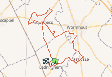
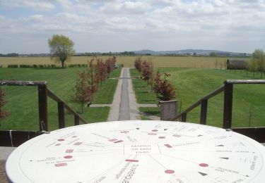
Trail Walking of 20 km to be discovered at Hauts-de-France, Nord, Ledringhem. This trail is proposed by Greg813.
Description
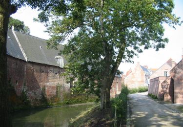
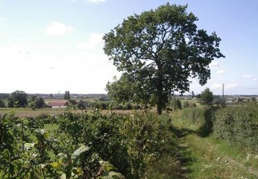
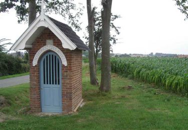
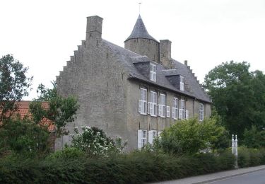
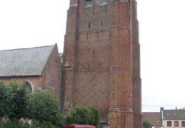
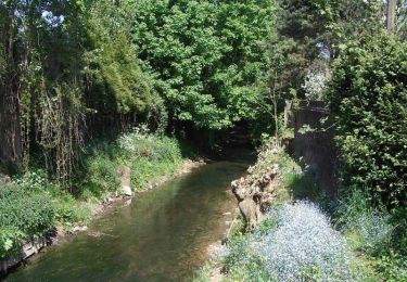
Randonnée avec Mettons le Monde en Marche, menant de Ledringhem à Wormhout et Esquelbecq , sur les lieux des combats de la seconde guerre mondiale, en passant par le mémorial de la Plaine au Bois.
Pour d'autres photos, voir le site de l'association :
https://mmm-rando.org/esquelbecq/
Positioning
Country:
France
Region :
Hauts-de-France
Department/Province :
Nord
Municipality :
Ledringhem
Location:
Unknown
Start:(Dec)
Start:(UTM)
460578 ; 5633737 (31U) N.
Comments
Trails nearby
![Trail Cycle Esquelbecq - Boucle d'Esquelbecq - Photo](https://media.geolcdn.com/t/375/260/ext.jpg?maxdim=2&url=https%3A%2F%2Fservices.sitytrail.com%2FGeolivesWS%2FDownloadMedia.ashx%3FTrailID%3D118733%26Media%3D12926_6.jpg)
![Cycle Cycle](https://static1.geolcdn.com/sitytour/trail-icons/200.png)
Boucle d'Esquelbecq
Cycle
Medium
Esquelbecq,
Hauts-de-France,
Nord,
France
![](/images/other/stat-length.png)
28 km | 30 km-effort
1h 30min
![](https://static1.geolcdn.com/siteimages/upload/files/16400158638029165_repeat_loop_refresh_sync_direction_icon.png)
Yes
![Trail Walking Wemaers-Cappel - Circuit des seigneurs de la Weesche - Zermezeele - Photo](https://media.geolcdn.com/t/375/260/ext.jpg?maxdim=2&url=https%3A%2F%2Fservices.sitytrail.com%2FGeolivesWS%2FDownloadMedia.ashx%3FTrailID%3D112752%26Media%3D11964_6.jpg)
![Walking Walking](https://static1.geolcdn.com/sitytour/trail-icons/101.png)
Circuit des seigneurs de la Weesche - Zermezeele
Walking
Medium
Wemaers-Cappel,
Hauts-de-France,
Nord,
France
![](/images/other/stat-length.png)
10.9 km | 12 km-effort
2h 40min
![](https://static1.geolcdn.com/siteimages/upload/files/16400158638029165_repeat_loop_refresh_sync_direction_icon.png)
Yes
![Trail Walking Arnèke - Circuit des 7 planètes 18 km - Arnèke - Photo](https://media.geolcdn.com/t/375/260/ext.jpg?maxdim=2&url=https%3A%2F%2Fservices.sitytrail.com%2FGeolivesWS%2FDownloadMedia.ashx%3FTrailID%3D112371%26Media%3D10474_6.jpg)
![Walking Walking](https://static1.geolcdn.com/sitytour/trail-icons/101.png)
Circuit des 7 planètes 18 km - Arnèke
Walking
Very difficult
Arnèke,
Hauts-de-France,
Nord,
France
![](/images/other/stat-length.png)
17.7 km | 19 km-effort
4h 30min
![](https://static1.geolcdn.com/siteimages/upload/files/16400158638029165_repeat_loop_refresh_sync_direction_icon.png)
Yes
![Trail Walking Wormhout - La Plaine au Bois (Massacre du 28 mai 1940) - Wormhout - Photo](https://media.geolcdn.com/t/375/260/ext.jpg?maxdim=2&url=https%3A%2F%2Fservices.sitytrail.com%2FGeolivesWS%2FDownloadMedia.ashx%3FTrailID%3D111841%26Media%3D8598_6.jpg)
![Walking Walking](https://static1.geolcdn.com/sitytour/trail-icons/101.png)
La Plaine au Bois (Massacre du 28 mai 1940) - Wormhout
Walking
Easy
Wormhout,
Hauts-de-France,
Nord,
France
![](/images/other/stat-length.png)
7.4 km | 7.9 km-effort
2h 0min
![](https://static1.geolcdn.com/siteimages/upload/files/16400158638029165_repeat_loop_refresh_sync_direction_icon.png)
Yes
![Trail Walking Zegerscappel - Circuit du Rijssel Berg - Zegerscappel - Photo](https://media.geolcdn.com/t/375/260/ext.jpg?maxdim=2&url=https%3A%2F%2Fservices.sitytrail.com%2FGeolivesWS%2FDownloadMedia.ashx%3FTrailID%3D110281%26Media%3D5676_6.jpg)
![Walking Walking](https://static1.geolcdn.com/sitytour/trail-icons/101.png)
Circuit du Rijssel Berg - Zegerscappel
Walking
Medium
Zegerscappel,
Hauts-de-France,
Nord,
France
![](/images/other/stat-length.png)
9.4 km | 10.2 km-effort
2h 25min
![](https://static1.geolcdn.com/siteimages/upload/files/16400158638029165_repeat_loop_refresh_sync_direction_icon.png)
Yes
![Trail Walking Arnèke - Circuit des 7 planètes (Arnéke) - Photo](https://media.geolcdn.com/t/375/260/ext.jpg?maxdim=2&url=https%3A%2F%2Fservices.sitytrail.com%2FGeolivesWS%2FDownloadMedia.ashx%3FTrailID%3D109688%26Media%3D4360_6.jpg)
![Walking Walking](https://static1.geolcdn.com/sitytour/trail-icons/101.png)
Circuit des 7 planètes (Arnéke)
Walking
Medium
Arnèke,
Hauts-de-France,
Nord,
France
![](/images/other/stat-length.png)
10.6 km | 11.6 km-effort
2h 40min
![](https://static1.geolcdn.com/siteimages/upload/files/16400158638029165_repeat_loop_refresh_sync_direction_icon.png)
Yes
![Trail Walking Esquelbecq - Des chênes au château - Esquelbecq - Photo](https://media.geolcdn.com/t/375/260/ext.jpg?maxdim=2&url=https%3A%2F%2Fservices.sitytrail.com%2FGeolivesWS%2FDownloadMedia.ashx%3FTrailID%3D109098%26Media%3D3151_6.jpg)
![Walking Walking](https://static1.geolcdn.com/sitytour/trail-icons/101.png)
Des chênes au château - Esquelbecq
Walking
Medium
Esquelbecq,
Hauts-de-France,
Nord,
France
![](/images/other/stat-length.png)
11.6 km | 12.4 km-effort
3h 0min
![](https://static1.geolcdn.com/siteimages/upload/files/16400158638029165_repeat_loop_refresh_sync_direction_icon.png)
Yes
![Trail Walking Wormhout - Circuit du moulin de la Briarde - Wormhout - Photo](https://media.geolcdn.com/t/375/260/ext.jpg?maxdim=2&url=https%3A%2F%2Fservices.sitytrail.com%2FGeolivesWS%2FDownloadMedia.ashx%3FTrailID%3D109092%26Media%3D3142_6.jpg)
![Walking Walking](https://static1.geolcdn.com/sitytour/trail-icons/101.png)
Circuit du moulin de la Briarde - Wormhout
Walking
Difficult
Wormhout,
Hauts-de-France,
Nord,
France
![](/images/other/stat-length.png)
13.8 km | 14.6 km-effort
3h 30min
![](https://static1.geolcdn.com/siteimages/upload/files/16400158638029165_repeat_loop_refresh_sync_direction_icon.png)
Yes
![Trail Walking Esquelbecq - La plaine au Bois - Photo](https://media.geolcdn.com/t/375/260/ext.jpg?maxdim=2&url=https%3A%2F%2Fservices.sitytrail.com%2FGeolivesWS%2FDownloadMedia.ashx%3FTrailID%3D108133%26Media%3D155_6.jpg)
![Walking Walking](https://static1.geolcdn.com/sitytour/trail-icons/101.png)
La plaine au Bois
Walking
Medium
(1)
Esquelbecq,
Hauts-de-France,
Nord,
France
![](/images/other/stat-length.png)
16.2 km | 17.1 km-effort
3h 30min
![](https://static1.geolcdn.com/siteimages/upload/files/16400158638029165_repeat_loop_refresh_sync_direction_icon.png)
Yes