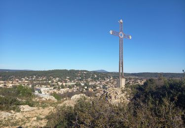
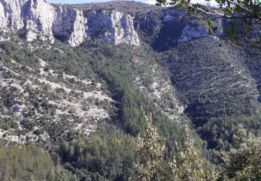
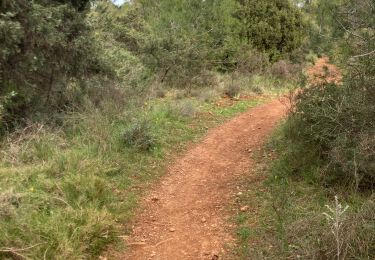
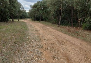
Trail Walking Murviel-lès-Montpellier - Double boucle autour de l'oppidum de Murviel-lès-Montpellier - Photo

Double boucle autour de l'oppidum de Murviel-lès-Montpellier

 ARVIEU
ARVIEU

User

© OpenStreetMap contributors
Length
Length
13.3 km
Max alt
Max alt
229 m
Uphill gradient
Uphill gradient
327 m
Km-Effort
Km-Effort  
17.7 km
Min alt
Min alt
98 m
Downhill gradient
Downhill gradient
328 m
Boucle
Boucle
Yes
Creation date :
2023-02-03 07:56:12.442
Updated on :
2023-02-03 08:00:01.075

(1 Reviews)

Walking
Walking
4h01
Difficulty : Medium

Scan this QR Code to open this trail in the SityTrail application

FREE GPS app for hiking

Logo SityTrail SityTrail

IGN / Geographical institutes

Download SityTrail from the App Store Download SityTrail from Google Play

Logo SityTrail SityTrail World

The world is yours!

Download SityTrail from the App Store Download SityTrail from Google Play Download SityTrail on Huawei AppGallery

About

Trail Walking of 13.3 km to be discovered at Occitania, Hérault, Murviel-lès-Montpellier. This trail is proposed by ARVIEU.

Elevation profile

Photos

Points of interest

Point of interest Murviel-lès-Montpellier - Parking de l'oppidum - Photo
ARVIEU
MURVIEL-LÈS-MONTPELLIER 
Point of interest Murviel-lès-Montpellier - Croisement des deux boucles - Photo
ARVIEU
MURVIEL-LÈS-MONTPELLIER 
Point of interest Murviel-lès-Montpellier - Départ piste montante - Photo
ARVIEU
MURVIEL-LÈS-MONTPELLIER 
Point of interest Saint-Paul-et-Valmalle - Abandon piste - Photo
ARVIEU
SAINT-PAUL-ET-VALMALLE 
Point of interest Murviel-lès-Montpellier - Traversée de route - Photo
ARVIEU
MURVIEL-LÈS-MONTPELLIER 
Point of interest Murviel-lès-Montpellier - Embranchement - Photo
ARVIEU
MURVIEL-LÈS-MONTPELLIER 
Point of interest Murviel-lès-Montpellier - Bifurcation - Photo
ARVIEU
MURVIEL-LÈS-MONTPELLIER 
Point of interest Murviel-lès-Montpellier - Tables pique-nique - Photo
ARVIEU
MURVIEL-LÈS-MONTPELLIER 
Point of interest Murviel-lès-Montpellier - Embranchement - Photo
ARVIEU
MURVIEL-LÈS-MONTPELLIER 
Point of interest Murviel-lès-Montpellier - Bifurcation à gauche - Photo
ARVIEU
MURVIEL-LÈS-MONTPELLIER 
Point of interest Murviel-lès-Montpellier - Croisement piste - Photo
ARVIEU
MURVIEL-LÈS-MONTPELLIER 
Point of interest Montarnaud - Ancienne voie ferrée - Photo
ARVIEU
Point of interest Saint-Georges-d'Orques - Pont - Photo
ARVIEU
SAINT-GEORGES-D'ORQUES 
Point of interest Murviel-lès-Montpellier - Chemin goudronné, à gauche - Photo
ARVIEU
MURVIEL-LÈS-MONTPELLIER 
Point of interest Murviel-lès-Montpellier - Parking de l'oppidum - Photo
ARVIEU
MURVIEL-LÈS-MONTPELLIER 

Positioning

Country:
France
Region :
Occitania
Department/Province :
Hérault
Municipality :
Murviel-lès-Montpellier
Location:
Unknown
Start:(UTM)
559570 ; 4828712 (31T) N.

Comments

Please log in to post a review or rate the element


Trails nearby

Trail Walking Grabels - Source de l'Avy et tour de Grabels 17.12.23  - Photo
Walking
GUIDE
fredetpascale

Walking

Easy
Grabels, Occitania, Hérault, France
11.4 km | 14.3 km-effort
3h 0min
Yes
Trail Walking Grabels - Grabels (source de l'Avy, goule de Laval) - Photo
Walking
coulombf

Walking

Easy
(1)
Grabels, Occitania, Hérault, France
10.7 km | 13.2 km-effort
2h 35min
Yes
Trail Walking Vailhauquès - belair grabels - Photo
Walking
richard.roure

Walking

Very easy
(1)
Vailhauquès, Occitania, Hérault, France
7.9 km | 9.5 km-effort
1h 29min
Yes
Trail Walking Grabels - serre grenouillet  - Photo
Walking
cavalierjeanpaul

Walking

Difficult
Grabels, Occitania, Hérault, France
10.6 km | 12.3 km-effort
4h 38min
No
Trail Nordic walking Montarnaud - Grand tour  - Photo
Nordic walking
fredpub34570

Nordic walking

Difficult
Montarnaud, Occitania, Hérault, France
16.1 km | 21 km-effort
3h 0min
Yes
Trail Walking Montarnaud - tour montarnaud et argelliers - Photo
Walking
jeanfcd

Walking

Easy
Montarnaud, Occitania, Hérault, France
17.1 km | 22 km-effort
3h 54min
Yes
Trail Walking Saint-Georges-d'Orques - Saint Georges d’orques la prose - Photo
Walking
lolitrail

Walking

Medium
(1)
Saint-Georges-d'Orques, Occitania, Hérault, France
9.5 km | 11.4 km-effort
2h 38min
No
Trail Walking Montarnaud - Montarnaud Bois Nègre  - Photo
Walking
Castor3467

Walking

Easy
(1)
Montarnaud, Occitania, Hérault, France
9.7 km | 12.8 km-effort
2h 30min
Yes
Trail Walking Juvignac - Le 1 mai 18 circuit de 16 kms vers la grotte aux fées  - Photo
Walking
labarone

Walking

Medium
Juvignac, Occitania, Hérault, France
63 km | 93 km-effort
5h 0min
No


Close
My subscriptions