Trail Walking Seillans - Tour du Lac de Meault - Photo
 aljac
aljac

User

© OpenStreetMap contributors
Length
Length
7.4 km
Max alt
Max alt
267 m
Uphill gradient
Uphill gradient
162 m
Km-Effort
Km-Effort  
9.6 km
Min alt
Min alt
185 m
Downhill gradient
Downhill gradient
161 m
Boucle
Boucle
Yes
Creation date :
2023-01-31 17:45:05.785
Updated on :
2023-01-31 17:51:04.429

(1 Reviews)

Walking
Walking
2h10
Difficulty : Medium

Scan this QR Code to open this trail in the SityTrail application

FREE GPS app for hiking

Logo SityTrail SityTrail

IGN / Geographical institutes

Download SityTrail from the App Store Download SityTrail from Google Play

Logo SityTrail SityTrail World

The world is yours!

Download SityTrail from the App Store Download SityTrail from Google Play Download SityTrail on Huawei AppGallery

About

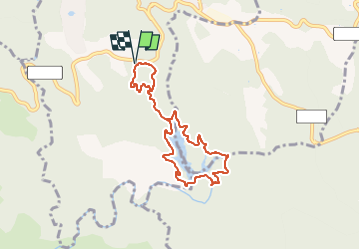
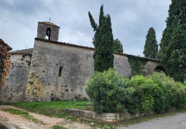
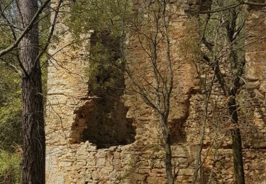
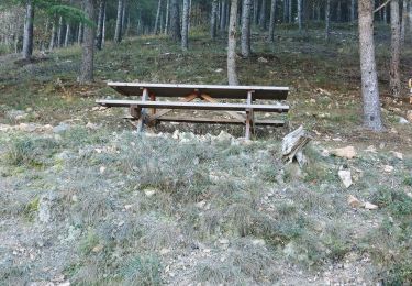
Trail Walking of 7.4 km to be discovered at Provence-Alpes-Côte d'Azur, Var, Seillans. This trail is proposed by aljac.

Description

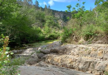
Randonnée effectuée en 1h58. La traversée en aval du déversoir peut présenter un danger. Suivre le marquage jaune (récent).

Elevation profile

Positioning

Country:
France
Region :
Provence-Alpes-Côte d'Azur
Department/Province :
Var
Municipality :
Seillans
Location:
Unknown
Start:(UTM)
308785 ; 4827946 (32T) N.

Comments

Please log in to post a review or rate the element


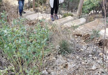
When you arrive on the dam, there is a tricky part for about 2m. Only room for 1 foot.


Trails nearby

Trail Walking Callas - gorge de Penafore - Photo
Walking
marmotte83

Walking

Very easy
(1)
Callas, Provence-Alpes-Côte d'Azur, Var, France
1.1 km | 1.3 km-effort
1h 33min
Yes
Trail On foot Bagnols-en-Forêt - BAGNOLS EN FORET- Bois du défens DRI - Photo
On foot

On foot

Easy
(2)
Bagnols-en-Forêt, Provence-Alpes-Côte d'Azur, Var, France
9.3 km | 12.7 km-effort
2h 52min
Yes
Trail Walking Seillans - Lac de Méaulx - Photo
Walking
Pascal-83

Walking

Medium
Seillans, Provence-Alpes-Côte d'Azur, Var, France
7.3 km | 9.5 km-effort
2h 9min
Yes
Trail Walking Callas - La catalane ,Font Blanche, les Cabanons - Photo
Walking
boulinevelyne

Walking

Medium
(1)
Callas, Provence-Alpes-Côte d'Azur, Var, France
10.3 km | 14.2 km-effort
3h 19min
Yes
Trail Walking Fayence - FAYENCE - TOUR DES CHAPELLES  - Photo
Walking
jean-marie.parachini

Walking

Easy
Fayence, Provence-Alpes-Côte d'Azur, Var, France
16.2 km | 21 km-effort
8h 3min
Yes
Trail Walking Seillans - La Pigne - Photo
Walking
avdem

Walking

Easy
Seillans, Provence-Alpes-Côte d'Azur, Var, France
16.3 km | 23 km-effort
5h 51min
Yes
Trail Walking Seillans - Le lac de Meaulx - Photo
Walking
boulinevelyne

Walking

Medium
Seillans, Provence-Alpes-Côte d'Azur, Var, France
10.8 km | 13.7 km-effort
2h 26min
Yes
Trail Walking Fayence - St Paul en Forêt - Lac de Méaulx - Pont de l'Endre - Piste Colle Douce - Photo
Walking
LtZIP

Walking

Easy
Fayence, Provence-Alpes-Côte d'Azur, Var, France
16.9 km | 22 km-effort
5h 32min
Yes
Trail Walking Fayence - Fayence - ND des Cyprès - ND des Selves - Photo
Walking
LtZIP

Walking

Easy
Fayence, Provence-Alpes-Côte d'Azur, Var, France
16.9 km | 22 km-effort
4h 27min
Yes


Close
My subscriptions