![](/images/other/stat-length.png)
![Trail Walking Gueberschwihr - Les Marcheurs...et la fondue..26/01/2024 - Photo](https://media.geolcdn.com/t/1900/400/ad885384-60ff-44a9-b1fd-e61a666f77f3.jpg&format=pjpeg&maxdim=2)
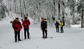
Les Marcheurs...et la fondue..26/01/2024
boubou68
User
![Length](/images/other/stat-length.png)
Length
20 km
![Max alt](https://static1.geolcdn.com/siteimages/upload/files/1508320355ic_sort_altitude_max_24dp.png)
Max alt
891 m
![Uphill gradient](https://static1.geolcdn.com/siteimages/upload/files/1508320355ic_sort_den_pos_24dp.png)
Uphill gradient
809 m
![Km-Effort](/images/other/stat-length.png)
Km-Effort
31 km
![Min alt](https://static1.geolcdn.com/siteimages/upload/files/1508320355ic_sort_altitude_min_24dp.png)
Min alt
264 m
![Downhill gradient](https://static1.geolcdn.com/siteimages/upload/files/1508320355ic_sort_den_neg_24dp.png)
Downhill gradient
809 m
![Boucle](https://static1.geolcdn.com/siteimages/upload/files/16400158638029165_repeat_loop_refresh_sync_direction_icon.png)
Boucle
Yes
Creation date :
2023-01-26 08:05:27.793
Updated on :
2023-01-26 15:31:19.095
![Walking](https://static1.geolcdn.com/sitytour/trail-icons/101.png)
4h59
Difficulty : Medium
![Scan this QR Code to open this trail in the SityTrail application](https://capi.geolives.com/qq0zvz2zws4bq2lad0pu/sitytour/trails/3530976/qr.png?size=200)
FREE GPS app for hiking
About
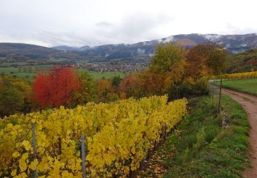
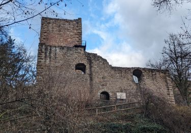
Trail Walking of 20 km to be discovered at Grand Est, Haut-Rhin, Gueberschwihr. This trail is proposed by boubou68.
Description
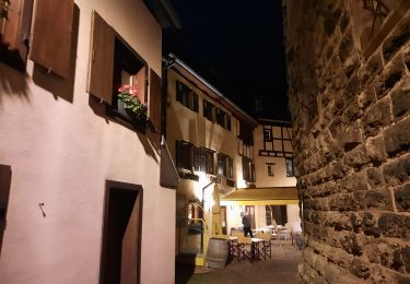
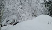
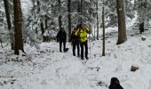
.Service cinq étoiles au STAUFFEN par Alain et Patrice pour une fondue magnifique....
Positioning
Country:
France
Region :
Grand Est
Department/Province :
Haut-Rhin
Municipality :
Gueberschwihr
Location:
Unknown
Start:(Dec)
Start:(UTM)
371372 ; 5318220 (32U) N.
Comments
Trails nearby
![Trail Walking Westhalten - 2021 03 04 Westhalten - Photo](https://media.geolcdn.com/t/375/260/227de508-d68e-430e-b1c3-67de94c52b45.jpg&format=jpg&maxdim=2)
![Walking Walking](https://static1.geolcdn.com/sitytour/trail-icons/101.png)
2021 03 04 Westhalten
Walking
Easy
(1)
Westhalten,
Grand Est,
Haut-Rhin,
France
![](/images/other/stat-length.png)
7.7 km | 11.3 km-effort
2h 21min
![](https://static1.geolcdn.com/siteimages/upload/files/16400158638029165_repeat_loop_refresh_sync_direction_icon.png)
Yes
![Walking Walking](https://static1.geolcdn.com/sitytour/trail-icons/101.png)
Osenbach - Sentier des Sols
Walking
Easy
(1)
Osenbach,
Grand Est,
Haut-Rhin,
France
![](/images/other/stat-length.png)
4.7 km | 6.6 km-effort
3h 0min
![](https://static1.geolcdn.com/siteimages/upload/files/16400158638029165_repeat_loop_refresh_sync_direction_icon.png)
Yes
![Trail Walking Eguisheim - suuntoapp-Hiking-2023-12-29T09-05-16Z - Photo](https://media.geolcdn.com/t/375/260/dcbc603a-6326-4148-957e-2ff1d984719d.jpg&format=jpg&maxdim=2)
![Walking Walking](https://static1.geolcdn.com/sitytour/trail-icons/101.png)
suuntoapp-Hiking-2023-12-29T09-05-16Z
Walking
Medium
Eguisheim,
Grand Est,
Haut-Rhin,
France
![](/images/other/stat-length.png)
22 km | 32 km-effort
7h 16min
![](https://static1.geolcdn.com/siteimages/upload/files/16400158638029165_repeat_loop_refresh_sync_direction_icon.png)
Yes
![Trail Walking Rouffach - SityTrail - Rouffach vers Schauenberg variante - Photo](https://media.geolcdn.com/t/375/260/ext.jpg?maxdim=2&url=https%3A%2F%2Fstatic1.geolcdn.com%2Fsiteimages%2Fupload%2Ffiles%2F1553511878bg_sport_marche.png)
![Walking Walking](https://static1.geolcdn.com/sitytour/trail-icons/101.png)
SityTrail - Rouffach vers Schauenberg variante
Walking
Easy
(1)
Rouffach,
Grand Est,
Haut-Rhin,
France
![](/images/other/stat-length.png)
10.6 km | 15.3 km-effort
3h 29min
![](https://static1.geolcdn.com/siteimages/upload/files/16400158638029165_repeat_loop_refresh_sync_direction_icon.png)
Yes
![Trail Walking Westhalten - ND du Hubel_Schauenberg - Photo](https://media.geolcdn.com/t/375/260/ext.jpg?maxdim=2&url=https%3A%2F%2Fstatic1.geolcdn.com%2Fsiteimages%2Fupload%2Ffiles%2F1553511878bg_sport_marche.png)
![Walking Walking](https://static1.geolcdn.com/sitytour/trail-icons/101.png)
ND du Hubel_Schauenberg
Walking
Medium
(2)
Westhalten,
Grand Est,
Haut-Rhin,
France
![](/images/other/stat-length.png)
8.3 km | 11.7 km-effort
2h 39min
![](https://static1.geolcdn.com/siteimages/upload/files/16400158638029165_repeat_loop_refresh_sync_direction_icon.png)
Yes
![Trail Walking Pfaffenheim - Schauenberg 1 - Photo](https://media.geolcdn.com/t/375/260/ext.jpg?maxdim=2&url=https%3A%2F%2Fstatic1.geolcdn.com%2Fsiteimages%2Fupload%2Ffiles%2F1553511878bg_sport_marche.png)
![Walking Walking](https://static1.geolcdn.com/sitytour/trail-icons/101.png)
Schauenberg 1
Walking
Easy
(1)
Pfaffenheim,
Grand Est,
Haut-Rhin,
France
![](/images/other/stat-length.png)
10.3 km | 16.5 km-effort
3h 30min
![](https://static1.geolcdn.com/siteimages/upload/files/16400158638029165_repeat_loop_refresh_sync_direction_icon.png)
Yes
![Trail Walking Eguisheim - eguishem- vignoble et château - Photo](https://media.geolcdn.com/t/375/260/716e53f7-6c62-4632-b95d-d4dde92fd7e4.jpg&format=jpg&maxdim=2)
![Walking Walking](https://static1.geolcdn.com/sitytour/trail-icons/101.png)
eguishem- vignoble et château
Walking
Medium
Eguisheim,
Grand Est,
Haut-Rhin,
France
![](/images/other/stat-length.png)
9.3 km | 13 km-effort
2h 34min
![](https://static1.geolcdn.com/siteimages/upload/files/16400158638029165_repeat_loop_refresh_sync_direction_icon.png)
Yes
![Trail Walking Eguisheim - SityTrail - 2709807 - eguisheim-husseren-les-chateux- - Photo](https://media.geolcdn.com/t/375/260/ext.jpg?maxdim=2&url=https%3A%2F%2Fstatic1.geolcdn.com%2Fsiteimages%2Fupload%2Ffiles%2F1553511878bg_sport_marche.png)
![Walking Walking](https://static1.geolcdn.com/sitytour/trail-icons/101.png)
SityTrail - 2709807 - eguisheim-husseren-les-chateux-
Walking
Medium
(1)
Eguisheim,
Grand Est,
Haut-Rhin,
France
![](/images/other/stat-length.png)
8.4 km | 11.5 km-effort
2h 37min
![](https://static1.geolcdn.com/siteimages/upload/files/16400158638029165_repeat_loop_refresh_sync_direction_icon.png)
Yes
![Trail Walking Pfaffenheim - Marche TL 10/2024 - Parking Chataignier- ND du Schauenburg-Rocher du Coucou-Carrières de Gueberschwihr-Sentier de découvertes- Taverne médiévale-Chapelle St Léonard et retour - Photo](https://media.geolcdn.com/t/375/260/ext.jpg?maxdim=2&url=https%3A%2F%2Fstatic1.geolcdn.com%2Fsiteimages%2Fupload%2Ffiles%2F1553511878bg_sport_marche.png)
![Walking Walking](https://static1.geolcdn.com/sitytour/trail-icons/101.png)
Marche TL 10/2024 - Parking Chataignier- ND du Schauenburg-Rocher du Coucou-C...
Walking
Difficult
(1)
Pfaffenheim,
Grand Est,
Haut-Rhin,
France
![](/images/other/stat-length.png)
8.5 km | 12.5 km-effort
2h 50min
![](https://static1.geolcdn.com/siteimages/upload/files/16400158638029165_repeat_loop_refresh_sync_direction_icon.png)
Yes