Trail Walking Mons - Circuit des Menhirs de Mons - Photo

Circuit des Menhirs de Mons

© OpenStreetMap contributors
Length
Length
11 km
Max alt
Max alt
980 m
Uphill gradient
Uphill gradient
268 m
Km-Effort
Km-Effort  
14.5 km
Min alt
Min alt
802 m
Downhill gradient
Downhill gradient
268 m
Boucle
Boucle
Yes
Creation date :
2023-01-22 10:14:49.598
Updated on :
2023-01-22 10:19:11.979

(0 Reviews)

Walking
Walking
3h18
Difficulty : Difficult

Scan this QR Code to open this trail in the SityTrail application

FREE GPS app for hiking

Logo SityTrail SityTrail

IGN / Geographical institutes

Download SityTrail from the App Store Download SityTrail from Google Play

Logo SityTrail SityTrail World

The world is yours!

Download SityTrail from the App Store Download SityTrail from Google Play Download SityTrail on Huawei AppGallery

About

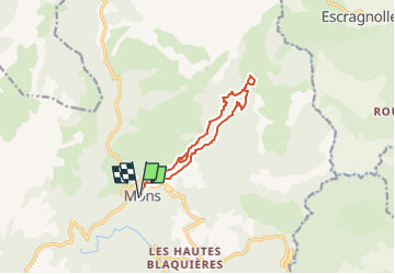
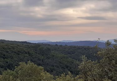
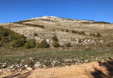
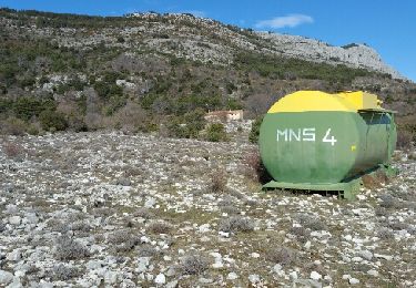
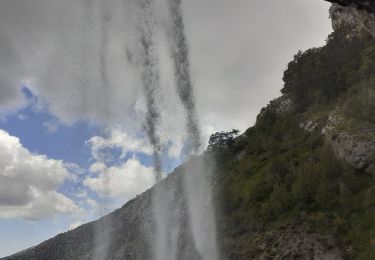
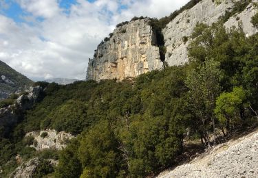
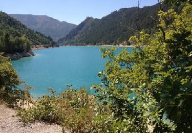
Trail Walking of 11 km to be discovered at Provence-Alpes-Côte d'Azur, Var, Mons. This trail is proposed by santaflor.

Description

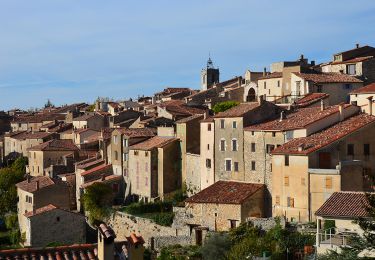
Sur ce sentier vous découvrirez deux menhirs,à cela vous pourrez ajouter la visite du village qui est magnifique.

Elevation profile

Positioning

Country:
France
Region :
Provence-Alpes-Côte d'Azur
Department/Province :
Var
Municipality :
Mons
Location:
Unknown
Start:(UTM)
315678 ; 4839905 (32T) N.

Trails nearby

Trail Mountain bike Mons - Mons => Les moulins par Mont  - Photo
Mountain bike
ajpbm

Mountain bike

Medium
Mons, Provence-Alpes-Côte d'Azur, Var, France
15.3 km | 22 km-effort
3h 10min
No
Trail Walking Mons - SityTrail - Mons - Cascade de la Siagnole -  Aqueduc de la Roche Taillée Chapelle St Pierre - Photo
Walking
donda

Walking

Very difficult
Mons, Provence-Alpes-Côte d'Azur, Var, France
16.2 km | 25 km-effort
5h 0min
Yes
Trail Walking Mons - Mons - Montagne des Louquiers - Chapelle St Pierre - Photo
Walking
LtZIP

Walking

Medium
Mons, Provence-Alpes-Côte d'Azur, Var, France
17.6 km | 25 km-effort
5h 50min
Yes
Trail Walking Mons - Mons  Cascade de la Siagnole  La Roche Taillée  Mégalithe de Riens - Photo
Walking

Walking

Very difficult
Mons, Provence-Alpes-Côte d'Azur, Var, France
16.9 km | 26 km-effort
4h 23min
Yes
Trail Walking Mons - Le Lachens depuis Mons - Photo
Walking
ETMU5496

Walking

Difficult
Mons, Provence-Alpes-Côte d'Azur, Var, France
23 km | 35 km-effort
6h 31min
Yes
Trail Walking Mons - Mons-Cascade de Clar - Photo
Walking
Sugg

Walking

Difficult
Mons, Provence-Alpes-Côte d'Azur, Var, France
20 km | 29 km-effort
6h 9min
No
Trail Walking Mons -  Cascade de Clar Mons - Photo
Walking
donda

Walking

Difficult
Mons, Provence-Alpes-Côte d'Azur, Var, France
18.8 km | 27 km-effort
6h 2min
Yes
Trail Walking Saint-Cézaire-sur-Siagne - site escalade des Malines - Photo
Walking
Palimpseste

Walking

Easy
Saint-Cézaire-sur-Siagne, Provence-Alpes-Côte d'Azur, Maritime Alps, France
4.4 km | 7.6 km-effort
1h 32min
Yes
Trail Cycle Mons - Mons barrage Chaudane - Photo
Cycle
pascalspr

Cycle

Difficult
Mons, Provence-Alpes-Côte d'Azur, Var, France
75 km | 98 km-effort
5h 31min
No


Close
My subscriptions