


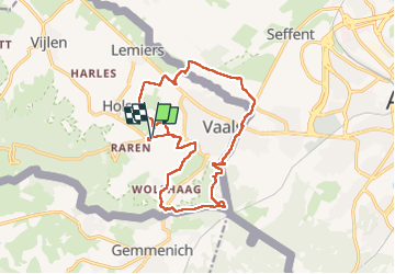

14 km | 17.6 km-effort


User


FREE GPS app for hiking
 SityTrail
IGN / Geographical institutes
SityTrail World
The world is yours!
Trail Walking of 15.2 km to be discovered at Limburg, Unknown, Vaals. This trail is proposed by moniquebvin.
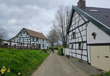
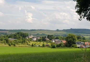
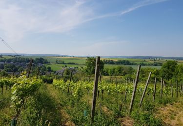
Super balade de mumu.larandonneuse, mais au départ de Bilderberg Kasteel. Très agréable, paysages et chemins très variés mais prévoir de bonnes bottines étanches en période pluvieuse. Plusieurs passages très boueux et glissants. Une belle découverte de la région des 3 frontières.
Walking

Walking

Walking

Walking

Walking

Walking
Walking
Walking

Walking