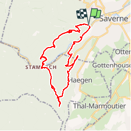
![](/images/other/stat-length.png)
![Trail Walking Saverne - Sud-Ouest de SAVERNE, le long de la Zorn - Photo](https://media.geolcdn.com/t/1900/400/ext.pjpeg?maxdim=2&url=https%3A%2F%2Fservices.sitytrail.com%2FGeolivesWS%2FDownloadMedia.ashx%3FTrailID%3D351183%26Media%3Dfix__20141004133643.jpg)
Sud-Ouest de SAVERNE, le long de la Zorn
jeanclaude12
User
![Length](/images/other/stat-length.png)
![Max alt](https://static1.geolcdn.com/siteimages/upload/files/1508320355ic_sort_altitude_max_24dp.png)
![Uphill gradient](https://static1.geolcdn.com/siteimages/upload/files/1508320355ic_sort_den_pos_24dp.png)
![Km-Effort](/images/other/stat-length.png)
![Min alt](https://static1.geolcdn.com/siteimages/upload/files/1508320355ic_sort_altitude_min_24dp.png)
![Downhill gradient](https://static1.geolcdn.com/siteimages/upload/files/1508320355ic_sort_den_neg_24dp.png)
![Boucle](https://static1.geolcdn.com/siteimages/upload/files/16400158638029165_repeat_loop_refresh_sync_direction_icon.png)
![Walking](https://static1.geolcdn.com/sitytour/trail-icons/101.png)
6h11
Difficulty : Medium
![Scan this QR Code to open this trail in the SityTrail application](https://capi.geolives.com/qq0zvz2zws4bq2lad0pu/sitytour/trails/351183/qr.png?size=200)
FREE GPS app for hiking
About
Trail Walking of 18.4 km to be discovered at Grand Est, Bas-Rhin, Saverne. This trail is proposed by jeanclaude12.
Description
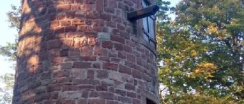
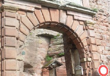
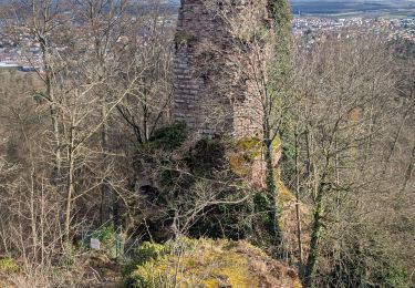
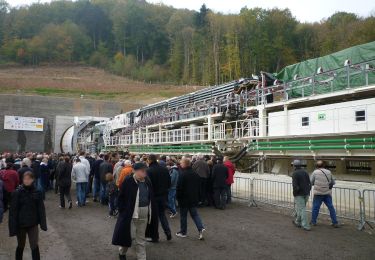
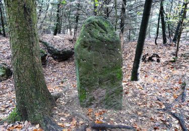
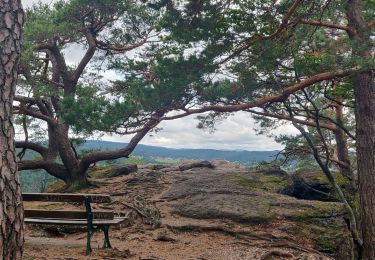
Grande et belle randonnée à la journée, au sud-ouest de Saverne, passant par la ruine du Greifenstein, la Grotte Saint-Vit et Rappenfels avant de plonger vers l'écluse de Stambach, puis remonter sur l'autre versant de la rivière Zorn par le Rocher Huck, la Tour de Brotsch, sa Roche et sa Grotte, la Table des Sorcières, les Châteaux du Petit et Grand Geroldseck, la Tour du Télégraphe de Chappe et, enfin, toute en majesté, le Château du Haut-Barr.
Points of interest
Positioning
Comments
Trails nearby
![Trail Mountain bike Saverne - Tour du Brotsch - Saverne - Photo](https://media.geolcdn.com/t/375/260/ext.jpg?maxdim=2&url=https%3A%2F%2Fservices.sitytrail.com%2FGeolivesWS%2FDownloadMedia.ashx%3FTrailID%3D105879%26Media%3D9858_4.jpg)
![Mountain bike Mountain bike](https://static1.geolcdn.com/sitytour/trail-icons/202.png)
Mountain bike
![](/images/other/stat-length.png)
![](https://static1.geolcdn.com/siteimages/upload/files/16400158638029165_repeat_loop_refresh_sync_direction_icon.png)
![Trail Walking Saverne - suuntoapp-Hiking-2025-01-26T10-25-17Z - Photo](https://media.geolcdn.com/t/375/260/66df0327-39b7-45a8-a8e4-88255af586df.jpg&format=jpg&maxdim=2)
![Walking Walking](https://static1.geolcdn.com/sitytour/trail-icons/101.png)
Walking
![](/images/other/stat-length.png)
![](https://static1.geolcdn.com/siteimages/upload/files/16400158638029165_repeat_loop_refresh_sync_direction_icon.png)
![Trail On foot Ernolsheim-lès-Saverne - Rectangle bleu barré de blanc - Photo](https://media.geolcdn.com/t/375/260/03314272-aa3e-4322-97f6-7afd0207efcf.jpeg&format=jpg&maxdim=2)
![On foot On foot](https://static1.geolcdn.com/sitytour/trail-icons/100.png)
On foot
![](/images/other/stat-length.png)
![](https://static1.geolcdn.com/siteimages/upload/files/16400158638029165_repeat_loop_refresh_sync_direction_icon.png)
![Trail On foot Saint-Jean-Saverne - Chevalet rouge - Photo](https://media.geolcdn.com/t/375/260/0dd39903-a686-40c3-9785-4ead1bbebc8f.jpeg&format=jpg&maxdim=2)
![On foot On foot](https://static1.geolcdn.com/sitytour/trail-icons/100.png)
On foot
![](/images/other/stat-length.png)
![](https://static1.geolcdn.com/siteimages/upload/files/16400158638029165_repeat_loop_refresh_sync_direction_icon.png)
![Trail On foot Saint-Jean-Saverne - Circuit Archéologique d'Ernolsheim-lès-Saverne - Photo](https://media.geolcdn.com/t/375/260/60c6095c-d8e2-44d1-91f6-754fc6d8b002.jpeg&format=jpg&maxdim=2)
![On foot On foot](https://static1.geolcdn.com/sitytour/trail-icons/100.png)
On foot
![](/images/other/stat-length.png)
![](https://static1.geolcdn.com/siteimages/upload/files/16400158638029165_repeat_loop_refresh_sync_direction_icon.png)
![Trail On foot Saint-Jean-Saverne - Circuit du Frohnberg - Photo](https://media.geolcdn.com/t/375/260/7f477f52-186a-47be-97f3-d4b05d97d596.jpeg&format=jpg&maxdim=2)
![On foot On foot](https://static1.geolcdn.com/sitytour/trail-icons/100.png)
On foot
![](/images/other/stat-length.png)
![](https://static1.geolcdn.com/siteimages/upload/files/16400158638029165_repeat_loop_refresh_sync_direction_icon.png)
![Trail On foot Saint-Jean-Saverne - Circuit de la Forêt des Dames - Photo](https://media.geolcdn.com/t/375/260/940f4f7a-5ffe-4be9-a519-9b1fc81fa3eb.jpeg&format=jpg&maxdim=2)
![On foot On foot](https://static1.geolcdn.com/sitytour/trail-icons/100.png)
On foot
![](/images/other/stat-length.png)
![](https://static1.geolcdn.com/siteimages/upload/files/16400158638029165_repeat_loop_refresh_sync_direction_icon.png)
![Trail Walking Reinhardsmunster - 2019-08-15 Marche Schaerferplatz Geissfels Ochsenstein - Photo](https://media.geolcdn.com/t/375/260/99549163-8418-49ab-b342-9e77b4e4ebca.jpg&format=jpg&maxdim=2)
![Walking Walking](https://static1.geolcdn.com/sitytour/trail-icons/101.png)
Walking
![](/images/other/stat-length.png)
![](https://static1.geolcdn.com/siteimages/upload/files/16400158638029165_repeat_loop_refresh_sync_direction_icon.png)
![Trail Walking Haegen - Haut Barr-Obersteigen-Haut Barr - Photo](https://media.geolcdn.com/t/375/260/ext.jpg?maxdim=2&url=https%3A%2F%2Fstatic1.geolcdn.com%2Fsiteimages%2Fupload%2Ffiles%2F1553511878bg_sport_marche.png)
![Walking Walking](https://static1.geolcdn.com/sitytour/trail-icons/101.png)
Walking
![](/images/other/stat-length.png)
![](https://static1.geolcdn.com/siteimages/upload/files/16400158638029165_repeat_loop_refresh_sync_direction_icon.png)