


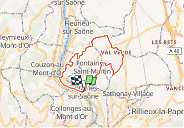

6.5 km | 10.7 km-effort


User


FREE GPS app for hiking
 SityTrail
IGN / Geographical institutes
SityTrail World
The world is yours!
Trail Nordic walking of 13.1 km to be discovered at Auvergne-Rhône-Alpes, Métropole de Lyon, Fontaines-sur-Saône. This trail is proposed by Maryma.
Une rando urbaine en première partie et bucolique en deuxième partie, bord du ruisseau des Echets, rives de la Saône (avec parcours d'artistes) .
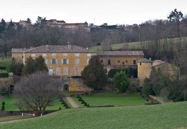
De charmantes ruelles à Rochetaillée !

Walking

Mountain bike

Walking
Walking

Mountain bike
Mountain bike
Walking
On foot

Walking