![](/images/other/stat-length.png)
![Trail Mountain bike Calès - Calès 32,7km - Photo](https://media.geolcdn.com/t/1900/400/ext.pjpeg?maxdim=2&url=https%3A%2F%2Fstatic1.geolcdn.com%2Fsiteimages%2Fupload%2Ffiles%2F1524743154velo.jpg)
Calès 32,7km
amelie14
User
![Length](/images/other/stat-length.png)
Length
33 km
![Max alt](https://static1.geolcdn.com/siteimages/upload/files/1508320355ic_sort_altitude_max_24dp.png)
Max alt
217 m
![Uphill gradient](https://static1.geolcdn.com/siteimages/upload/files/1508320355ic_sort_den_pos_24dp.png)
Uphill gradient
579 m
![Km-Effort](/images/other/stat-length.png)
Km-Effort
40 km
![Min alt](https://static1.geolcdn.com/siteimages/upload/files/1508320355ic_sort_altitude_min_24dp.png)
Min alt
44 m
![Downhill gradient](https://static1.geolcdn.com/siteimages/upload/files/1508320355ic_sort_den_neg_24dp.png)
Downhill gradient
576 m
![Boucle](https://static1.geolcdn.com/siteimages/upload/files/16400158638029165_repeat_loop_refresh_sync_direction_icon.png)
Boucle
Yes
Creation date :
2023-01-01 12:57:09.954
Updated on :
2023-01-01 15:32:27.604
![Mountain bike](https://static1.geolcdn.com/sitytour/trail-icons/202.png)
1h45
Difficulty : Medium
![Scan this QR Code to open this trail in the SityTrail application](https://capi.geolives.com/qq0zvz2zws4bq2lad0pu/sitytour/trails/3500938/qr.png?size=200)
FREE GPS app for hiking
About
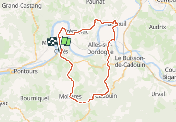
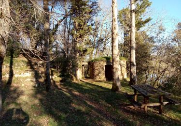
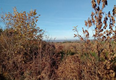
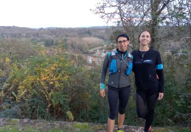
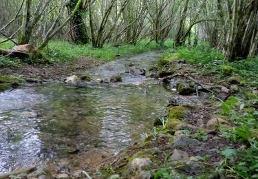
Trail Mountain bike of 33 km to be discovered at New Aquitaine, Dordogne, Calès. This trail is proposed by amelie14.
Description
Principalement de la route sur ce circuit (seulement une portion de chemin herbeux) où le VTT est appréciable pour le confort et le braquet dans le dénivelé positif :-)
Positioning
Country:
France
Region :
New Aquitaine
Department/Province :
Dordogne
Municipality :
Calès
Location:
Unknown
Start:(Dec)
Start:(UTM)
326861 ; 4969107 (31T) N.
Comments
Trails nearby
![Trail Walking Badefols-sur-Dordogne - Badefols Tremola Limeuil - Photo](https://media.geolcdn.com/t/375/260/ext.jpg?maxdim=2&url=https%3A%2F%2Fservices.sitytrail.com%2FGeolivesWS%2FDownloadMedia.ashx%3FTrailID%3D268029%26Media%3D20120812110708.jpeg)
![Walking Walking](https://static1.geolcdn.com/sitytour/trail-icons/101.png)
Badefols Tremola Limeuil
Walking
Easy
Badefols-sur-Dordogne,
New Aquitaine,
Dordogne,
France
![](/images/other/stat-length.png)
13.5 km | 17.9 km-effort
3h 47min
![](https://static1.geolcdn.com/siteimages/upload/files/16400158638029165_repeat_loop_refresh_sync_direction_icon.png)
No
![Trail Walking Badefols-sur-Dordogne - Badefols Tremola Limeuil - Photo](https://media.geolcdn.com/t/375/260/ext.jpg?maxdim=2&url=https%3A%2F%2Fservices.sitytrail.com%2FGeolivesWS%2FDownloadMedia.ashx%3FTrailID%3D268028%26Media%3D20120812110708.jpeg)
![Walking Walking](https://static1.geolcdn.com/sitytour/trail-icons/101.png)
Badefols Tremola Limeuil
Walking
Easy
Badefols-sur-Dordogne,
New Aquitaine,
Dordogne,
France
![](/images/other/stat-length.png)
13.5 km | 17.9 km-effort
3h 47min
![](https://static1.geolcdn.com/siteimages/upload/files/16400158638029165_repeat_loop_refresh_sync_direction_icon.png)
No
![Trail Walking Badefols-sur-Dordogne - Badefols Tremola - Photo](https://media.geolcdn.com/t/375/260/ext.jpg?maxdim=2&url=https%3A%2F%2Fservices.sitytrail.com%2FGeolivesWS%2FDownloadMedia.ashx%3FTrailID%3D149344%26Media%3D20120812110708.jpeg)
![Walking Walking](https://static1.geolcdn.com/sitytour/trail-icons/101.png)
Badefols Tremola
Walking
Easy
Badefols-sur-Dordogne,
New Aquitaine,
Dordogne,
France
![](/images/other/stat-length.png)
11.1 km | 14.4 km-effort
2h 25min
![](https://static1.geolcdn.com/siteimages/upload/files/16400158638029165_repeat_loop_refresh_sync_direction_icon.png)
No
![Trail Walking Trémolat - Circuit de la Plaine à Trémolat - Photo](https://media.geolcdn.com/t/375/260/ext.jpg?maxdim=2&url=https%3A%2F%2Fservices.sitytrail.com%2FGeolivesWS%2FDownloadMedia.ashx%3FTrailID%3D111769%26Media%3D8261_6.jpg)
![Walking Walking](https://static1.geolcdn.com/sitytour/trail-icons/101.png)
Circuit de la Plaine à Trémolat
Walking
Medium
(1)
Trémolat,
New Aquitaine,
Dordogne,
France
![](/images/other/stat-length.png)
9.8 km | 12.1 km-effort
2h 30min
![](https://static1.geolcdn.com/siteimages/upload/files/16400158638029165_repeat_loop_refresh_sync_direction_icon.png)
Yes
![Trail Walking Trémolat - Circuit du Cingle à Trémolat - Photo](https://media.geolcdn.com/t/375/260/ext.jpg?maxdim=2&url=https%3A%2F%2Fservices.sitytrail.com%2FGeolivesWS%2FDownloadMedia.ashx%3FTrailID%3D111768%26Media%3D8260_6.jpg)
![Walking Walking](https://static1.geolcdn.com/sitytour/trail-icons/101.png)
Circuit du Cingle à Trémolat
Walking
Easy
(3)
Trémolat,
New Aquitaine,
Dordogne,
France
![](/images/other/stat-length.png)
6.7 km | 9 km-effort
1h 45min
![](https://static1.geolcdn.com/siteimages/upload/files/16400158638029165_repeat_loop_refresh_sync_direction_icon.png)
Yes
![Trail Walking Lalinde - Sauveboeuf 14,4km - Photo](https://media.geolcdn.com/t/375/260/ext.jpg?maxdim=2&url=https%3A%2F%2Fmedia.geolcdn.com%2Ff%2F57bad7d6-cdc8-49af-853c-05939ee56322.jpg)
![Walking Walking](https://static1.geolcdn.com/sitytour/trail-icons/101.png)
Sauveboeuf 14,4km
Walking
Medium
Lalinde,
New Aquitaine,
Dordogne,
France
![](/images/other/stat-length.png)
14.4 km | 18.1 km-effort
2h 49min
![](https://static1.geolcdn.com/siteimages/upload/files/16400158638029165_repeat_loop_refresh_sync_direction_icon.png)
Yes
![Trail Walking Couze-et-Saint-Front - Lalinde 15,9km - Photo](https://media.geolcdn.com/t/375/260/ext.jpg?maxdim=2&url=https%3A%2F%2Fmedia.geolcdn.com%2Ff%2F76b13a64-4068-4054-8854-9b7e0fc8feb1.jpg)
![Walking Walking](https://static1.geolcdn.com/sitytour/trail-icons/101.png)
Lalinde 15,9km
Walking
Medium
Couze-et-Saint-Front,
New Aquitaine,
Dordogne,
France
![](/images/other/stat-length.png)
15.9 km | 20 km-effort
3h 7min
![](https://static1.geolcdn.com/siteimages/upload/files/16400158638029165_repeat_loop_refresh_sync_direction_icon.png)
Yes
![Trail Walking Mauzac-et-Grand-Castang - Mauzac 13,4km - Photo](https://media.geolcdn.com/t/375/260/ext.jpg?maxdim=2&url=https%3A%2F%2Fmedia.geolcdn.com%2Ff%2F711b247a-3f77-4a57-92ce-34182c14d050.jpg)
![Walking Walking](https://static1.geolcdn.com/sitytour/trail-icons/101.png)
Mauzac 13,4km
Walking
Medium
Mauzac-et-Grand-Castang,
New Aquitaine,
Dordogne,
France
![](/images/other/stat-length.png)
13.4 km | 17.4 km-effort
2h 34min
![](https://static1.geolcdn.com/siteimages/upload/files/16400158638029165_repeat_loop_refresh_sync_direction_icon.png)
Yes
![Trail Walking Paunat - Trėmolat 10,1km - Photo](https://media.geolcdn.com/t/375/260/ext.jpg?maxdim=2&url=https%3A%2F%2Fmedia.geolcdn.com%2Ff%2F8f2695d9-06ce-47d7-a4ee-451294358616.jpg)
![Walking Walking](https://static1.geolcdn.com/sitytour/trail-icons/101.png)
Trėmolat 10,1km
Walking
Medium
Paunat,
New Aquitaine,
Dordogne,
France
![](/images/other/stat-length.png)
10.1 km | 13.8 km-effort
2h 8min
![](https://static1.geolcdn.com/siteimages/upload/files/16400158638029165_repeat_loop_refresh_sync_direction_icon.png)
Yes