![](/images/other/stat-length.png)
![Trail Walking Tongeren - Tongres - Photo](https://media.geolcdn.com/t/1900/400/e6784500-8094-4a7e-b3d4-8606bc9495c2.jpg&format=pjpeg&maxdim=2)
Tongres
mumu.larandonneuse
User GUIDE
![Length](/images/other/stat-length.png)
![Max alt](https://static1.geolcdn.com/siteimages/upload/files/1508320355ic_sort_altitude_max_24dp.png)
![Uphill gradient](https://static1.geolcdn.com/siteimages/upload/files/1508320355ic_sort_den_pos_24dp.png)
![Km-Effort](/images/other/stat-length.png)
![Min alt](https://static1.geolcdn.com/siteimages/upload/files/1508320355ic_sort_altitude_min_24dp.png)
![Downhill gradient](https://static1.geolcdn.com/siteimages/upload/files/1508320355ic_sort_den_neg_24dp.png)
![Boucle](https://static1.geolcdn.com/siteimages/upload/files/16400158638029165_repeat_loop_refresh_sync_direction_icon.png)
![Walking](https://static1.geolcdn.com/sitytour/trail-icons/101.png)
3h13
Difficulty : Easy
![Scan this QR Code to open this trail in the SityTrail application](https://capi.geolives.com/qq0zvz2zws4bq2lad0pu/sitytour/trails/3495660/qr.png?size=200)
FREE GPS app for hiking
About
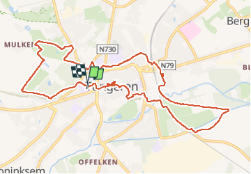
Trail Walking of 12.4 km to be discovered at Flanders, Limburg, Tongeren. This trail is proposed by mumu.larandonneuse.
Description
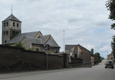
🇧🇪 Tongres, la première ville de Belgique ! Une ville pleine d'histoire, de culture et d'antiquités.
Le plus célèbre habitant de Tongres est sans aucun doute Ambiorix. Roi des Éburons, il inflige à l’occupant romain une lourde défaite. Si lourde que Jules César qualifiera les Belges de « plus braves de tous les peuples de la Gaule »... pour ensuite n’en faire qu’une bouchée. Ambiorix y échappa et disparut complètement de la surface de la Terre. Jusqu’en 1866, où il réapparut sur la Grand-Place de Tongres, statufié.
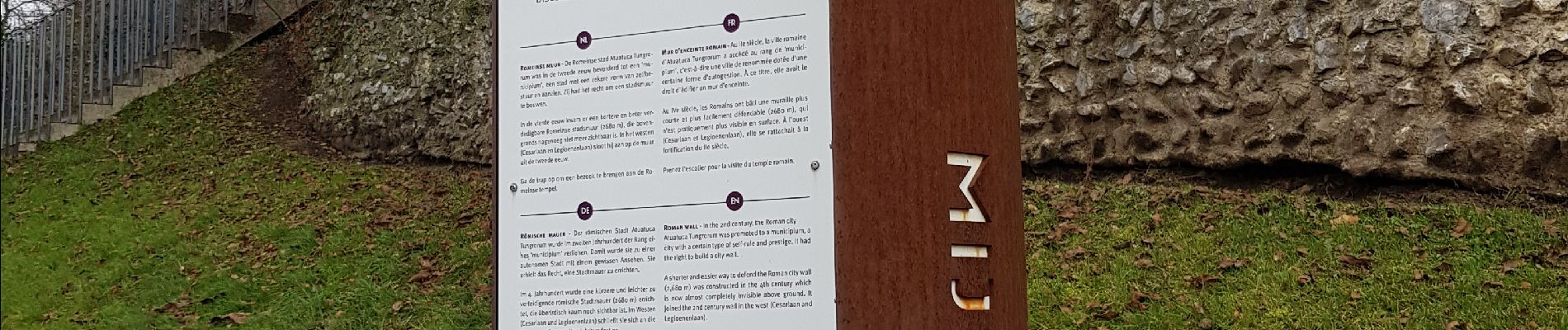
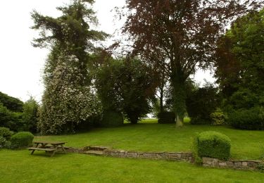
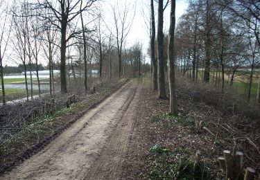
➕ Parcours combinant nature & ville passant par les incontournables ... le Parc Plinius, les vestiges des murs romains, le Temple romain, la réserve naturelle De Kevie, le centre historique, la basilique Notre-Dame, ...
📌 & 🅿️ gratuit Watertorenstraat à Tongres
🚂 Départ possible de la gare, le parcours y passe.
Positioning
Comments
Trails nearby
![Trail Walking Tongeren - 2021-10-23_19h52m36_1502 - Photo](https://media.geolcdn.com/t/375/260/d71d4a1e-f4de-4acf-94ea-656bc11edf66.jpg&format=jpg&maxdim=2)
![Walking Walking](https://static1.geolcdn.com/sitytour/trail-icons/101.png)
Walking
![](/images/other/stat-length.png)
![](https://static1.geolcdn.com/siteimages/upload/files/16400158638029165_repeat_loop_refresh_sync_direction_icon.png)
![Trail On foot Kortessem - pittoreske-kerkdorpen-startplaats-zammelen-oranje - Photo](https://media.geolcdn.com/t/375/260/fc718cb3-95ec-485f-a77f-edadc1be0696.jpeg&format=jpg&maxdim=2)
![On foot On foot](https://static1.geolcdn.com/sitytour/trail-icons/100.png)
On foot
![](/images/other/stat-length.png)
![](https://static1.geolcdn.com/siteimages/upload/files/16400158638029165_repeat_loop_refresh_sync_direction_icon.png)
![Trail Walking Tongeren - Promenade de la beauté cachée à Lauw - Photo](https://media.geolcdn.com/t/375/260/e09aa99f-84cb-4b46-8a0c-50d633d5a7ef.jpg&format=jpg&maxdim=2)
![Walking Walking](https://static1.geolcdn.com/sitytour/trail-icons/101.png)
Walking
![](/images/other/stat-length.png)
![](https://static1.geolcdn.com/siteimages/upload/files/16400158638029165_repeat_loop_refresh_sync_direction_icon.png)
![Trail On foot Tongeren - Rond de bronnen van de Mombeek - Photo](https://media.geolcdn.com/t/375/260/13e3acb7-2467-4a11-bfa7-f876dab6b0eb.jpeg&format=jpg&maxdim=2)
![On foot On foot](https://static1.geolcdn.com/sitytour/trail-icons/100.png)
On foot
![](/images/other/stat-length.png)
![](https://static1.geolcdn.com/siteimages/upload/files/16400158638029165_repeat_loop_refresh_sync_direction_icon.png)
![Trail On foot Tongeren - Widooie - Photo](https://media.geolcdn.com/t/375/260/1460d0c9-37d5-4e75-86eb-ce79ff244b22.jpeg&format=jpg&maxdim=2)
![On foot On foot](https://static1.geolcdn.com/sitytour/trail-icons/100.png)
![Trail On foot Tongeren - Molsterbos - Photo](https://media.geolcdn.com/t/375/260/3c500f4e-d8ab-4470-8eed-45fbfc940cd4.jpeg&format=jpg&maxdim=2)
![On foot On foot](https://static1.geolcdn.com/sitytour/trail-icons/100.png)
![Trail On foot Tongeren - 's Herenelderen - Photo](https://media.geolcdn.com/t/375/260/5ab8c445-6053-4792-93e2-8364cf86f17e.jpeg&format=jpg&maxdim=2)
![On foot On foot](https://static1.geolcdn.com/sitytour/trail-icons/100.png)
On foot
![](/images/other/stat-length.png)
![](https://static1.geolcdn.com/siteimages/upload/files/16400158638029165_repeat_loop_refresh_sync_direction_icon.png)
![Trail On foot Tongeren - Rutten - Photo](https://media.geolcdn.com/t/375/260/128745d3-c995-43bd-9aeb-f310fcbdef14.jpeg&format=jpg&maxdim=2)
![On foot On foot](https://static1.geolcdn.com/sitytour/trail-icons/100.png)
![Trail On foot Tongeren - Mal - Photo](https://media.geolcdn.com/t/375/260/73ec92f8-b6f9-4e9a-8736-49b1be80c469.jpeg&format=jpg&maxdim=2)
![On foot On foot](https://static1.geolcdn.com/sitytour/trail-icons/100.png)