Trail Walking Unknown - ديكاطلون  - Photo
© OpenStreetMap contributors
Length
Length
5 km
Max alt
Max alt
66 m
Uphill gradient
Uphill gradient
73 m
Km-Effort
Km-Effort  
6 km
Min alt
Min alt
33 m
Downhill gradient
Downhill gradient
66 m
Boucle
Boucle
No
Creation date :
2022-12-24 10:47:44.717
Updated on :
2022-12-26 13:40:14.608

(0 Reviews)

Walking
Walking
1h04
Difficulty : Easy

Scan this QR Code to open this trail in the SityTrail application

FREE GPS app for hiking

Logo SityTrail SityTrail

IGN / Geographical institutes

Download SityTrail from the App Store Download SityTrail from Google Play

Logo SityTrail SityTrail World

The world is yours!

Download SityTrail from the App Store Download SityTrail from Google Play Download SityTrail on Huawei AppGallery

About

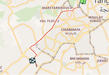
Trail Walking of 5 km to be discovered at Tangier-Tetouan-Al Hoceima, pachalik de Tanger طنجة. This trail is proposed by عثمان الساهلي.

Description

ديكاطلون

Elevation profile

Positioning

Country:
Morocco
Region :
Tangier-Tetouan-Al Hoceima
Department/Province :
pachalik de Tanger طنجة
Municipality :
Unknown
Location:
Unknown
Start:(UTM)
245175 ; 3962719 (30S) N.

Trails nearby

Trail Walking arrondissement de Charf-Mghogha الشرف مغوغة - المنار - Photo
Walking
عثمان الساهلي

Walking

Very difficult
arrondissement de Charf-Mghogha الشرف مغوغة, Tangier-Tetouan-Al Hoceima, pachalik de Tanger طنجة, Morocco
20 km | 26 km-effort
1h 34min
No
Trail sport Tangier - Tanger - Photo
sport
Etienneh57

sport

Very easy
Tangier, Tangier-Tetouan-Al Hoceima, pachalik de Tanger طنجة, Morocco
9.3 km | 11.7 km-effort
Unknown
No
Trail Walking  - الطريق  - Photo
Walking
عثمان الساهلي

Walking

Easy
, Tangier-Tetouan-Al Hoceima, pachalik de Tanger طنجة, Morocco
1.7 km | 1.8 km-effort
23min
No


Close
My subscriptions