


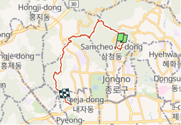


8.3 km | 12.5 km-effort


User


FREE GPS app for hiking
 SityTrail
IGN / Geographical institutes
SityTrail World
The world is yours!
Trail Walking of 7.2 km to be discovered at Seoul. This trail is proposed by dudu42.
Belle randonnée le long des remparts.
Escaliers et chemin très agréable.
Belle vue sur le parcours mais photos interdites côté mont Bukhansan a cause des équipements et base militaire


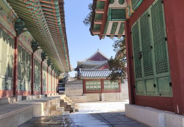
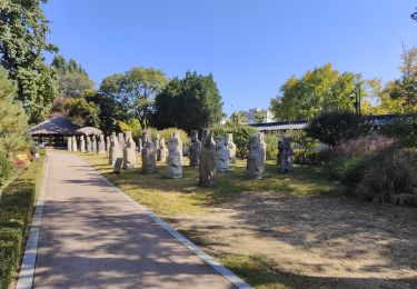
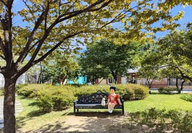
27 photos in total. Please click on a photo to see them all in the gallery.

Walking


Other activity

Other activity
Other activity
Walking
