Trail Walking Torres del Paine - Refuge Grey depuis Paine Grande - Photo
 GOHIER
GOHIER

User

© OpenStreetMap contributors
Length
Length
12.8 km
Max alt
Max alt
441 m
Uphill gradient
Uphill gradient
739 m
Km-Effort
Km-Effort  
23 km
Min alt
Min alt
40 m
Downhill gradient
Downhill gradient
702 m
Boucle
Boucle
No
Creation date :
2022-12-08 12:49:52.0
Updated on :
2022-12-10 20:27:07.968

(0 Reviews)

Walking
Walking
5h51
Difficulty : Difficult

Scan this QR Code to open this trail in the SityTrail application

FREE GPS app for hiking

Logo SityTrail SityTrail

IGN / Geographical institutes

Download SityTrail from the App Store Download SityTrail from Google Play

Logo SityTrail SityTrail World

The world is yours!

Download SityTrail from the App Store Download SityTrail from Google Play Download SityTrail on Huawei AppGallery

About

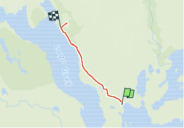
Trail Walking of 12.8 km to be discovered at Region of Magallanes and Chilean Antarctica, Provincia de Última Esperanza, Torres del Paine. This trail is proposed by GOHIER.

Description

Loooong et humide mais l’arrivée sur le glacier Grey est magnifique.

Elevation profile

Positioning

Country:
Chile
Region :
Region of Magallanes and Chilean Antarctica
Department/Province :
Provincia de Última Esperanza
Municipality :
Torres del Paine
Location:
Unknown
Start:(UTM)
633523 ; 4340375 (18F) S.

Trails nearby

Trail Walking Torres del Paine - Mirador Britannico depuis Paine Grande - Photo
Walking
GOHIER

Walking

Very difficult
Torres del Paine, Region of Magallanes and Chilean Antarctica, Provincia de Última Esperanza, Chile
29 km | 41 km-effort
13h 31min
Yes


Close
My subscriptions