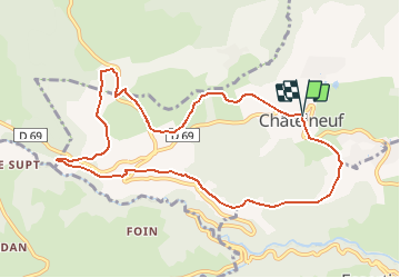
Trail Walking Châtelneuf - Garolle Jaune - Photo
© OpenStreetMap contributors
Length
Length
10.1 km
Max alt
Max alt
989 m
Uphill gradient
Uphill gradient
247 m
Km-Effort
Km-Effort  
13.4 km
Min alt
Min alt
811 m
Downhill gradient
Downhill gradient
243 m
Boucle
Boucle
Yes
Creation date :
2014-12-10 00:00:00.0
Updated on :
2014-12-10 00:00:00.0

(4 Reviews)

Walking
Walking
2h56
Difficulty : Easy

Scan this QR Code to open this trail in the SityTrail application

FREE GPS app for hiking

Logo SityTrail SityTrail

IGN / Geographical institutes

Download SityTrail from the App Store Download SityTrail from Google Play

Logo SityTrail SityTrail World

The world is yours!

Download SityTrail from the App Store Download SityTrail from Google Play Download SityTrail on Huawei AppGallery

About

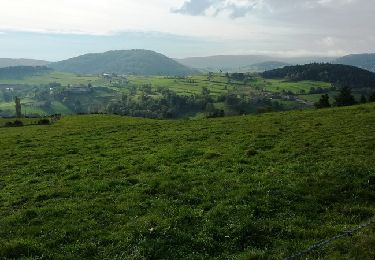
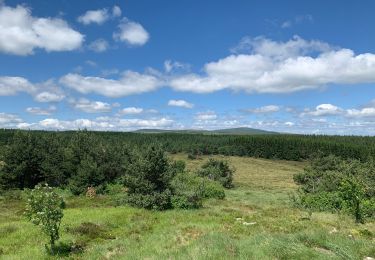
Trail Walking of 10.1 km to be discovered at Auvergne-Rhône-Alpes, Loire, Châtelneuf. This trail is proposed by patrando49.

Elevation profile

Positioning

Country:
France
Region :
Auvergne-Rhône-Alpes
Department/Province :
Loire
Municipality :
Châtelneuf
Location:
Unknown
Start:(UTM)
576553 ; 5054275 (31T) N.

Comments

Please log in to post a review or rate the element


Trails nearby

Trail Walking Essertines-en-Châtelneuf - Essertine en Chatelneuf - Photo
Walking
Migrounet42

Walking

Difficult
Essertines-en-Châtelneuf, Auvergne-Rhône-Alpes, Loire, France
15.8 km | 23 km-effort
4h 52min
Yes
Trail Walking Champdieu - Randonnée sur les hauteurs de Champdieu  - Photo
Walking
dudu42

Walking

Medium
Champdieu, Auvergne-Rhône-Alpes, Loire, France
14.3 km | 20 km-effort
3h 29min
Yes
Trail Walking Saint-Bonnet-le-Courreau - A la découverte de la fourme - parcours 5 - Photo
Walking
fabrixte

Walking

Medium
Saint-Bonnet-le-Courreau, Auvergne-Rhône-Alpes, Loire, France
19.9 km | 29 km-effort
3h 47min
Yes
Trail Mountain bike Essertines-en-Châtelneuf - Rando du Sou des Écoles (2014-VTT-53km) - Essertines en Châtelneuf - Photo
Mountain bike
tracegps

Mountain bike

Very difficult
Essertines-en-Châtelneuf, Auvergne-Rhône-Alpes, Loire, France
55 km | 74 km-effort
4h 30min
Yes
Trail Mountain bike Bard - Pierre sur Haute - Photo
Mountain bike
Pref42

Mountain bike

Very difficult
Bard, Auvergne-Rhône-Alpes, Loire, France
55 km | 0 m-effort
5h 54min
Yes
Trail Walking Roche - Tour du pic de Glizieux - Photo
Walking
cyclopat42600

Walking

Easy
Roche, Auvergne-Rhône-Alpes, Loire, France
8.4 km | 11.4 km-effort
2h 33min
Yes
Trail sport Saint-Bonnet-le-Courreau - Monate  - Photo
sport
maxtardy

sport

Very easy
Saint-Bonnet-le-Courreau, Auvergne-Rhône-Alpes, Loire, France
5.1 km | 7.5 km-effort
Unknown
Yes
Trail Walking Lérigneux - Supers  - Photo
Walking
ricoux

Walking

Very difficult
Lérigneux, Auvergne-Rhône-Alpes, Loire, France
87 km | 109 km-effort
8h 48min
No
Trail Walking Lérigneux - Lérigneux - Photo
Walking
psesjs

Walking

Easy
Lérigneux, Auvergne-Rhône-Alpes, Loire, France
19.5 km | 27 km-effort
4h 36min
Yes


Close
My subscriptions