Trail Walking Lablachère - Lablachère - Sentier des vignerons - Photo

Lablachère - Sentier des vignerons

© OpenStreetMap contributors
Length
Length
7.9 km
Max alt
Max alt
364 m
Uphill gradient
Uphill gradient
166 m
Km-Effort
Km-Effort  
10.1 km
Min alt
Min alt
236 m
Downhill gradient
Downhill gradient
165 m
Boucle
Boucle
Yes
Creation date :
2022-11-27 10:19:08.885
Updated on :
2022-11-27 10:19:26.362

(0 Reviews)

Walking
Walking
2h17
Difficulty : Medium

Scan this QR Code to open this trail in the SityTrail application

FREE GPS app for hiking

Logo SityTrail SityTrail

IGN / Geographical institutes

Download SityTrail from the App Store Download SityTrail from Google Play

Logo SityTrail SityTrail World

The world is yours!

Download SityTrail from the App Store Download SityTrail from Google Play Download SityTrail on Huawei AppGallery

About

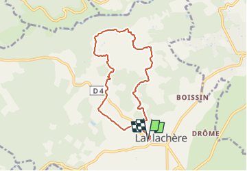
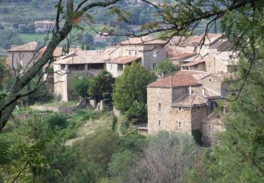
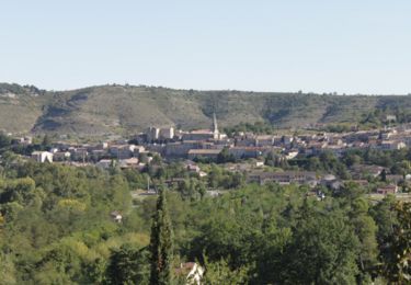
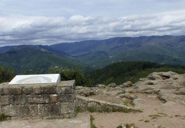
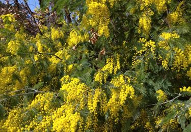
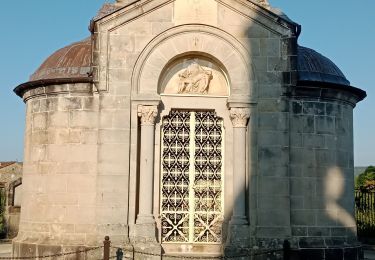
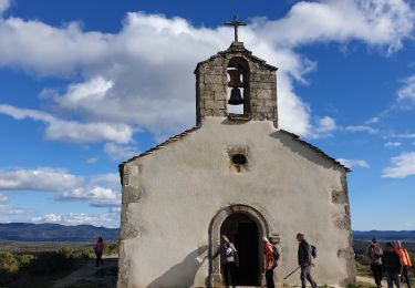
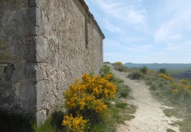
Trail Walking of 7.9 km to be discovered at Auvergne-Rhône-Alpes, Ardèche, Lablachère. This trail is proposed by ganinette.

Description

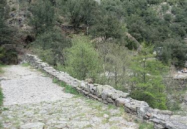
Départ de la cave de Lablachère, sentier balisé dans les vignobles: du grès, les pins, les vignes et les faïsses,

Elevation profile

Points of interest

Point of interest Lablachère - 0000013 - Photo
ganinette
LABLACHÈRE 
Point of interest Lablachère - 0000014 - Photo
ganinette
LABLACHÈRE 

Positioning

Country:
France
Region :
Auvergne-Rhône-Alpes
Department/Province :
Ardèche
Municipality :
Lablachère
Location:
Unknown
Start:(Dec)
Start:(UTM)
596271 ; 4924187 (31T) N.

Trails nearby

Trail Walking Saint-André-Lachamp - le pont de la brousse - Photo
Walking
losjo

Walking

Difficult
(2)
Saint-André-Lachamp, Auvergne-Rhône-Alpes, Ardèche, France
21 km | 34 km-effort
8h 2min
Yes
Trail Walking Payzac - Le sentier des Chanels - Payzac - Photo
Walking
tracegps

Walking

Medium
(1)
Payzac, Auvergne-Rhône-Alpes, Ardèche, France
4 km | 5.6 km-effort
1h 0min
Yes
Trail Walking Joyeuse - Le balcon du Freyssinet - Joyeuse - Photo
Walking
tracegps

Walking

Medium
(4)
Joyeuse, Auvergne-Rhône-Alpes, Ardèche, France
6.7 km | 9 km-effort
1h 45min
Yes
Trail Walking Vernon - Vernon Tour de Brison 20km - Photo
Walking
GUIDE
thonyc

Walking

Difficult
Vernon, Auvergne-Rhône-Alpes, Ardèche, France
19.9 km | 29 km-effort
6h 0min
Yes
Trail Walking Lablachère - planzolle  - Photo
Walking
marquet

Walking

Very easy
(1)
Lablachère, Auvergne-Rhône-Alpes, Ardèche, France
10.7 km | 14.1 km-effort
3h 50min
Yes
Trail Walking Les Assions - SityTrail - Boucle des Assions - Chapelle Ste.Appolonie - Photo
Walking
ganinette

Walking

Medium
Les Assions, Auvergne-Rhône-Alpes, Ardèche, France
6.5 km | 9.4 km-effort
2h 8min
Yes
Trail Walking Les Assions - Boucle des Assions - Chapelle Ste.Appolonie - Photo
Walking
rigol05

Walking

Medium
Les Assions, Auvergne-Rhône-Alpes, Ardèche, France
8.9 km | 13 km-effort
2h 58min
Yes
Trail Walking Ribes - Ribes - Photo
Walking
GUIDE
antignacs

Walking

Very easy
Ribes, Auvergne-Rhône-Alpes, Ardèche, France
14.9 km | 21 km-effort
6h 13min
Yes
Trail Walking Vernon - Tétines et cascade de Baumicou - Photo
Walking
cousam

Walking

Medium
(1)
Vernon, Auvergne-Rhône-Alpes, Ardèche, France
16 km | 24 km-effort
5h 41min
Yes


Close
My subscriptions