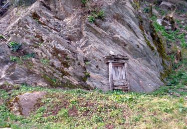
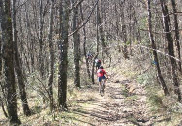
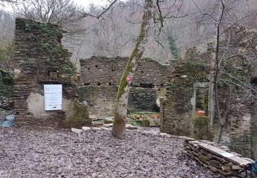
Trail Walking Saint-Grégoire - Sentier du Château de Labastide-Vassals - Photo

Sentier du Château de Labastide-Vassals

 tercla
tercla

User

© OpenStreetMap contributors
Length
Length
11.2 km
Max alt
Max alt
367 m
Uphill gradient
Uphill gradient
283 m
Km-Effort
Km-Effort  
15 km
Min alt
Min alt
216 m
Downhill gradient
Downhill gradient
285 m
Boucle
Boucle
Yes
Creation date :
2022-11-21 15:35:54.138
Updated on :
2022-11-21 15:36:55.677

(0 Reviews)

Walking
Walking
3h24
Difficulty : Difficult

Scan this QR Code to open this trail in the SityTrail application

FREE GPS app for hiking

Logo SityTrail SityTrail

IGN / Geographical institutes

Download SityTrail from the App Store Download SityTrail from Google Play

Logo SityTrail SityTrail World

The world is yours!

Download SityTrail from the App Store Download SityTrail from Google Play Download SityTrail on Huawei AppGallery

About

Trail Walking of 11.2 km to be discovered at Occitania, Tarn, Saint-Grégoire. This trail is proposed by tercla.

Elevation profile

Points of interest

Point of interest Saint-Grégoire - Parking de l'église - Photo
tercla
SAINT-GRÉGOIRE 
Point of interest Saint-Grégoire - Large piste de terreà droite - Photo
tercla
Point of interest Saint-Grégoire -  Calvaire de Bourrel - Photo
tercla
SAINT-GRÉGOIRE 
Point of interest Saint-Grégoire - Centre équestre de Puech Merlhou - Photo
tercla
Point of interest Saint-Grégoire - Croisement avec le sentier du retour vers le haras - Photo
tercla
Point of interest Saint-Grégoire - À gauche aux quatre chemins - Photo
tercla
Point of interest Crespinet - Gué de pierres - Photo
tercla
CRESPINET 
Point of interest Crespinet - À gauche à la fourche - Photo
tercla
Point of interest Saint-Grégoire - Continuer en face après visite Donjon - Photo
tercla
Point of interest Saint-Grégoire - Revenir sur ses pas - Photo
tercla
SAINT-GRÉGOIRE 
Point of interest Saint-Grégoire - Sente étroite à droite - Photo
tercla
SAINT-GRÉGOIRE 
Point of interest Saint-Grégoire - Bifurcation à  gauche - Photo
tercla
SAINT-GRÉGOIRE 
Point of interest Saint-Grégoire - Parking de l'église - Photo
tercla
SAINT-GRÉGOIRE 

Positioning

Country:
France
Region :
Occitania
Department/Province :
Tarn
Municipality :
Saint-Grégoire
Location:
Unknown
Start:(UTM)
440686 ; 4867884 (31T) N.

Trails nearby

Trail Walking Crespinet - Peygues depuis le pont des Corbières  - Photo
Walking
tercla

Walking

Medium
Crespinet, Occitania, Tarn, France
9.6 km | 14 km-effort
3h 4min
Yes
Trail Walking Bellegarde-Marsal - Marsal : le méandre de Marsal - Photo
Walking
tercla

Walking

Medium
(1)
Bellegarde-Marsal, Occitania, Tarn, France
10.3 km | 14.6 km-effort
3h 0min
Yes
Trail Mountain bike Arthès - Le long du Tarn vers Arthes - Photo
Mountain bike
tracegps

Mountain bike

Very difficult
Arthès, Occitania, Tarn, France
31 km | 40 km-effort
2h 30min
Yes
Trail Walking Saint-Grégoire - greg - Photo
Walking
jackgautier

Walking

Very easy
Saint-Grégoire, Occitania, Tarn, France
45 km | 70 km-effort
6h 12min
No
Trail Walking Saint-Grégoire - 81_Saint Gregoire longue - Photo
Walking
jab31

Walking

Medium
Saint-Grégoire, Occitania, Tarn, France
15.9 km | 21 km-effort
4h 6min
Yes
Trail Walking Saint-Juéry - 81_Saint_Juery_long - Photo
Walking
jab31

Walking

Easy
Saint-Juéry, Occitania, Tarn, France
17.7 km | 23 km-effort
2h 25min
Yes
Trail Walking Saint-Grégoire - 81_Saint Gregoire réalisé  - Photo
Walking
jab31

Walking

Medium
Saint-Grégoire, Occitania, Tarn, France
15.4 km | 20 km-effort
2h 57min
Yes
Trail Walking Saint-Juéry - acalats - Photo
Walking
density53

Walking

Very easy
Saint-Juéry, Occitania, Tarn, France
4.6 km | 5.8 km-effort
1h 10min
Yes
Trail Running Saint-Juéry - Trail des forgerons 2018 - Photo
Running
J-Mi

Running

Medium
Saint-Juéry, Occitania, Tarn, France
30 km | 42 km-effort
Unknown
Yes


Close
My subscriptions