51 km | 61 km-effort
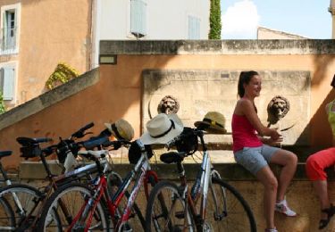
GRAVEL-challenge-70km-allrideluberon-2022
baboudu04
User
Length
68 km
Max alt
574 m
Uphill gradient
1163 m
Km-Effort
84 km
Min alt
187 m
Downhill gradient
1163 m
Boucle
Yes
Creation date :
2022-11-17 09:22:01.734
Updated on :
2022-11-17 09:22:01.734
FREE GPS app for hiking
About
Trail of 68 km to be discovered at Provence-Alpes-Côte d'Azur, Vaucluse, Apt. This trail is proposed by baboudu04.
Description
Total: 68.3km
Positioning
Country:
France
Region :
Provence-Alpes-Côte d'Azur
Department/Province :
Vaucluse
Municipality :
Apt
Location:
Unknown
Start:(Dec)
Start:(UTM)
691584 ; 4861387 (31T) N.
Comments
Trails nearby
Saignon Bories
Walking
Easy
(2)
Saignon,
Provence-Alpes-Côte d'Azur,
Vaucluse,
France
10.8 km | 13.8 km-effort
3h 2min
Yes
Plateau des Claparèdes - Saignon
Walking
Medium
(1)
Buoux,
Provence-Alpes-Côte d'Azur,
Vaucluse,
France
10.8 km | 14.6 km-effort
5h 0min
Yes
Circuit Vélo - Les Ocres en vélo - Apt
Cycle
Difficult
(1)
Apt,
Provence-Alpes-Côte d'Azur,
Vaucluse,
France
50 km | 60 km-effort
5h 0min
Yes
D'APT à Saignon boucle V2 par la route
Walking
Difficult
(1)
Apt,
Provence-Alpes-Côte d'Azur,
Vaucluse,
France
10.7 km | 14.4 km-effort
3h 17min
Yes
Buoux /Saignon
Walking
Difficult
Buoux,
Provence-Alpes-Côte d'Azur,
Vaucluse,
France
12.4 km | 15.6 km-effort
5h 45min
Yes
D'APT à Saignon boucle
Walking
Difficult
(1)
Apt,
Provence-Alpes-Côte d'Azur,
Vaucluse,
France
9.1 km | 13 km-effort
2h 56min
Yes
CR_Domitia_BE_25_Apt_Cereste_20220407
Walking
Medium
Apt,
Provence-Alpes-Côte d'Azur,
Vaucluse,
France
21 km | 29 km-effort
5h 54min
No
SityTrail - 2428982 - grp-luberon-tour-des-clapaedes-42km
Walking
Difficult
Buoux,
Provence-Alpes-Côte d'Azur,
Vaucluse,
France
17.7 km | 23 km-effort
5h 40min
Yes